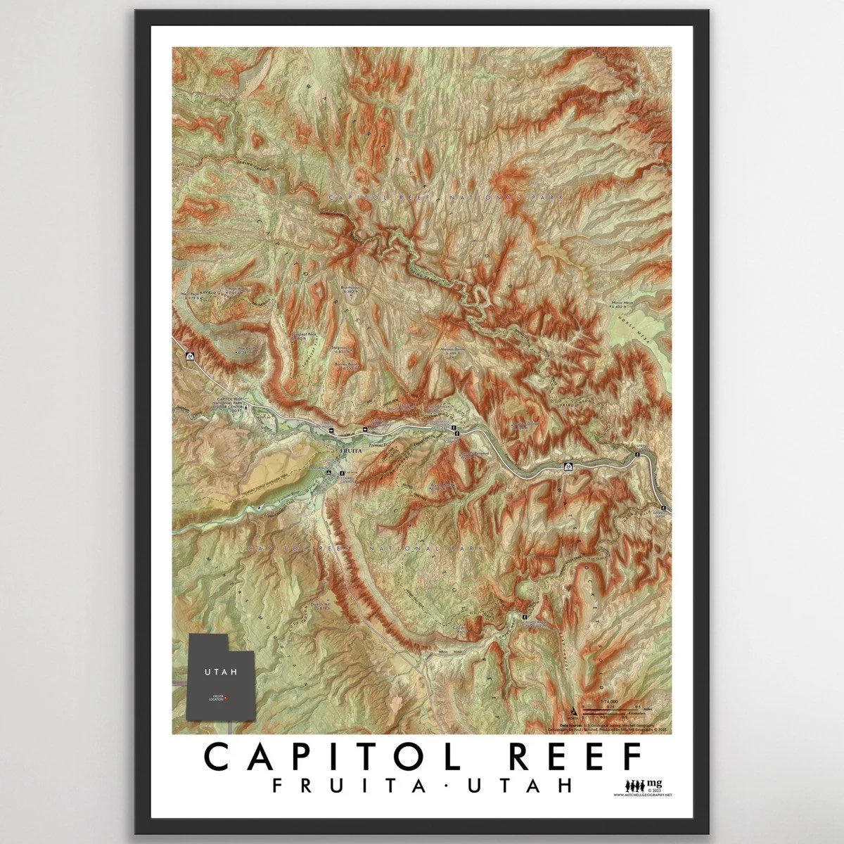
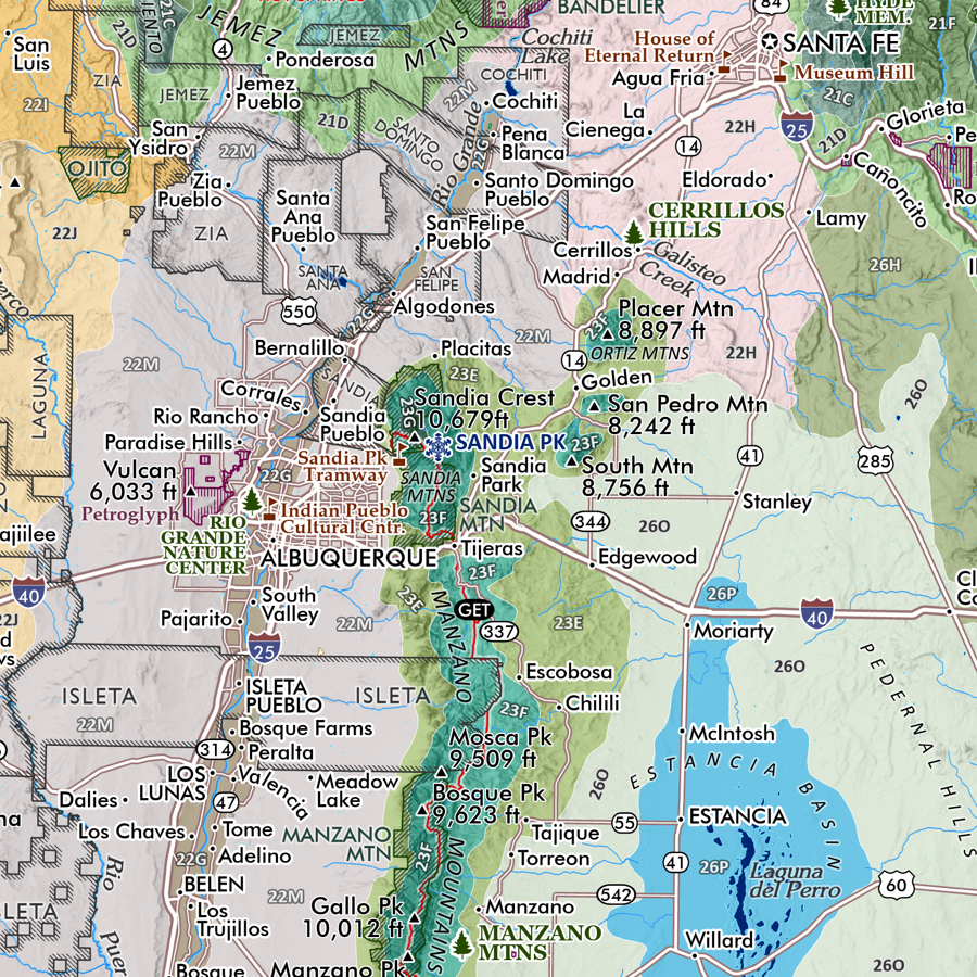
 Image 1 of 5
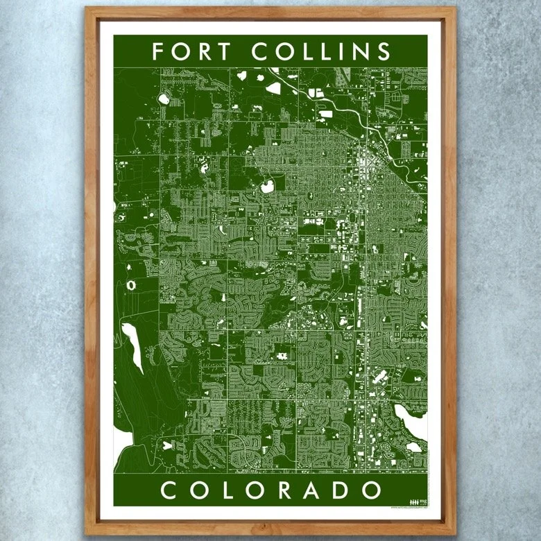
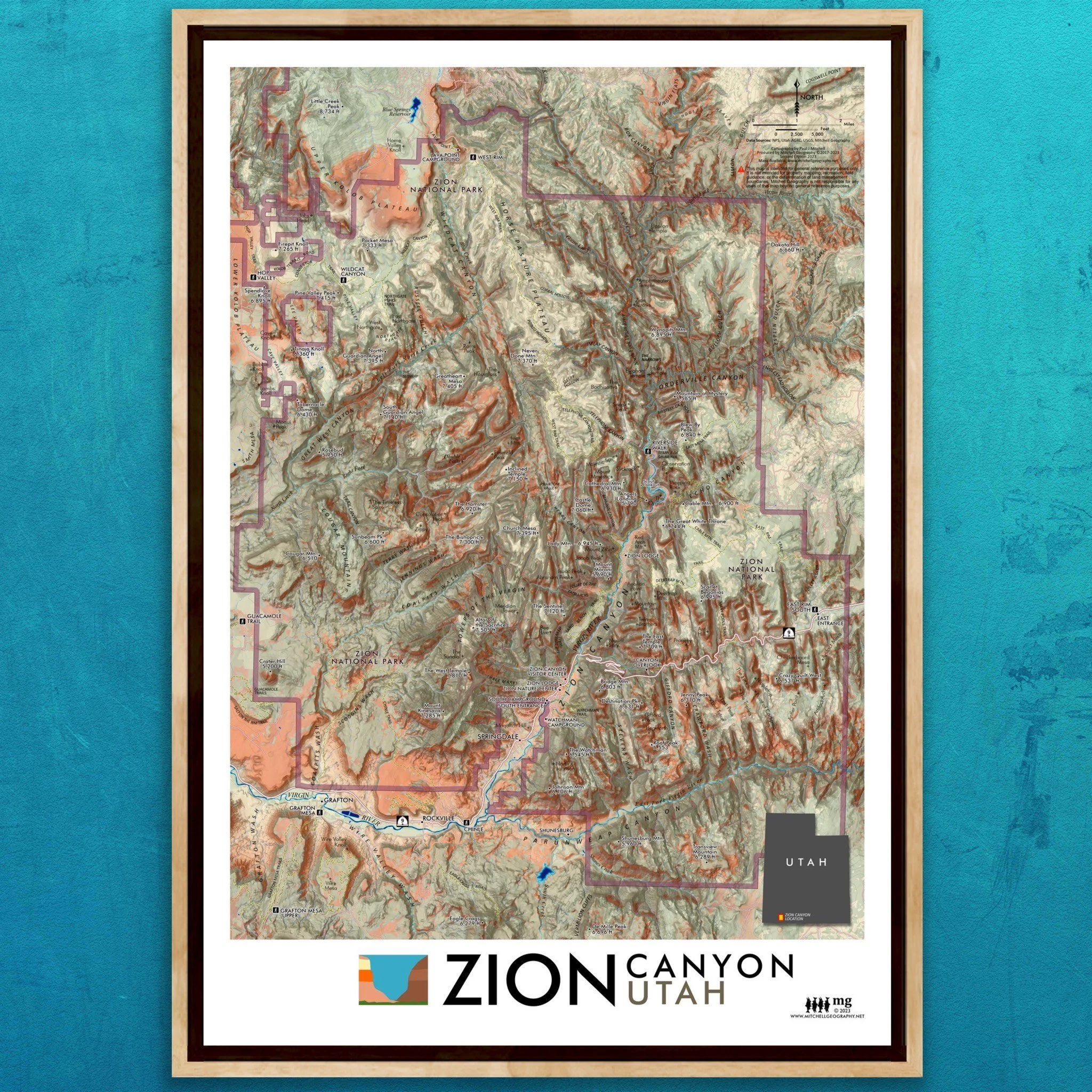
 Image 2 of 5
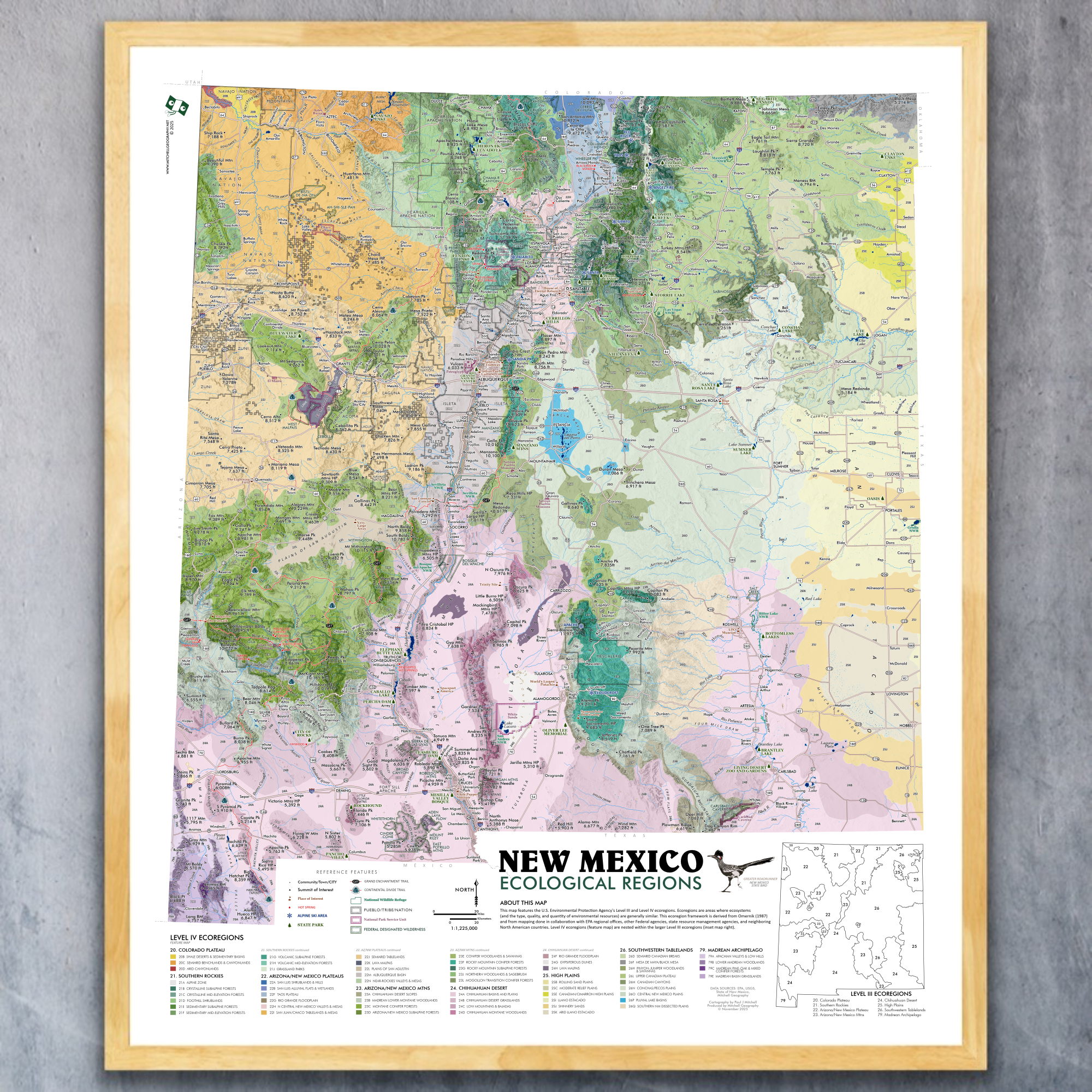
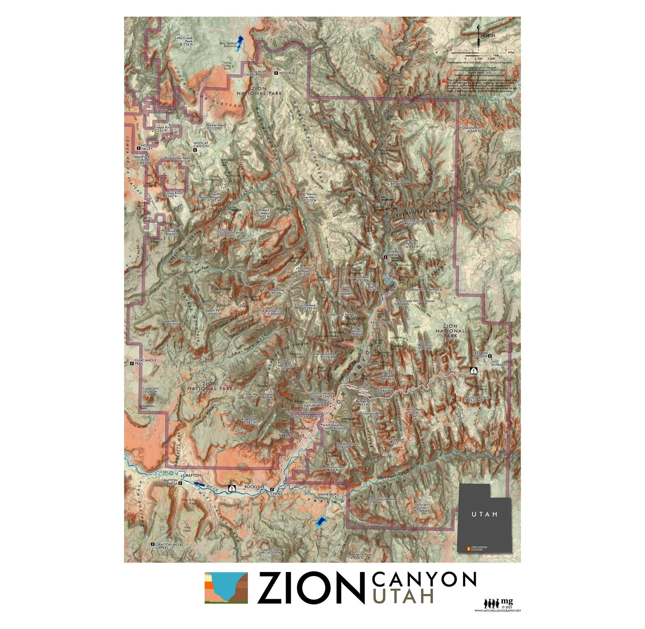
 Image 3 of 5
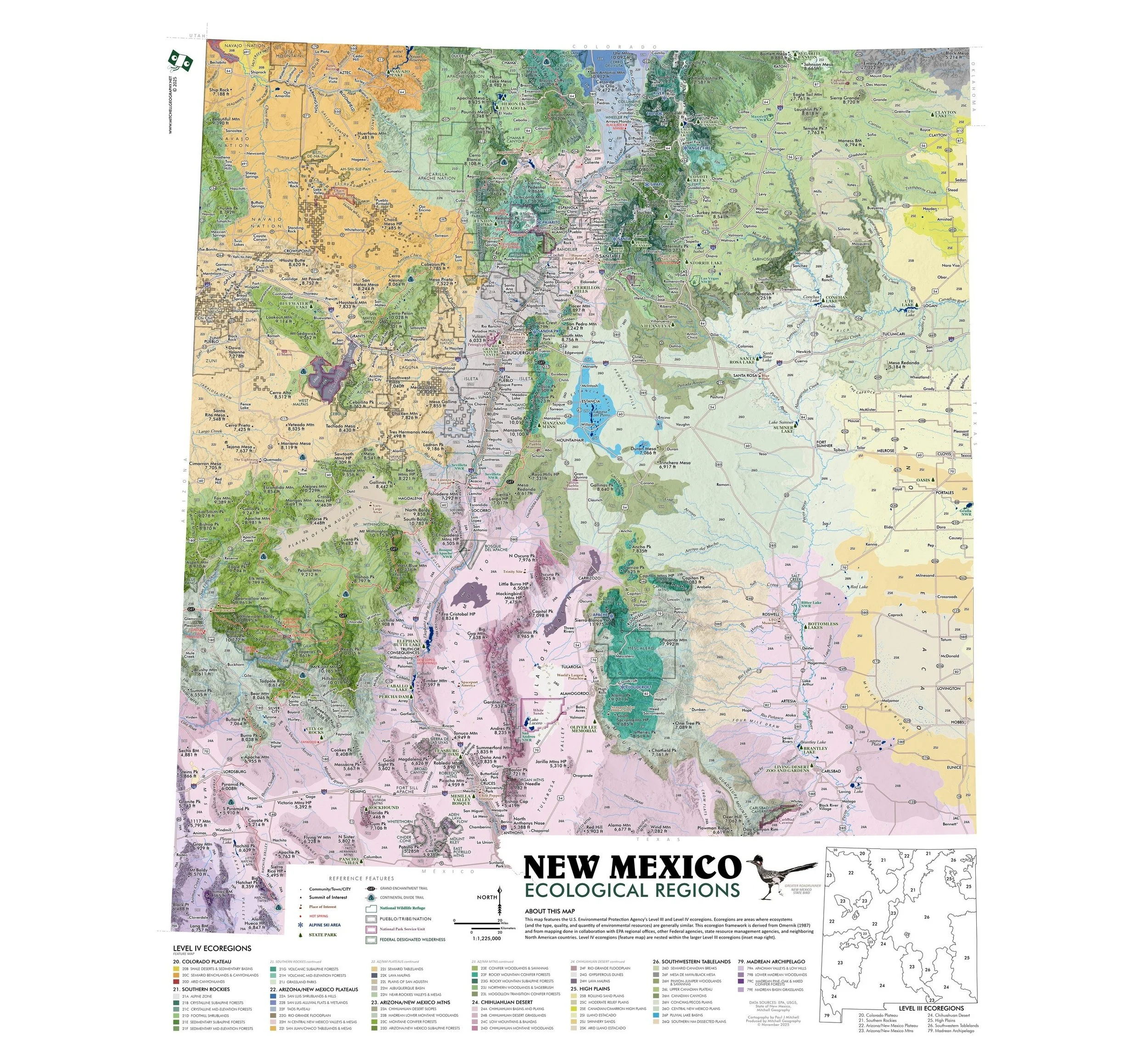
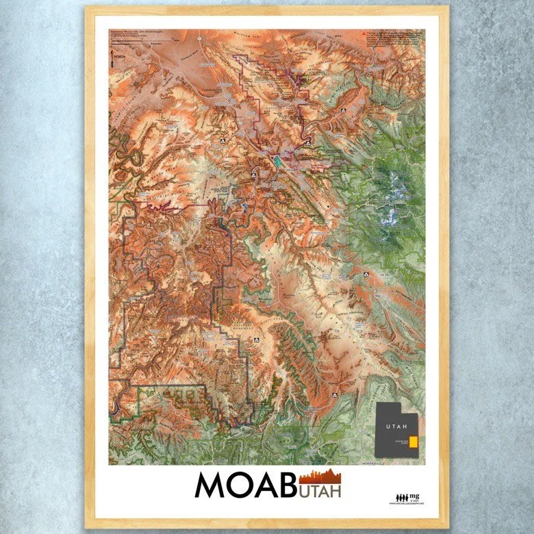
 Image 4 of 5
 Image 5 of 5
13 in. x 19 in. flat wall map - shipped flat.
1:275,000
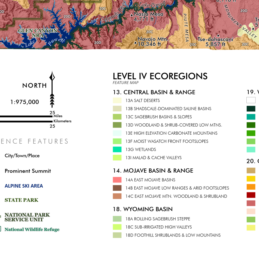
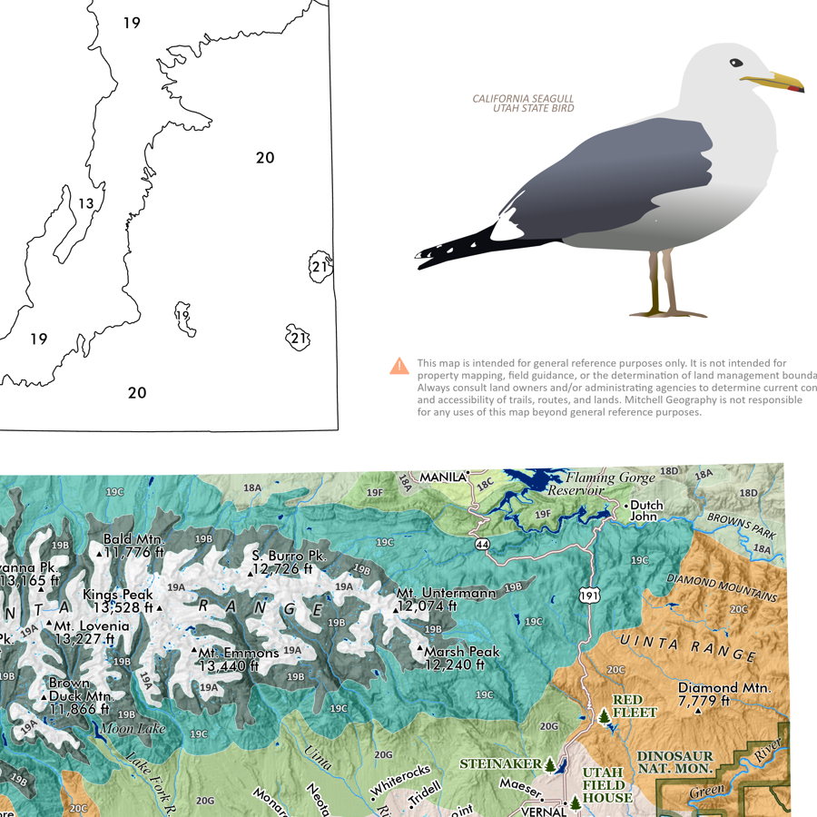
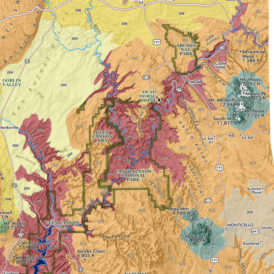
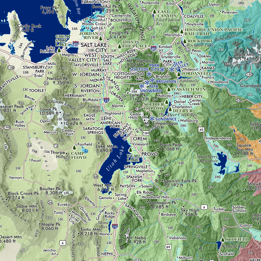
Moab Utah map. Feature overview map of the Moab, Utah region. Feature overview map of the Moab, Utah region. This wall map is well researched & richly detailed — to include primary 2WD primary roads and routes, unique landforms (arches, pillars, etc.) alongside larger landscape features (La Sal Mountains, The Needles, etc.), and special land management classes such as national parks and BLM WSAs.
Taking in the diverse landscapes surrounding Moab this map’s wide extent includes the La Sal Mountains on the East, to Labyrinth Canyon Wilderness along the Green River in the West; from The Poison Strip/Yellow Cat Road area in the North, to the town of Monticello in the South. Within are the boundaries of Arches National Park, Dead Horse Point State Park, Sand Flats Recreation Area, the Manti-La Sal National Forest section of the La Sal Mountains, the majority of Canyonlands National Park (Horseshoe Canyon Unit is excluded), northern portions of Bears Ears National Monument, numerous BLM Wilderness Study Areas (Lost Spring Canyon, Grandstaff Canyon, Mill Creek Canyon, Behind the Rocks, Bridger Jack Mesa, Butler Wash, Dark Canyon ISA Complex), and portions of the Manti-La Sal NF in the Abajo Mountains.
The richly detailed annotations include site specific natural landforms (canyons, mesas, plateaus, summits, arches, pillars, washes, etc.) and a diverse range of cultural sites (trailhead point locations, overlooks, popular petroglyphs, and other points of reference as scale permits). Primary and well travelled 2WD passenger car roads are mapped and labelled (a few stretches of 4WD routes are also mapped and labelled as such). Perennial and intermittent rivers and creeks are as well mapped and labelled. The map’s extent captures the Colorado River’s traverse from east to west and the lower canyons of the Green River meeting at their confluence within Canyonlands National Park.
Please note trail centerlines/routes are not included in this map, only trailhead point locations (popular sites for hiking, mountain biking, and OHVs). The scale simply doesn’t allow for the depiction of the trail density.
A 24 x 20 inch version of this map including trails, OHV trails, and tracks is also available.
13 in. x 19 in. flat wall map - shipped flat.
1:275,000
Moab Utah map. Feature overview map of the Moab, Utah region. Feature overview map of the Moab, Utah region. This wall map is well researched & richly detailed — to include primary 2WD primary roads and routes, unique landforms (arches, pillars, etc.) alongside larger landscape features (La Sal Mountains, The Needles, etc.), and special land management classes such as national parks and BLM WSAs.
Taking in the diverse landscapes surrounding Moab this map’s wide extent includes the La Sal Mountains on the East, to Labyrinth Canyon Wilderness along the Green River in the West; from The Poison Strip/Yellow Cat Road area in the North, to the town of Monticello in the South. Within are the boundaries of Arches National Park, Dead Horse Point State Park, Sand Flats Recreation Area, the Manti-La Sal National Forest section of the La Sal Mountains, the majority of Canyonlands National Park (Horseshoe Canyon Unit is excluded), northern portions of Bears Ears National Monument, numerous BLM Wilderness Study Areas (Lost Spring Canyon, Grandstaff Canyon, Mill Creek Canyon, Behind the Rocks, Bridger Jack Mesa, Butler Wash, Dark Canyon ISA Complex), and portions of the Manti-La Sal NF in the Abajo Mountains.
The richly detailed annotations include site specific natural landforms (canyons, mesas, plateaus, summits, arches, pillars, washes, etc.) and a diverse range of cultural sites (trailhead point locations, overlooks, popular petroglyphs, and other points of reference as scale permits). Primary and well travelled 2WD passenger car roads are mapped and labelled (a few stretches of 4WD routes are also mapped and labelled as such). Perennial and intermittent rivers and creeks are as well mapped and labelled. The map’s extent captures the Colorado River’s traverse from east to west and the lower canyons of the Green River meeting at their confluence within Canyonlands National Park.
Please note trail centerlines/routes are not included in this map, only trailhead point locations (popular sites for hiking, mountain biking, and OHVs). The scale simply doesn’t allow for the depiction of the trail density.
A 24 x 20 inch version of this map including trails, OHV trails, and tracks is also available.