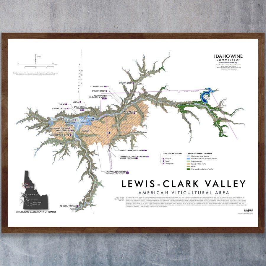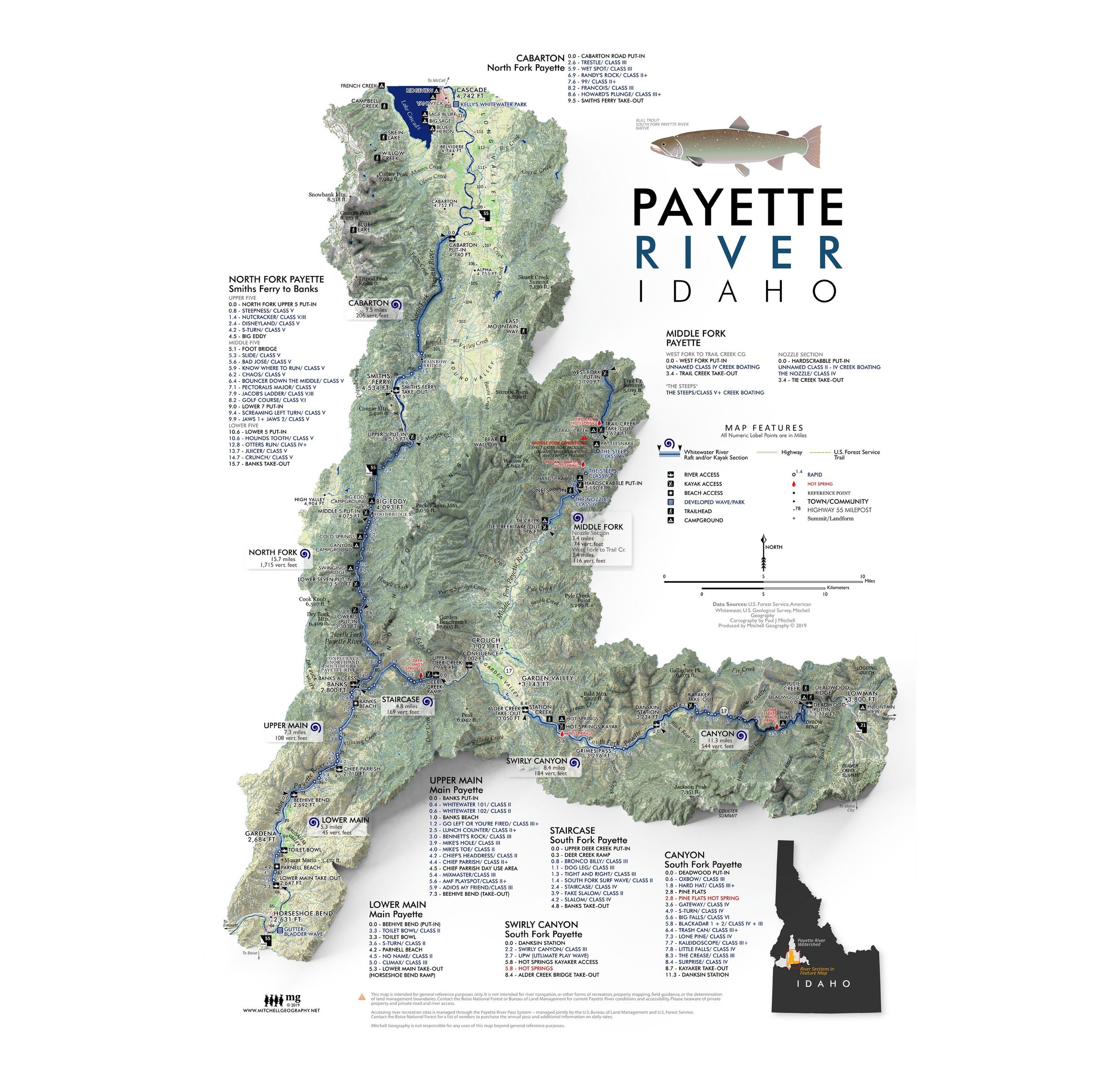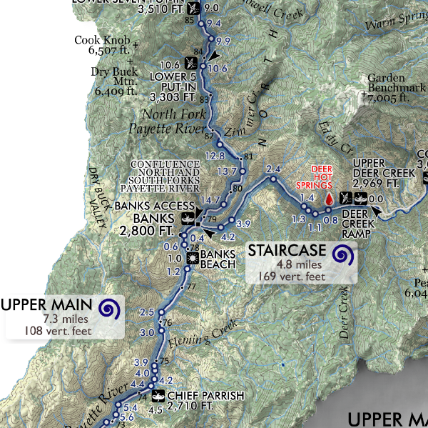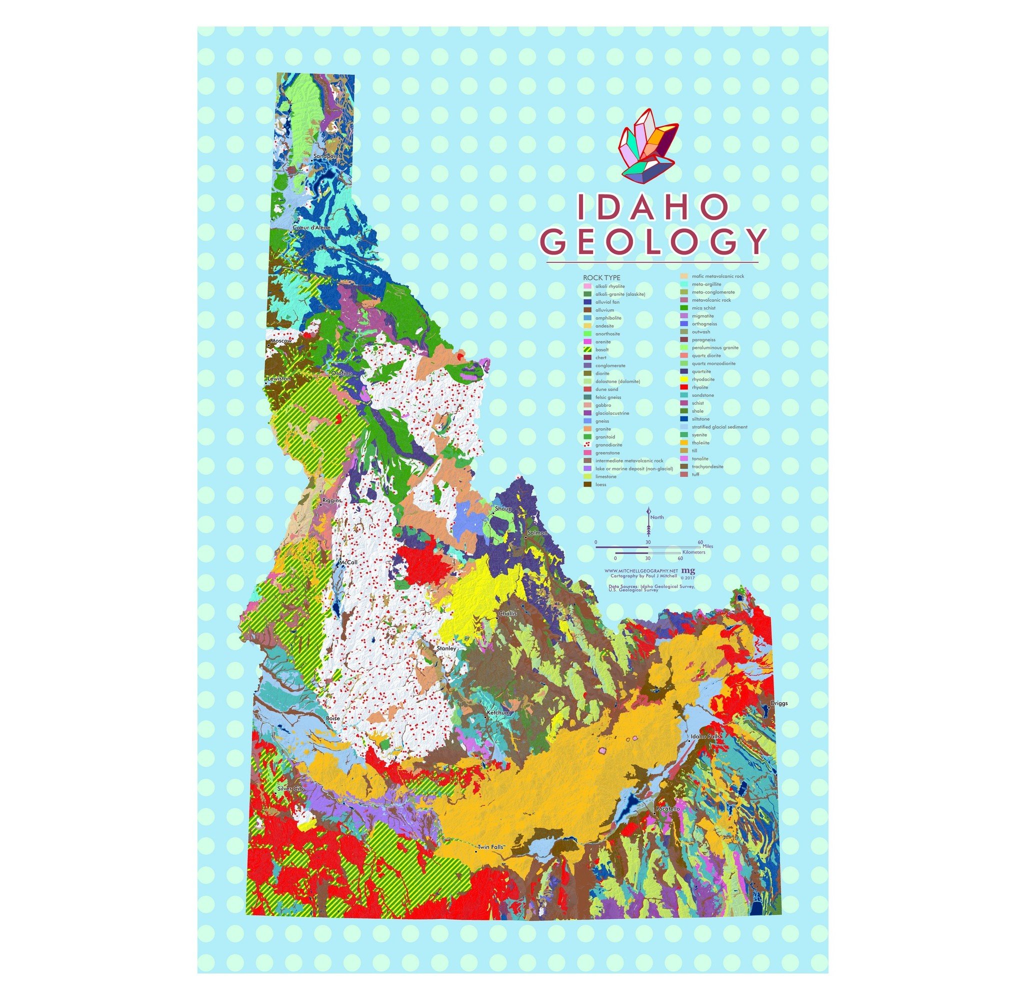
Payette Lake (19 in x 13 in)
13 inch by 19 inch flat wall map, printed on heavy fine paper. Shipped rolled or flat, order volume dependent.
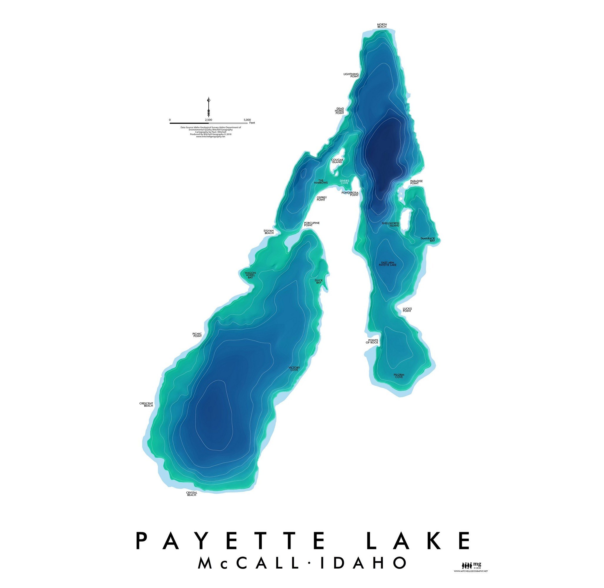
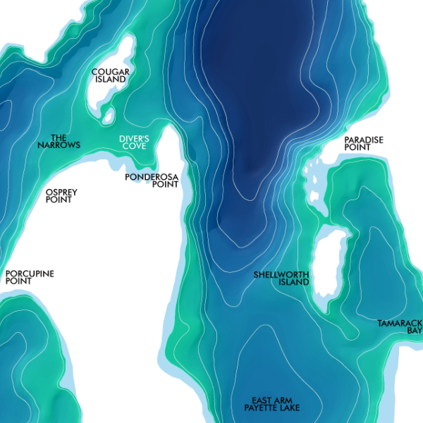
Payette Lake, Valley County, Idaho. McCall's stunning background — feature bathymetry map including all named bays, points, and beaches labeled.
13 inch by 19 inch flat wall map, printed on heavy fine paper. Shipped rolled or flat, order volume dependent.
Payette Lake, Valley County, Idaho. McCall's stunning background — feature bathymetry map including all named bays, points, and beaches labeled.
13 inch by 19 inch flat wall map, printed on heavy fine paper. Shipped rolled or flat, order volume dependent.
Payette Lake, Valley County, Idaho. McCall's stunning background — feature bathymetry map including all named bays, points, and beaches labeled.