
Payette River
Two sizes; 24 inch x 18 inch (ships rolled) OR 13 inch by 19 inch (ships flat) flat wall map, printed on heavy fine paper.
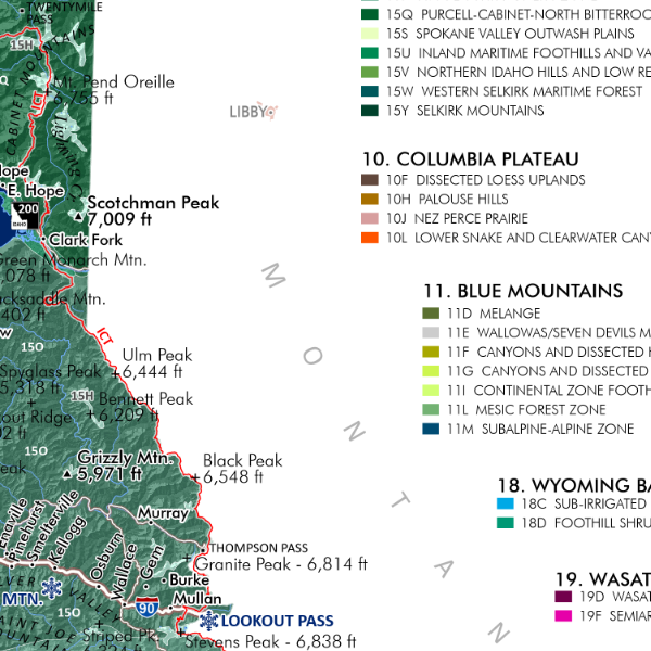
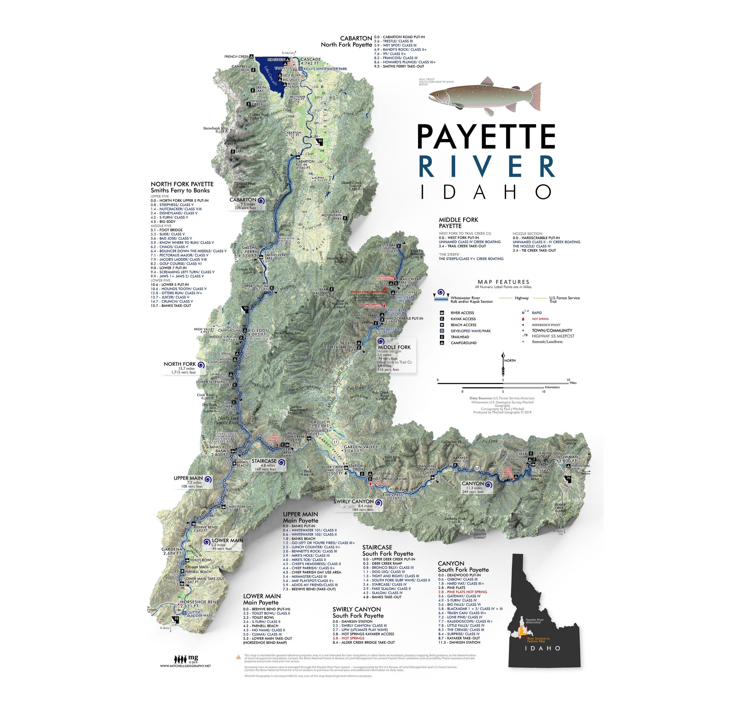
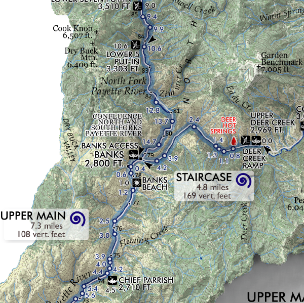
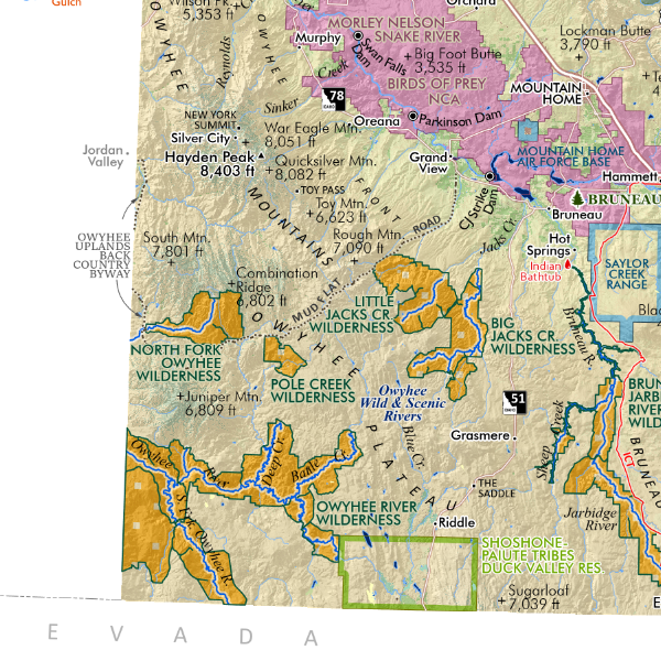
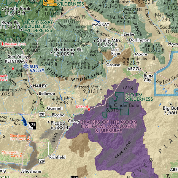
Payette River, Idaho. Map featuring the primary boating sections of the Main, South, North, and Middle Forks of the Payette River in Southwestern Idaho. Map features raft/kayak put-ins and take-outs, “primary “rapids, accessible beaches, area campsites, USFS Trails, “primary” hot springs, and place names within the area of these river segments. River features are labeled on the map by mile points referenced to the put-ins. High 55 mileposts are also labeled along the Main and North Fork from Horseshoe Bend all the way to Cascade.
Region of the map extends from Lowman on the South Fork to Banks, the Middle Fork (including Crouch and north to the West Fork), the North Fork from Cascade south thru Smiths Ferry and Banks and ending in Horseshoe Bend.
Two sizes; 24 inch x 18 inch (ships rolled) OR 13 inch by 19 inch (ships flat) flat wall map, printed on heavy fine paper.
Payette River, Idaho. Map featuring the primary boating sections of the Main, South, North, and Middle Forks of the Payette River in Southwestern Idaho. Map features raft/kayak put-ins and take-outs, “primary “rapids, accessible beaches, area campsites, USFS Trails, “primary” hot springs, and place names within the area of these river segments. River features are labeled on the map by mile points referenced to the put-ins. High 55 mileposts are also labeled along the Main and North Fork from Horseshoe Bend all the way to Cascade.
Region of the map extends from Lowman on the South Fork to Banks, the Middle Fork (including Crouch and north to the West Fork), the North Fork from Cascade south thru Smiths Ferry and Banks and ending in Horseshoe Bend.


![Camel's Back [Boise Idaho] (19 in x 13 in)](https://images.squarespace-cdn.com/content/v1/64dfe5c447627a1ab4b29d07/1699989430957-PGLZ4WM4WRNNHFPDRKKY/CamelsBack_framed.JPG)