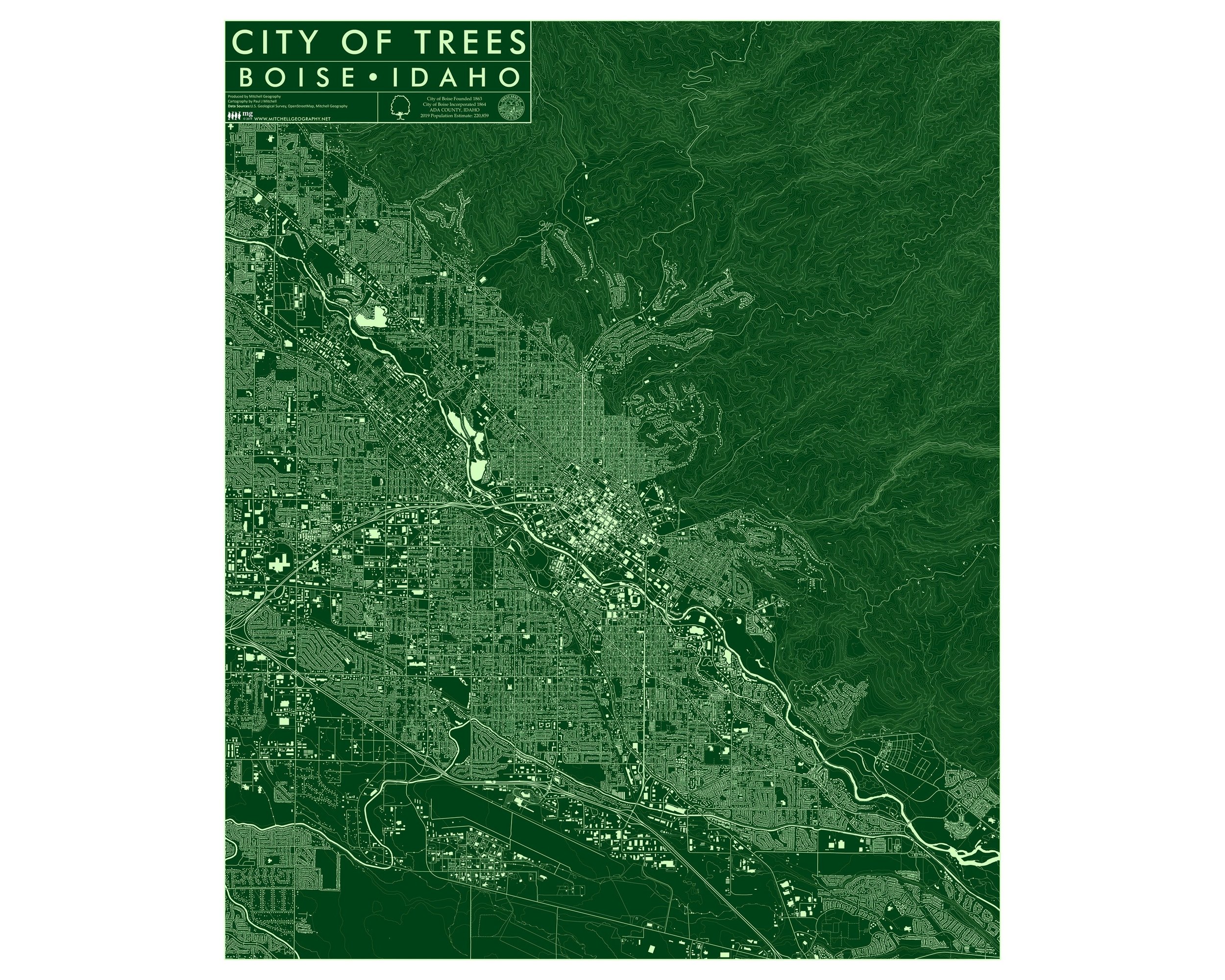
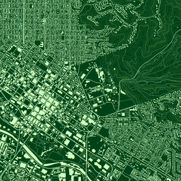
1:1,400,000 (24 inch x 20 inch version)
24 inch × 20 inch & 13 inch by 19 inch flat wall map, printed on heavy fine paper. 18 x 24 inch version is shipped rolled while the 13 x 19 inch version is shipped flat.
*Detail images displayed are from the 24 inch version of this map, the 13 × 19 has less labels and annotation, detail, etc.
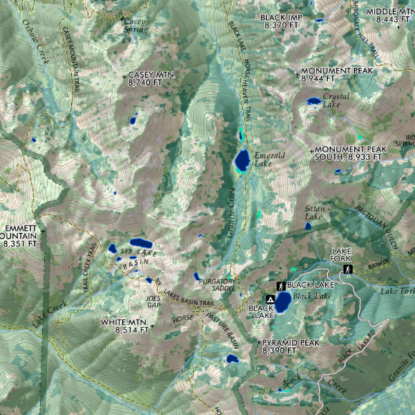
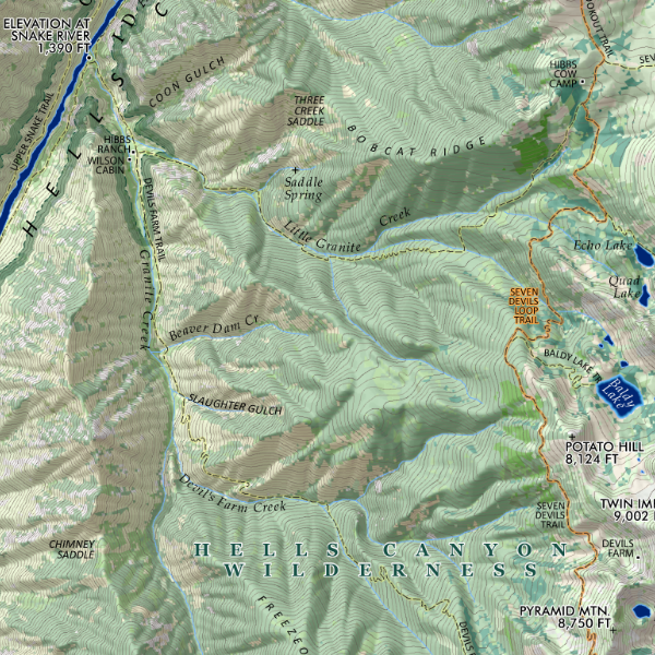
A re-symbolization of the EPA's Level IV ecological regions for the landscapes of Idaho. Includes inset Idaho Level III and North American reference maps for context and detailed Level IV legend codes for the feature map. Detailed reference labels includes places, state parks, special land management categories, alpine ski areas, special sites, highways/major roads, prominent and recognized summits and landforms of significance, and familiar hot springs (i.e. not all your secret hot springs, just the common ones ;-) ).
1:1,400,000 (24 inch x 20 inch version)
24 inch × 20 inch & 13 inch by 19 inch flat wall map, printed on heavy fine paper. 18 x 24 inch version is shipped rolled while the 13 x 19 inch version is shipped flat.
*Detail images displayed are from the 24 inch version of this map, the 13 × 19 has less labels and annotation, detail, etc.
A re-symbolization of the EPA's Level IV ecological regions for the landscapes of Idaho. Includes inset Idaho Level III and North American reference maps for context and detailed Level IV legend codes for the feature map. Detailed reference labels includes places, state parks, special land management categories, alpine ski areas, special sites, highways/major roads, prominent and recognized summits and landforms of significance, and familiar hot springs (i.e. not all your secret hot springs, just the common ones ;-) ).

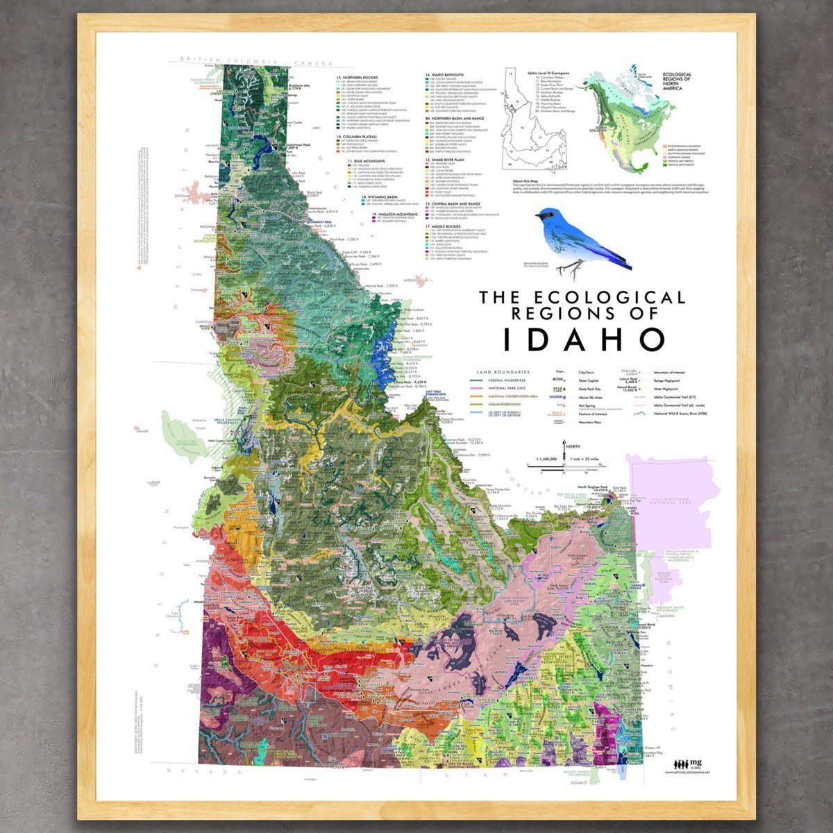 Image 1 of 10
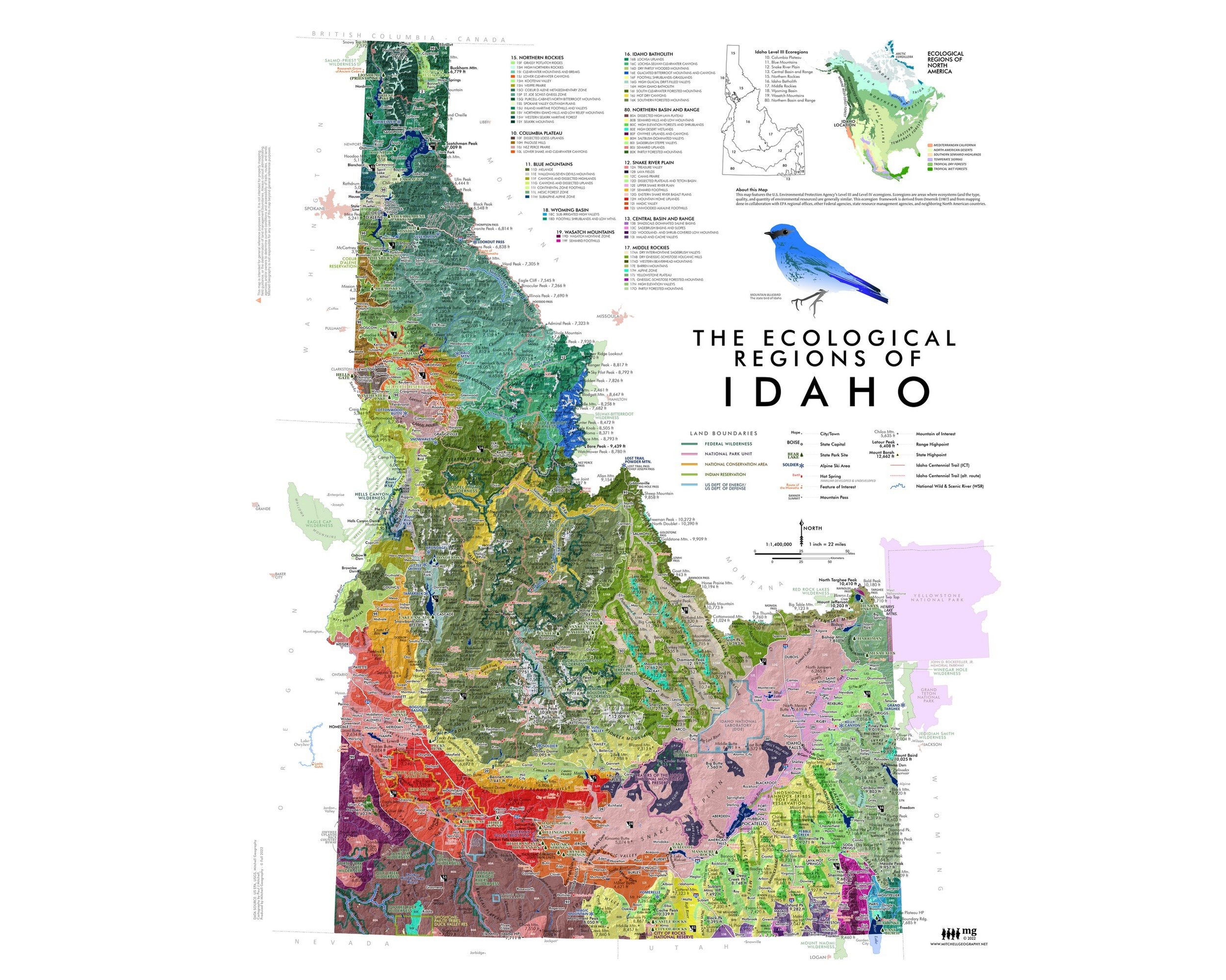 Image 2 of 10
 Image 3 of 10
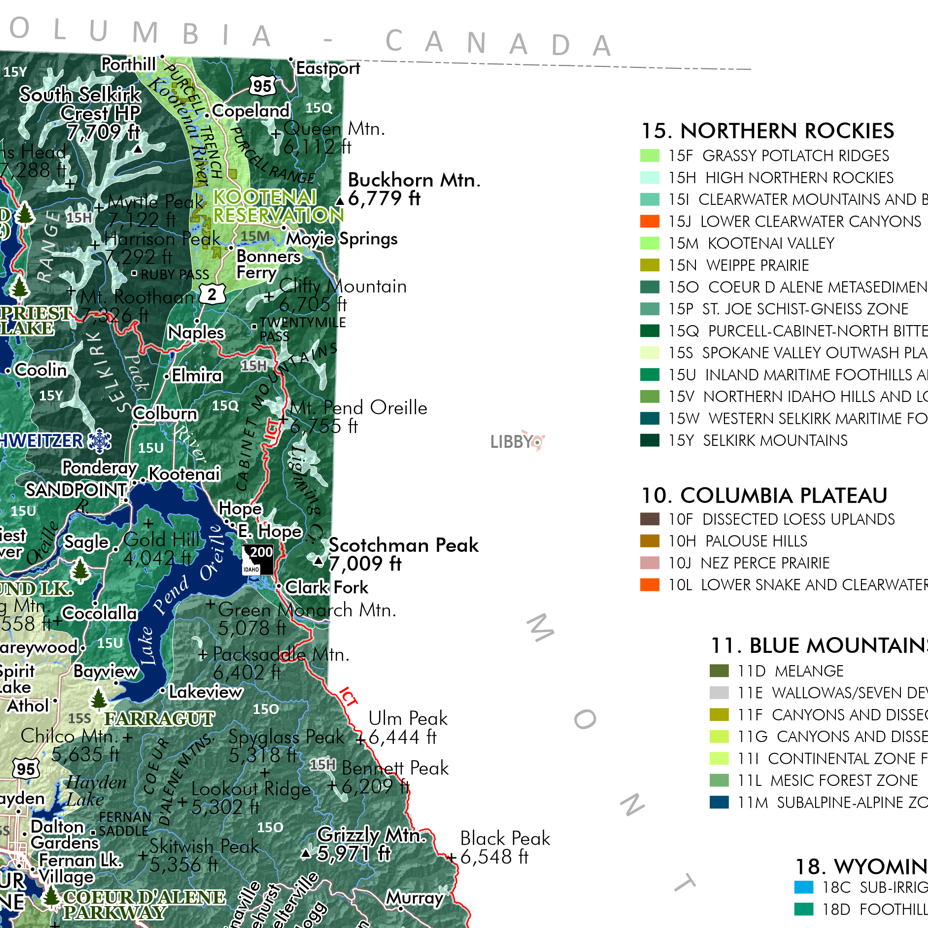 Image 4 of 10
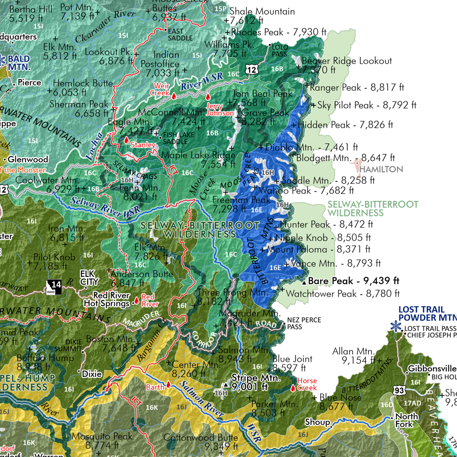 Image 5 of 10
 Image 6 of 10
 Image 7 of 10
 Image 8 of 10
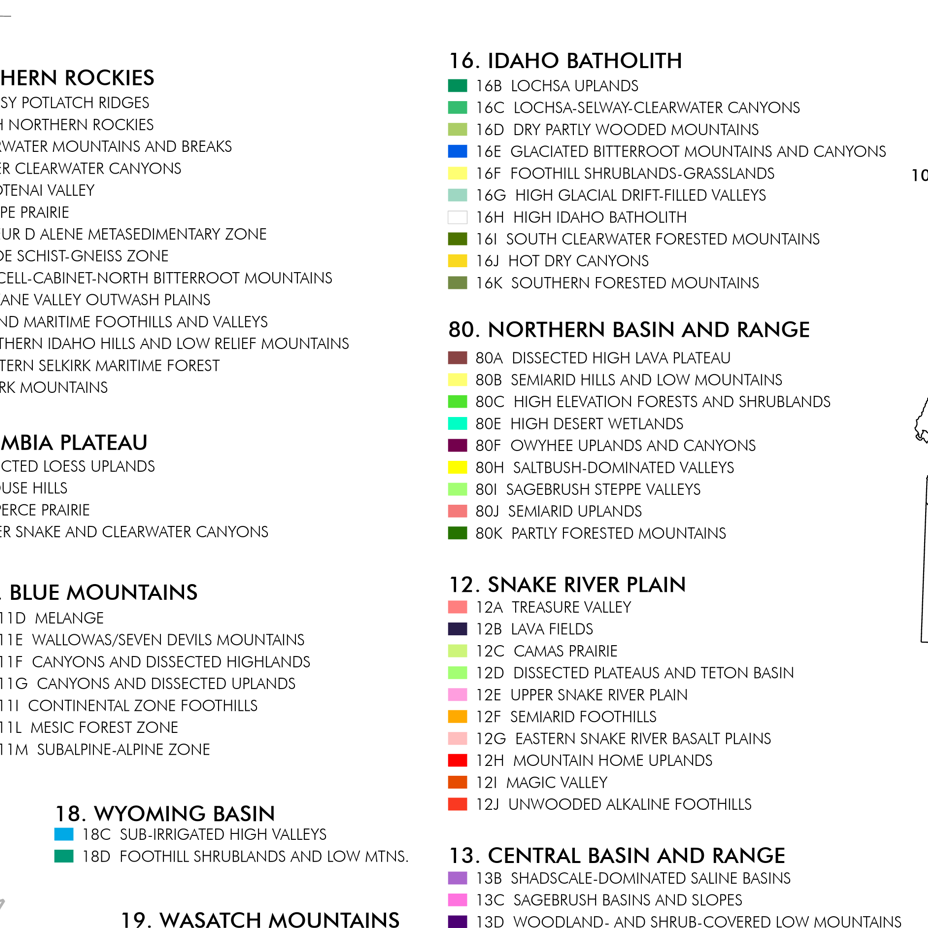 Image 9 of 10
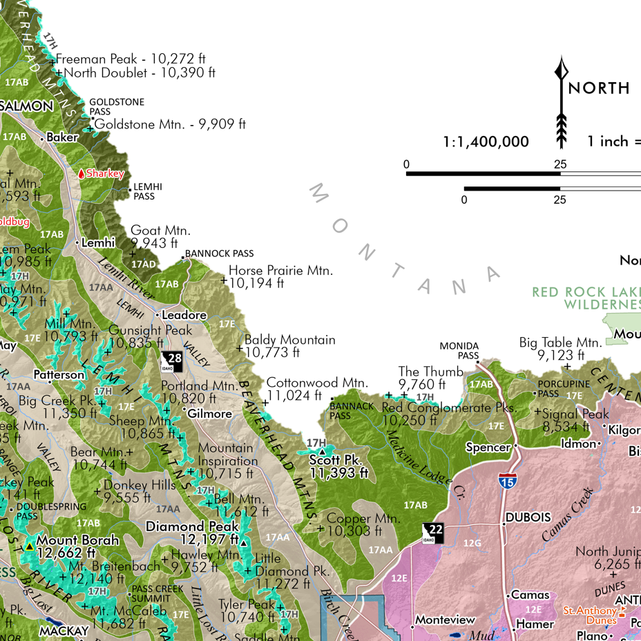 Image 10 of 10
![Camel's Back [Boise Idaho] (19 in x 13 in)](https://images.squarespace-cdn.com/content/v1/64dfe5c447627a1ab4b29d07/1699989430957-PGLZ4WM4WRNNHFPDRKKY/CamelsBack_framed.JPG)