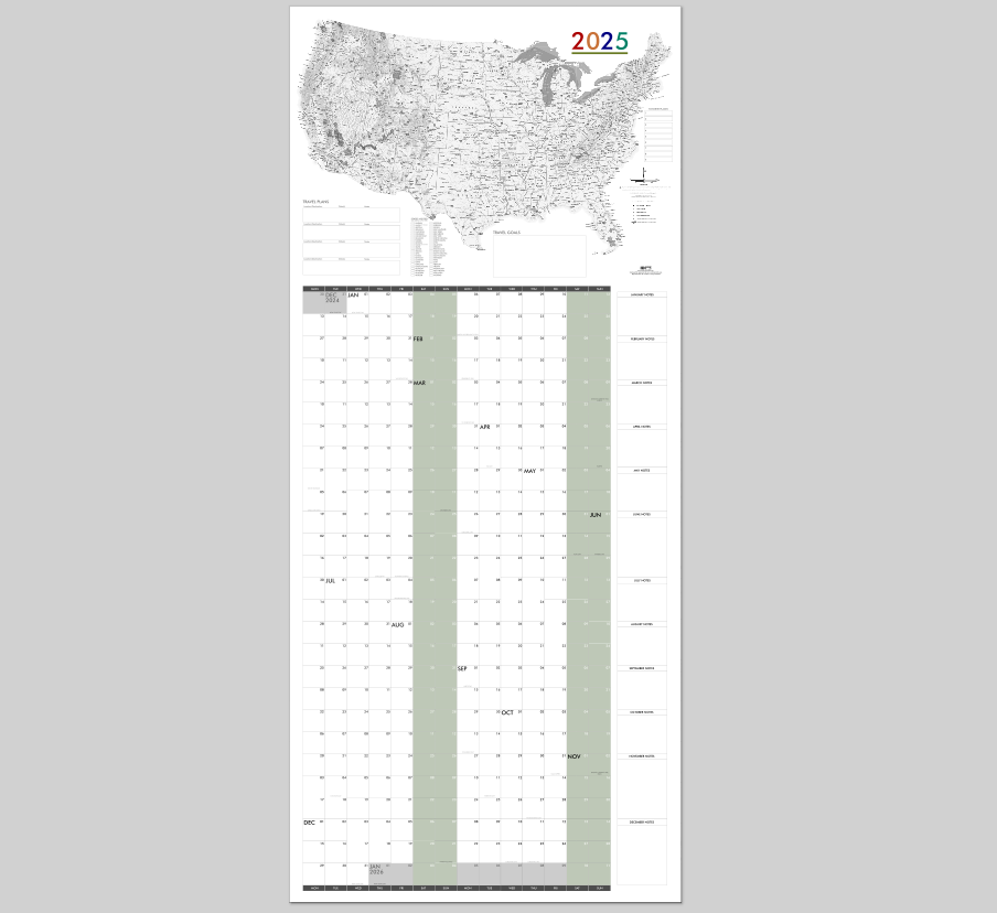

PRINTABLE Q3 (Jul-Sep) 2025 28" x 36" All-in-one Map Calendar - Aligned Weekends - Digital PDF Instant Download
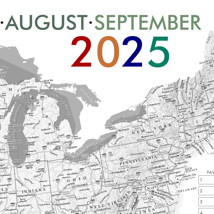
JULY AUGUST SEPTEMBER 3RD QUARTER 2025 All-In-One Map Calendar!
28 inches wide x 36 inches long
DIGITAL DOWNLOAD ONLY. (15MB PDF instant download following checkout - image is 300 dpi)
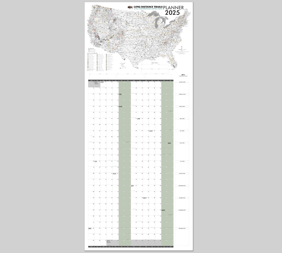
This all-in-one map calendar wall planner is designed to be printed to a 28" x 64" sheet size (i.e. perfect for the back of a door). This is a digital PDF file download, you are responsible for printing and associated printing costs.
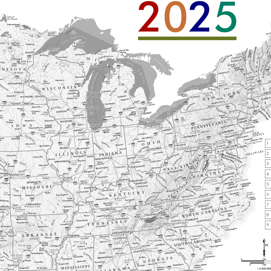
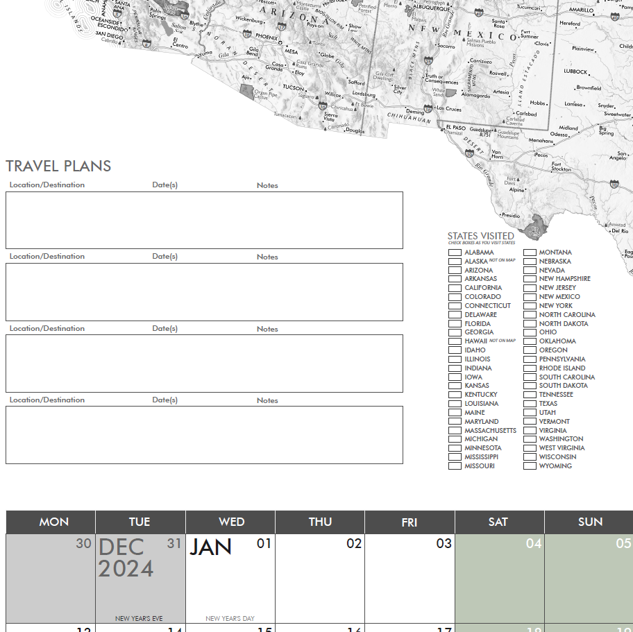
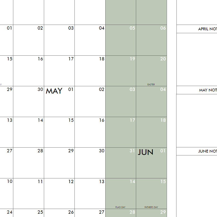
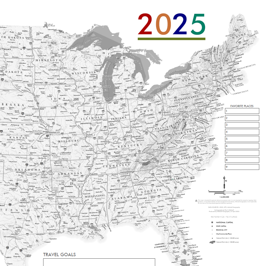
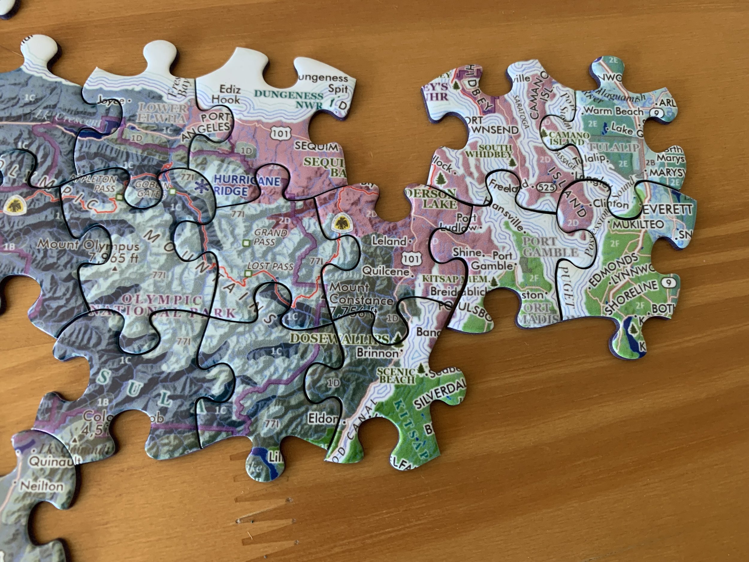
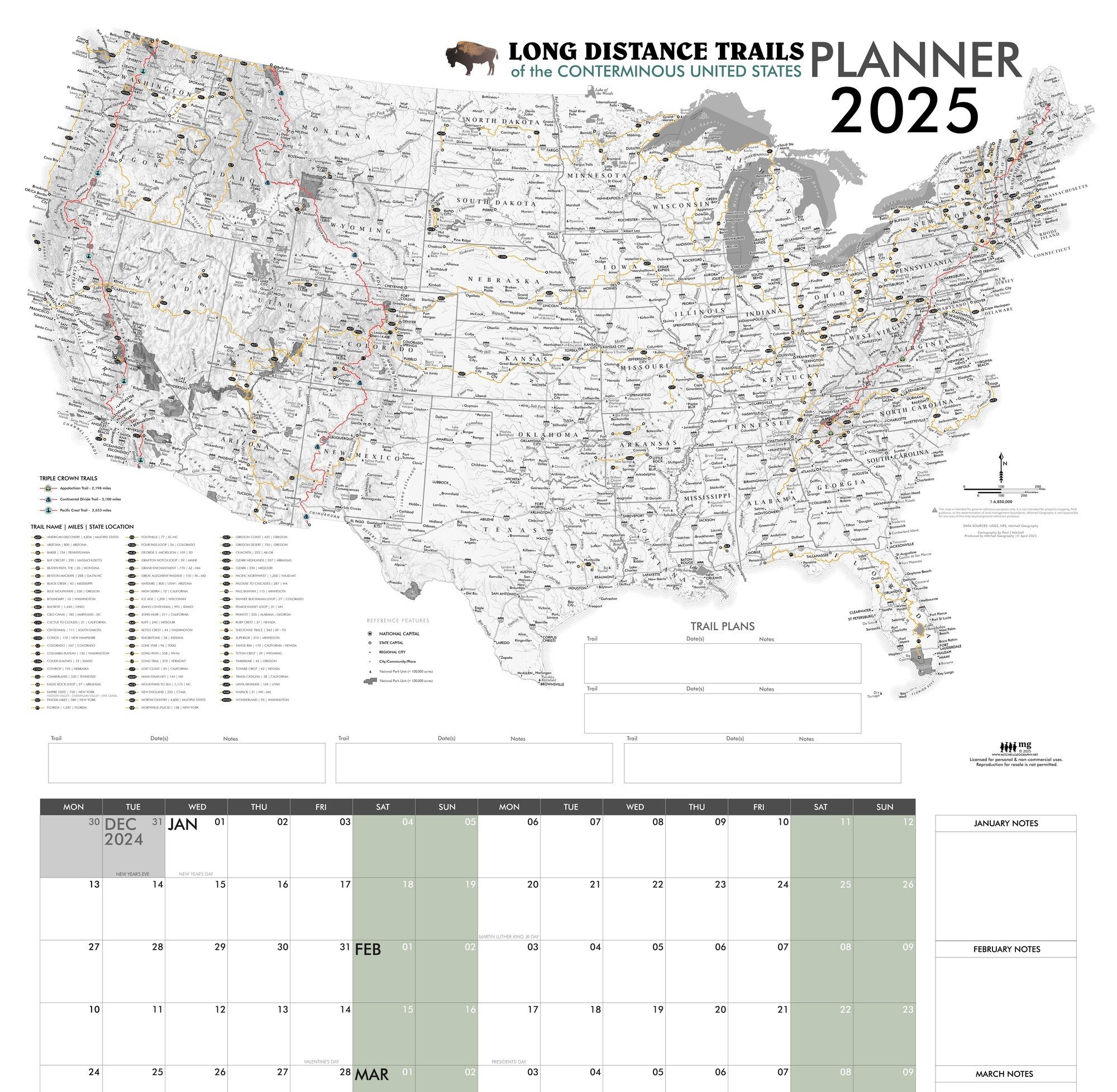
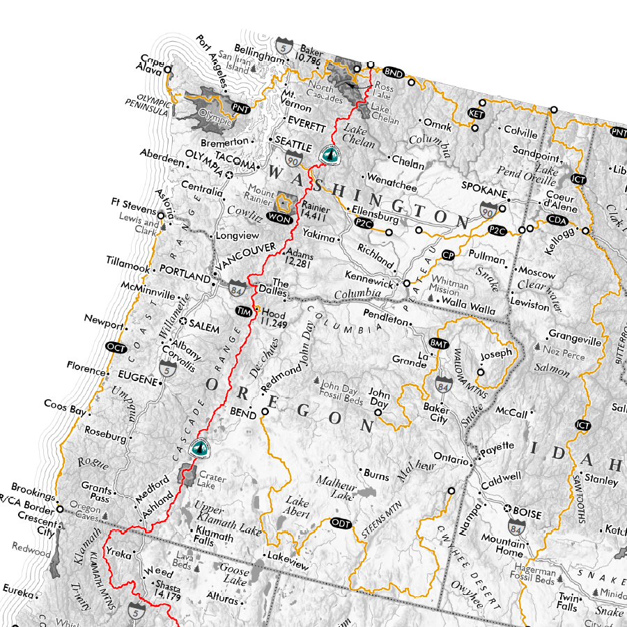
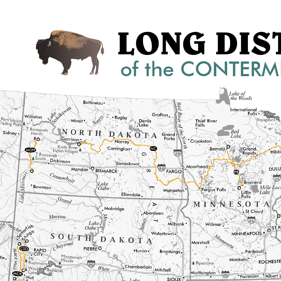
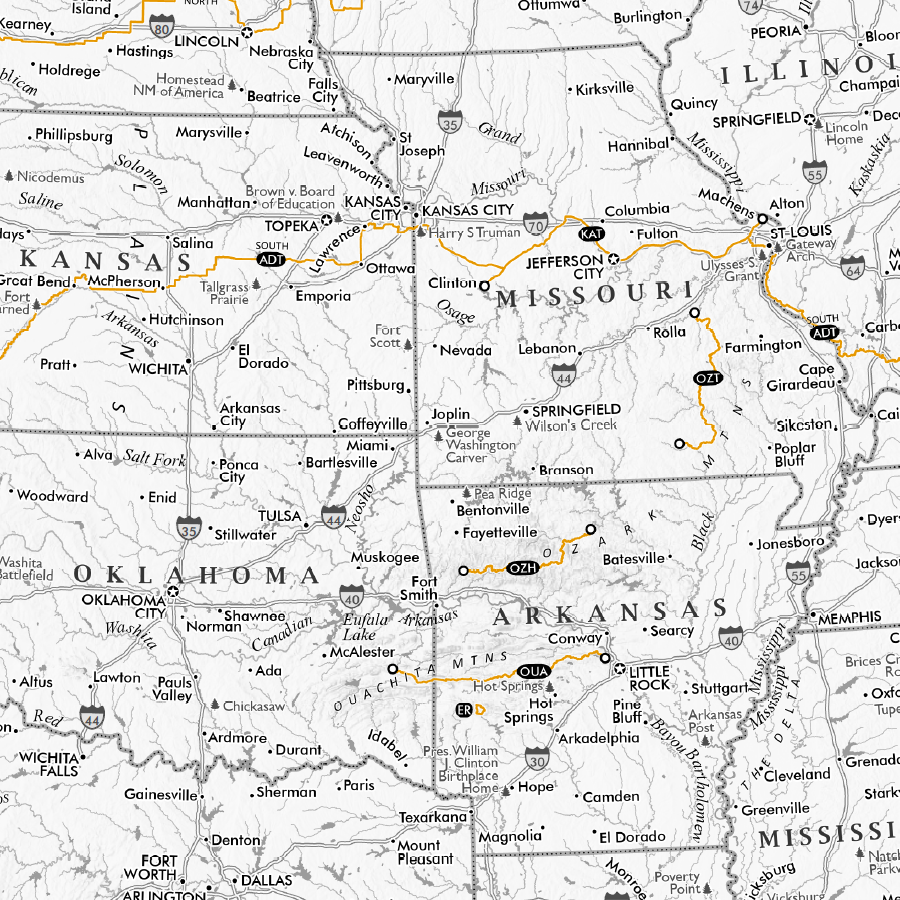
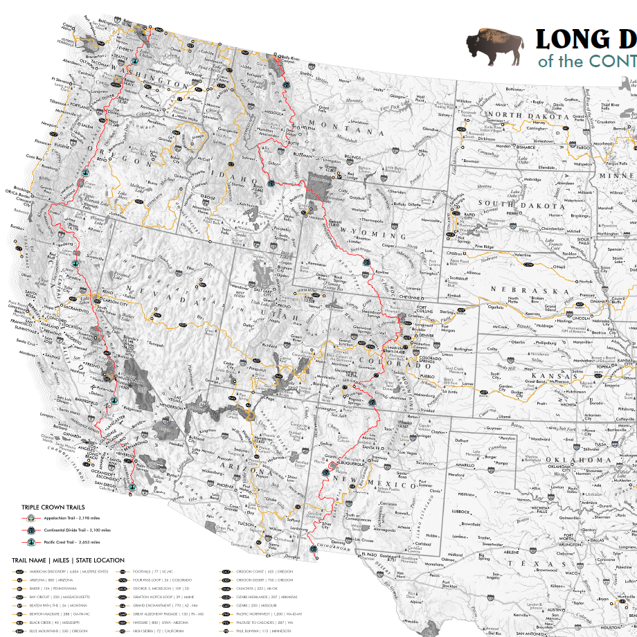
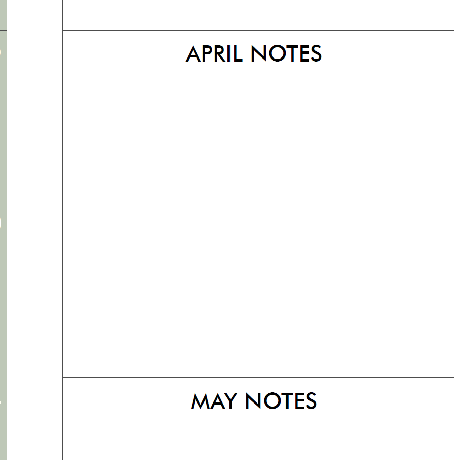
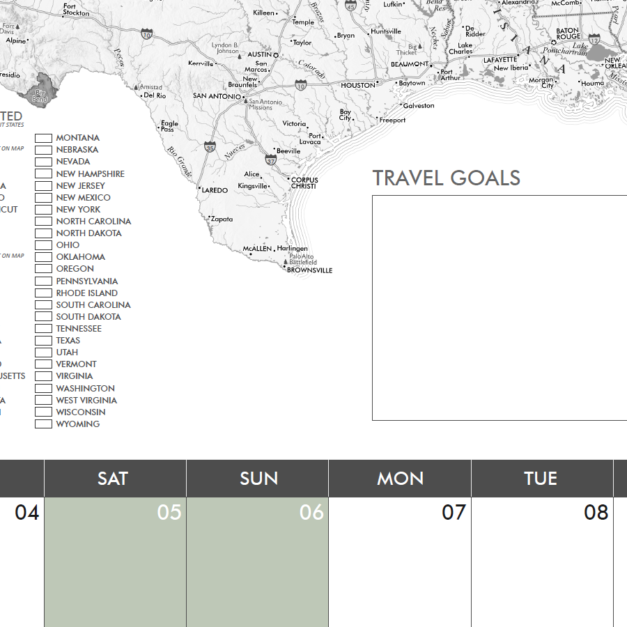
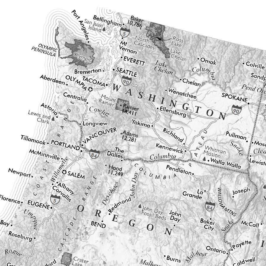
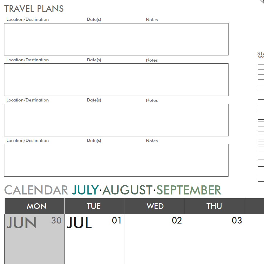
Featuring a grayscale map at the top, you can draw and highlight travel plans directly on the map with colored pens/makers travel plans as well as make use of the full year weekend aligned calendar planner below. This map features the 48 conterminous states (Alaska & Hawaii aren't included sorry to say). Capsules for travel plans and goals, along with a fun state checklist allow you to keep track of trips and plans. A side bar for monthly note capsules gives you additional space to detail your plans.
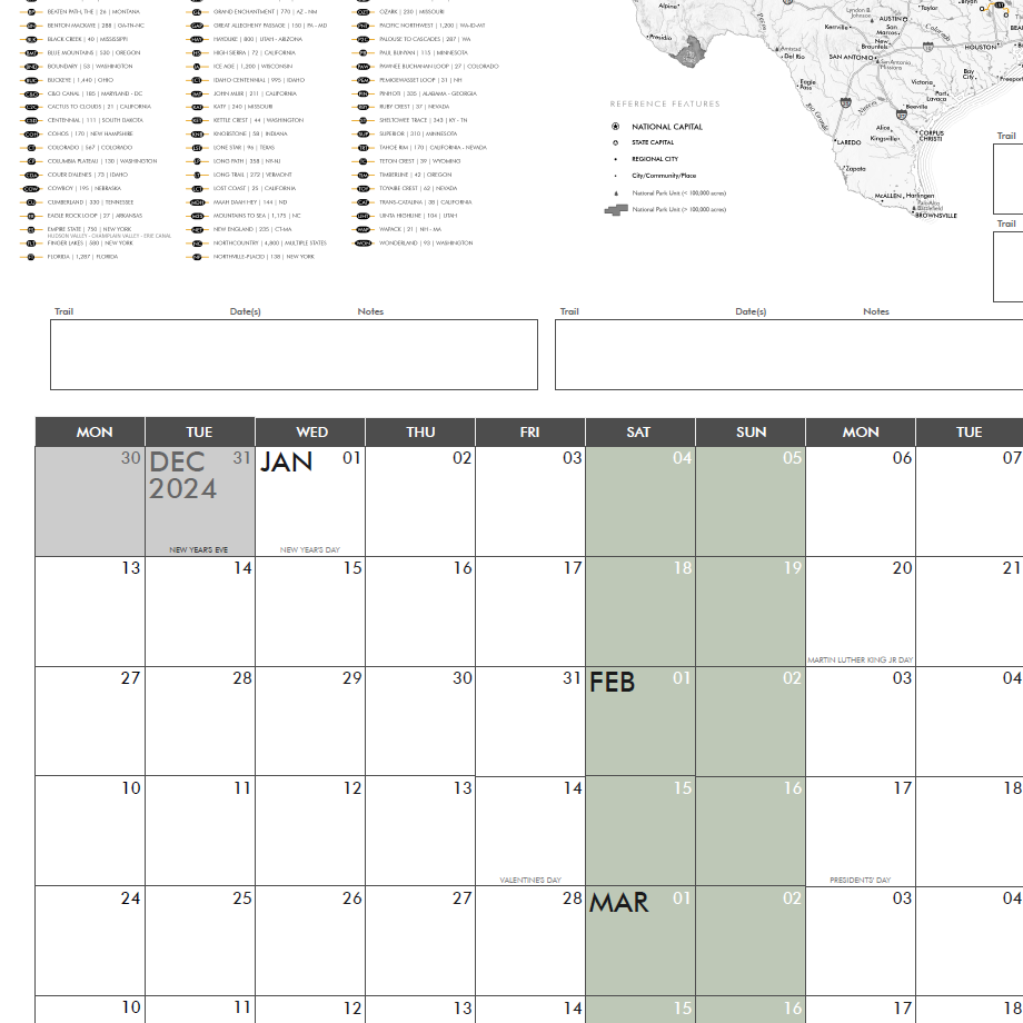
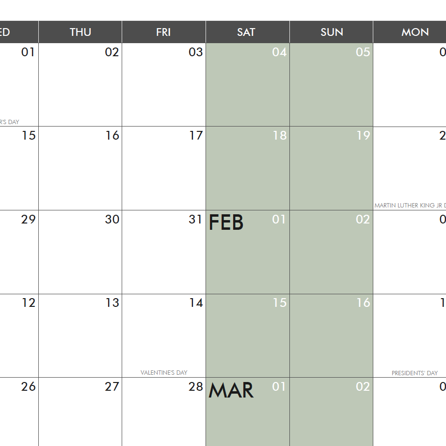
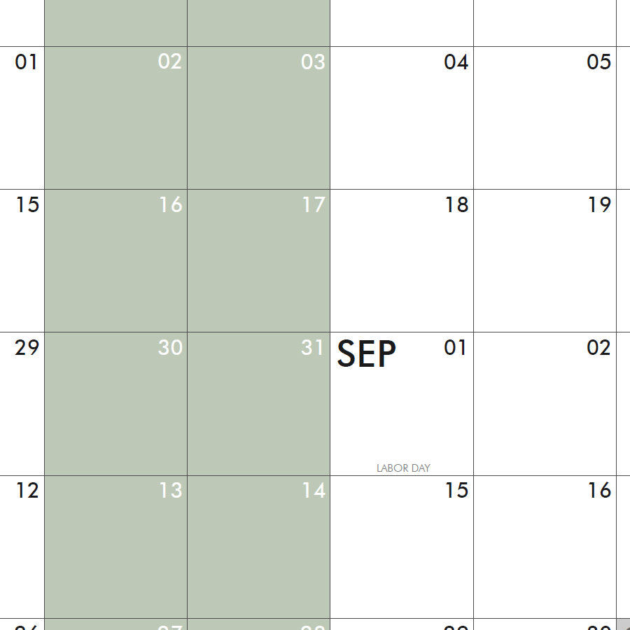
Daily scheduling spaces are just under 2" x 2" squares. Official US Holidays are listed.
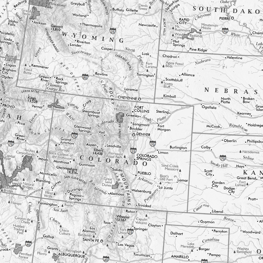
Map scale is 1:6,850,000
Map includes major cities, many regional towns and places of note, hydrology, interstate highways, landforms, many high points, and the majority of national park units as scale allows (e.g. small urban parks are not included)
JULY AUGUST SEPTEMBER 3RD QUARTER 2025 All-In-One Map Calendar!
28 inches wide x 36 inches long
DIGITAL DOWNLOAD ONLY. (15MB PDF instant download following checkout - image is 300 dpi)
This all-in-one map calendar wall planner is designed to be printed to a 28" x 64" sheet size (i.e. perfect for the back of a door). This is a digital PDF file download, you are responsible for printing and associated printing costs.
Featuring a grayscale map at the top, you can draw and highlight travel plans directly on the map with colored pens/makers travel plans as well as make use of the full year weekend aligned calendar planner below. This map features the 48 conterminous states (Alaska & Hawaii aren't included sorry to say). Capsules for travel plans and goals, along with a fun state checklist allow you to keep track of trips and plans. A side bar for monthly note capsules gives you additional space to detail your plans.
Daily scheduling spaces are just under 2" x 2" squares. Official US Holidays are listed.
Map scale is 1:6,850,000
Map includes major cities, many regional towns and places of note, hydrology, interstate highways, landforms, many high points, and the majority of national park units as scale allows (e.g. small urban parks are not included)