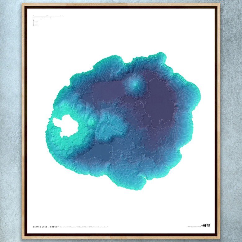
Image 1 of 3
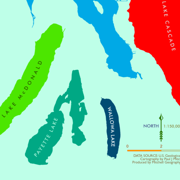
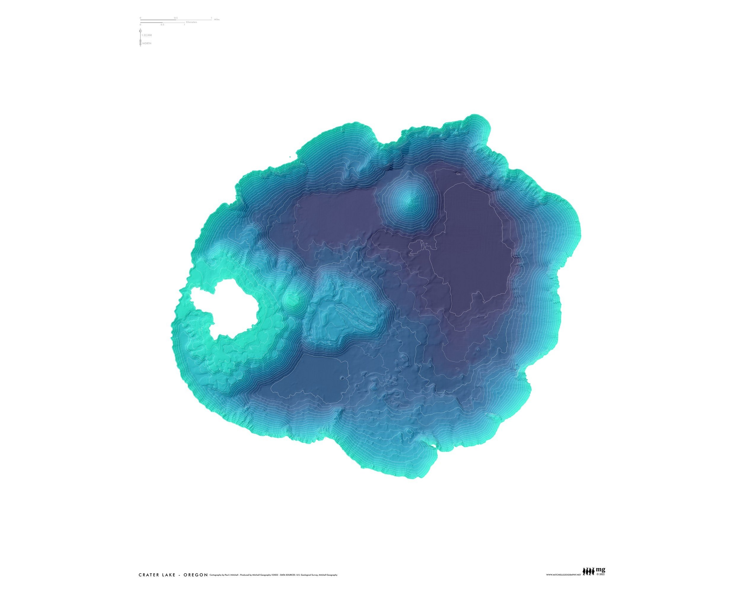
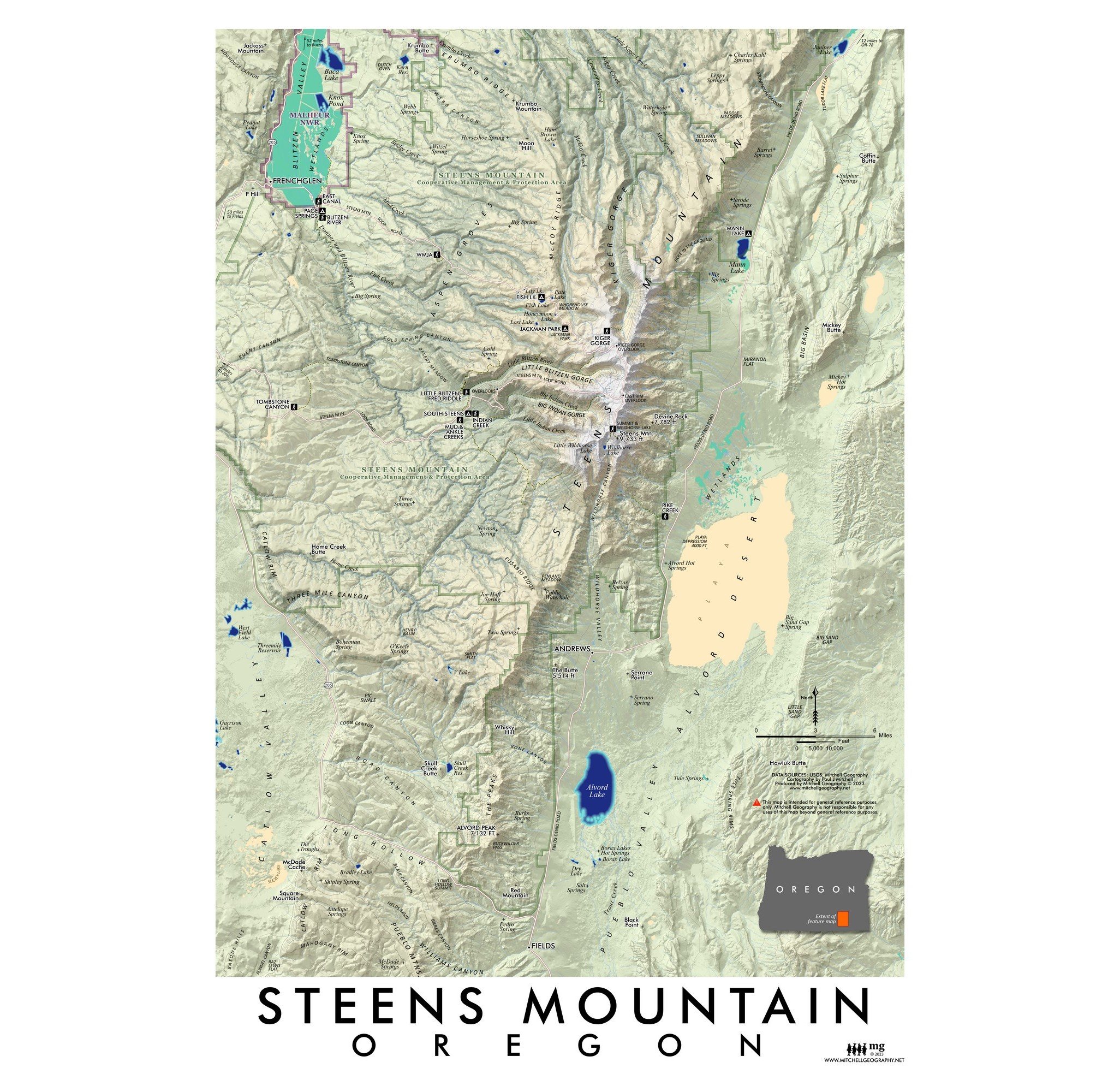 Image 2 of 3
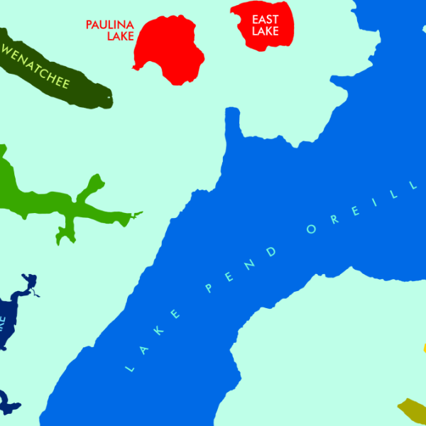
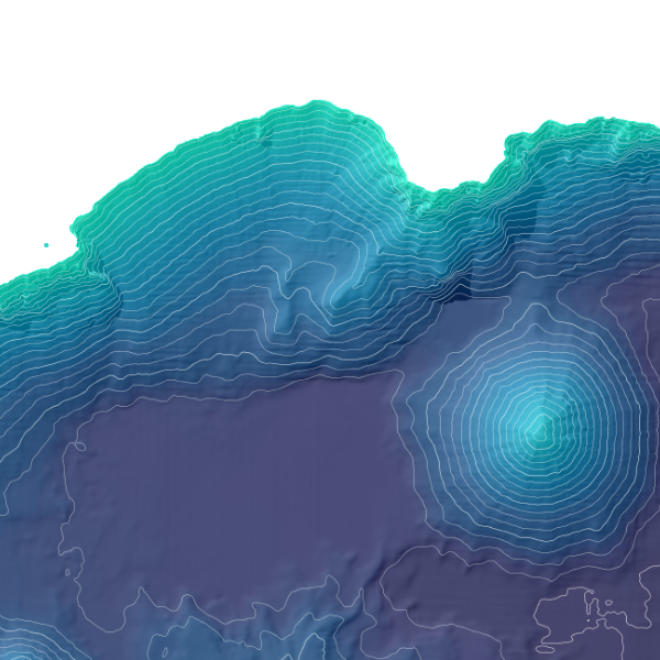
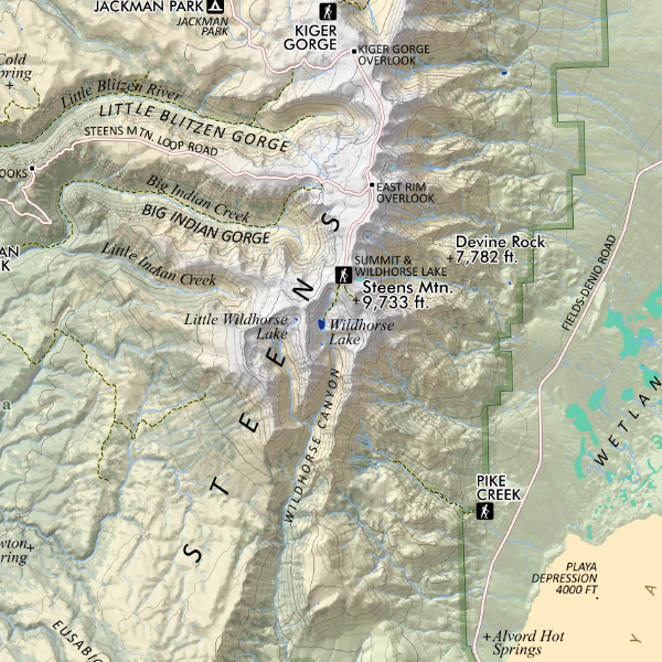 Image 3 of 3
1:184,000
13 inch by 19 inch flat wall map, printed on heavy fine paper. Packed and shipped flat.
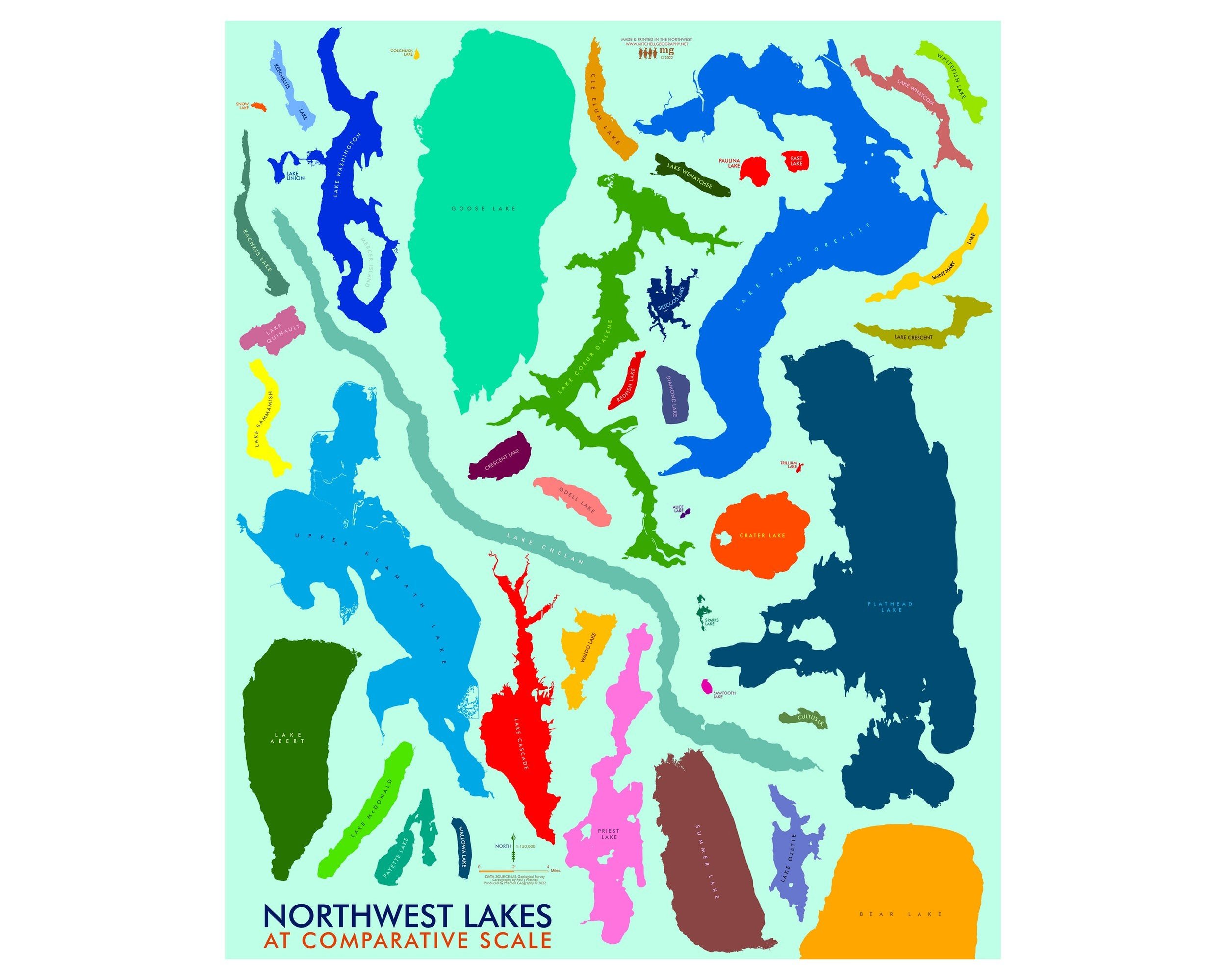
Steens Mountain, Oregon. Steens Mountain located in southeast Oregon is the tallest feature for miles in any direction. It's rugged east face drops nearly 5,000 vertical feet to the Alvord Desert's hot springs, alkali flats and bizarre lakes with endemic trout. The mountain's western flank gently slopes with large aspen groves and glacially carved gorges and canyons. Map features landforms and unique hydrologic features labeled. April 2023 update added trails, more feature labels, boundaries for the Steens Mtn. Cooperative Management Area, Malheur NWR area within map extent, the Steens Mountain Loop Road, and improved general map legibility.
1:184,000
13 inch by 19 inch flat wall map, printed on heavy fine paper. Packed and shipped flat.
Steens Mountain, Oregon. Steens Mountain located in southeast Oregon is the tallest feature for miles in any direction. It's rugged east face drops nearly 5,000 vertical feet to the Alvord Desert's hot springs, alkali flats and bizarre lakes with endemic trout. The mountain's western flank gently slopes with large aspen groves and glacially carved gorges and canyons. Map features landforms and unique hydrologic features labeled. April 2023 update added trails, more feature labels, boundaries for the Steens Mtn. Cooperative Management Area, Malheur NWR area within map extent, the Steens Mountain Loop Road, and improved general map legibility.