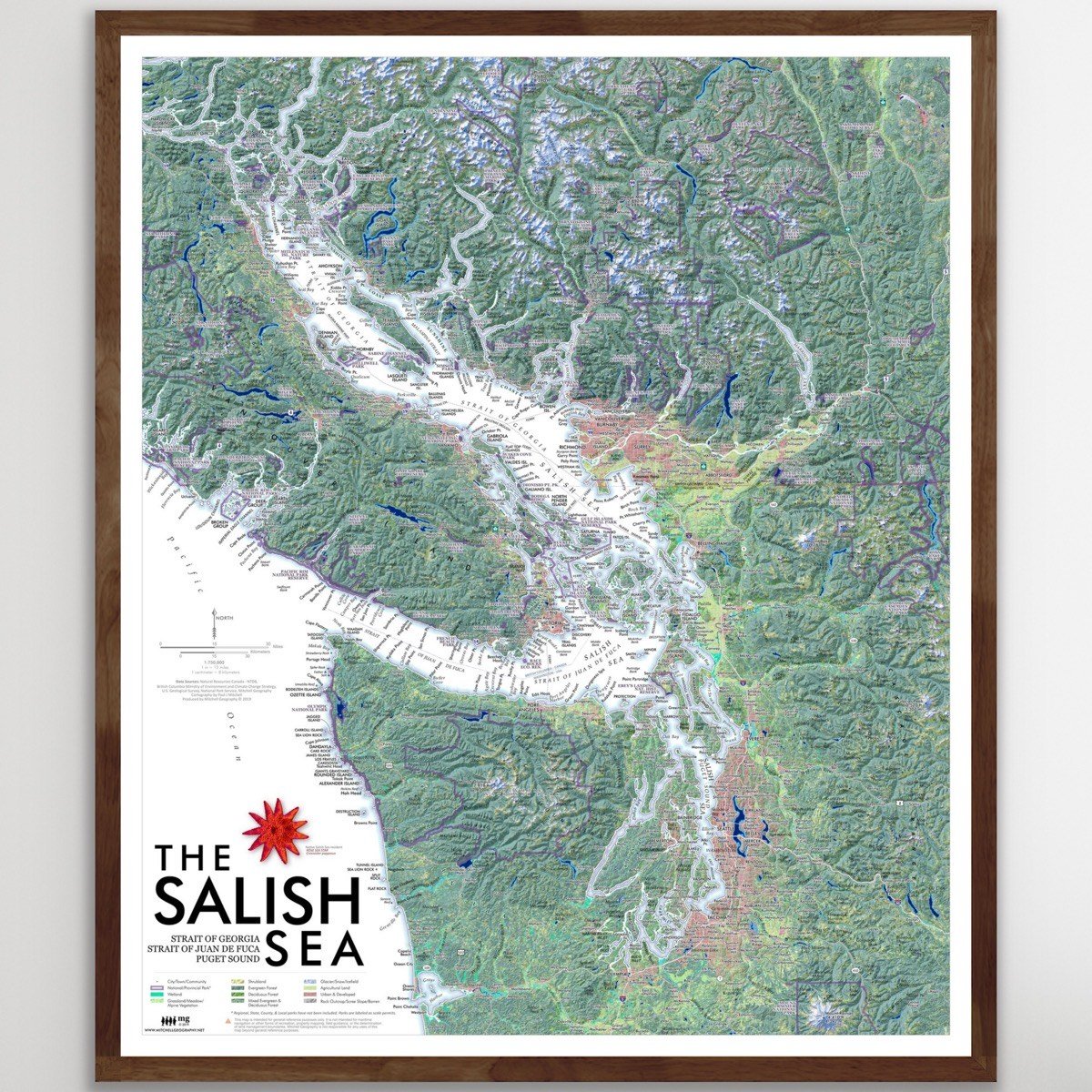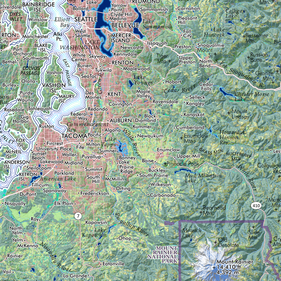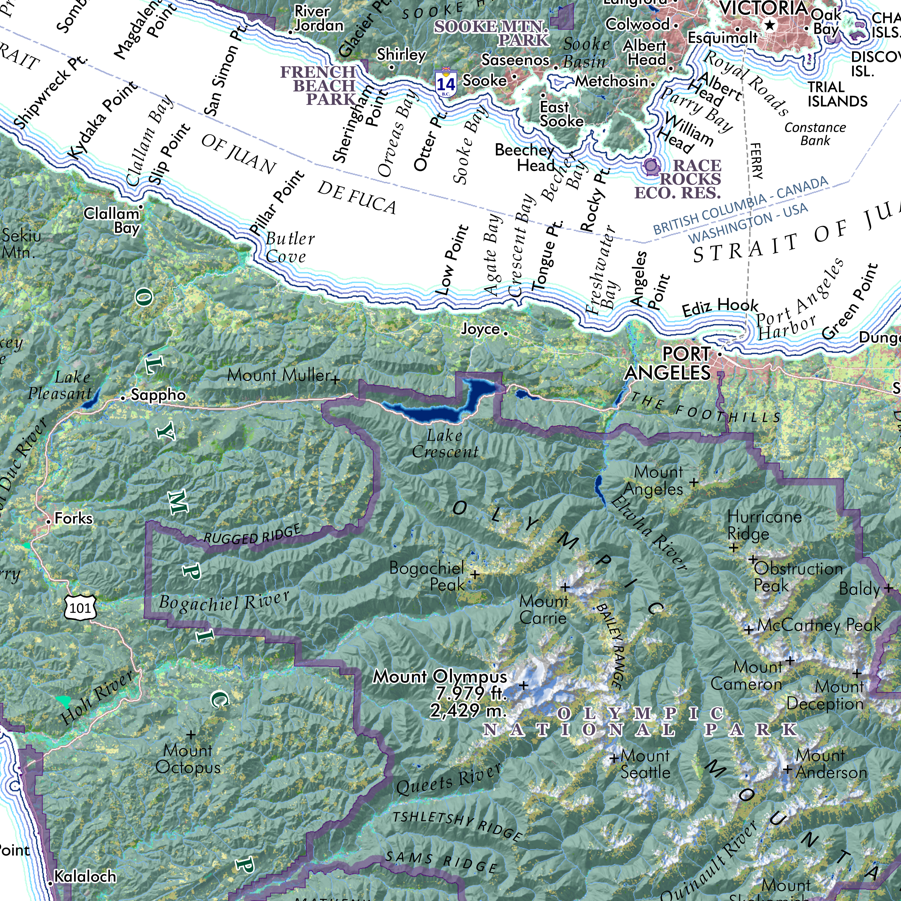


Washington State (24 in x 20 in)
1:1,100,000
20 inch x 24 inch — flat wall map, printed on a heavy fine paper — shipped rolled.
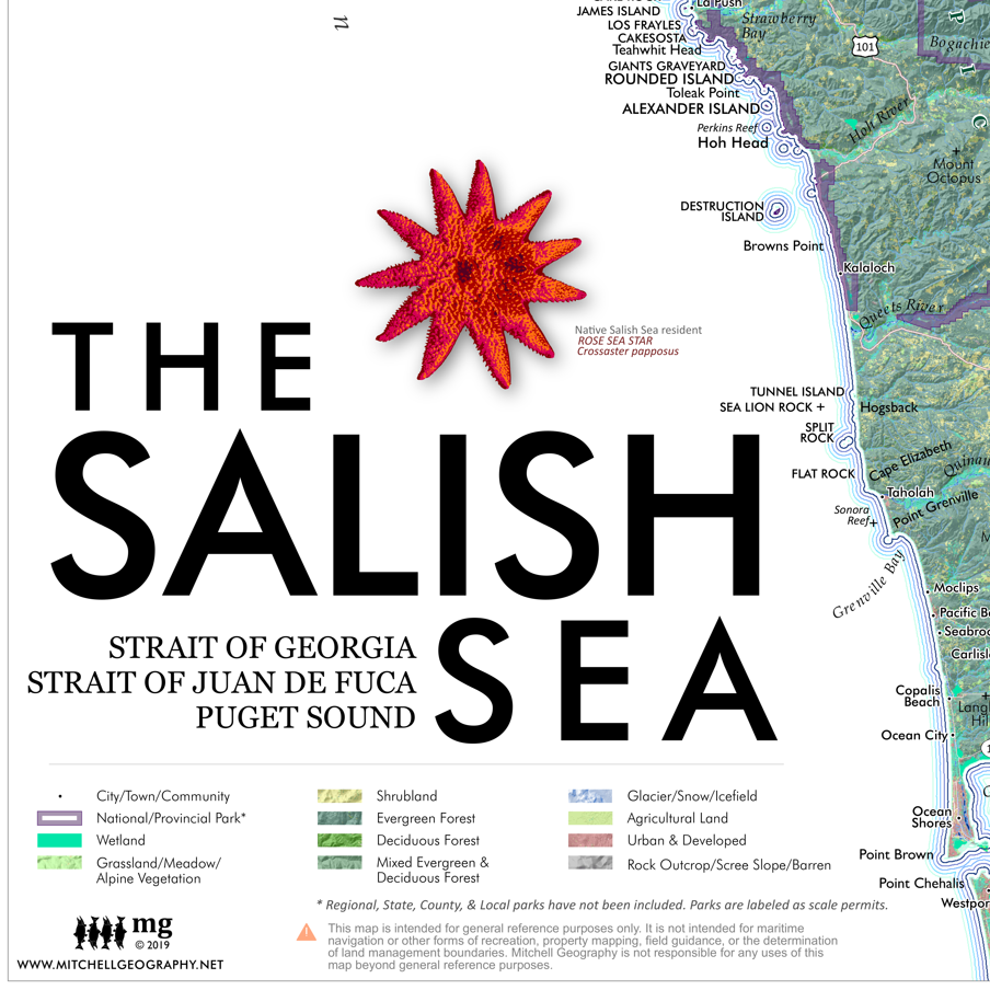
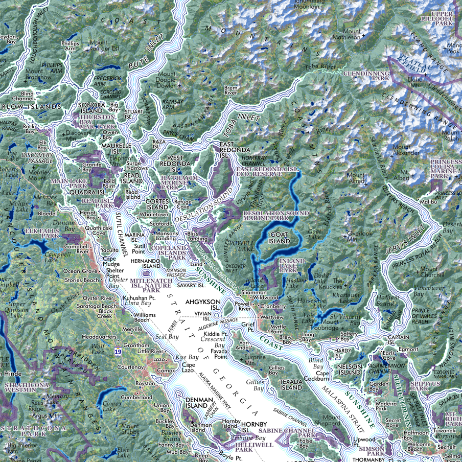
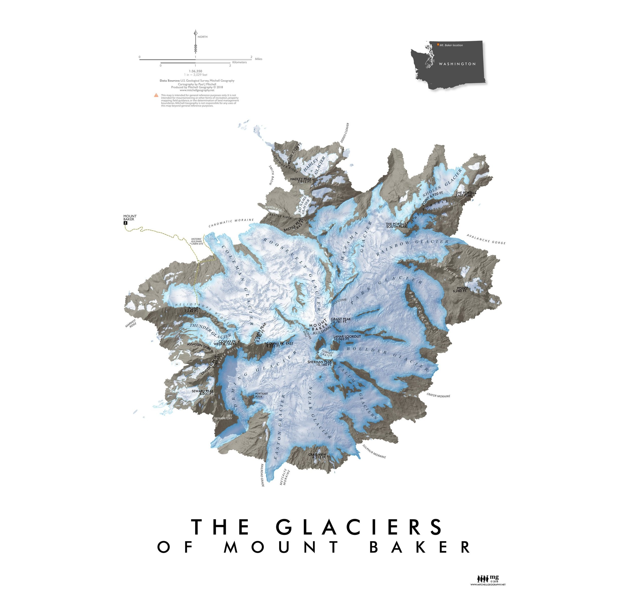
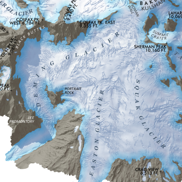
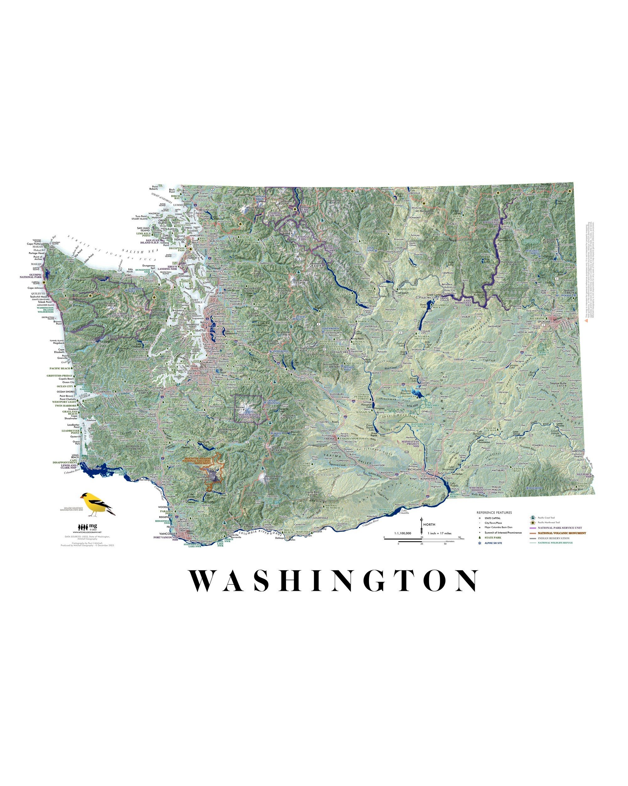
General reference map of Washington State. Detailed annotations include cities/towns/places, state parks, alpine ski areas, highways/major roads, prominent summits of interest, landforms of significance, National Park units, Indian Reservations, and National Wildlife Refuges. The Pacific Crest Trail and Pacific Northwest Trail are also featured.
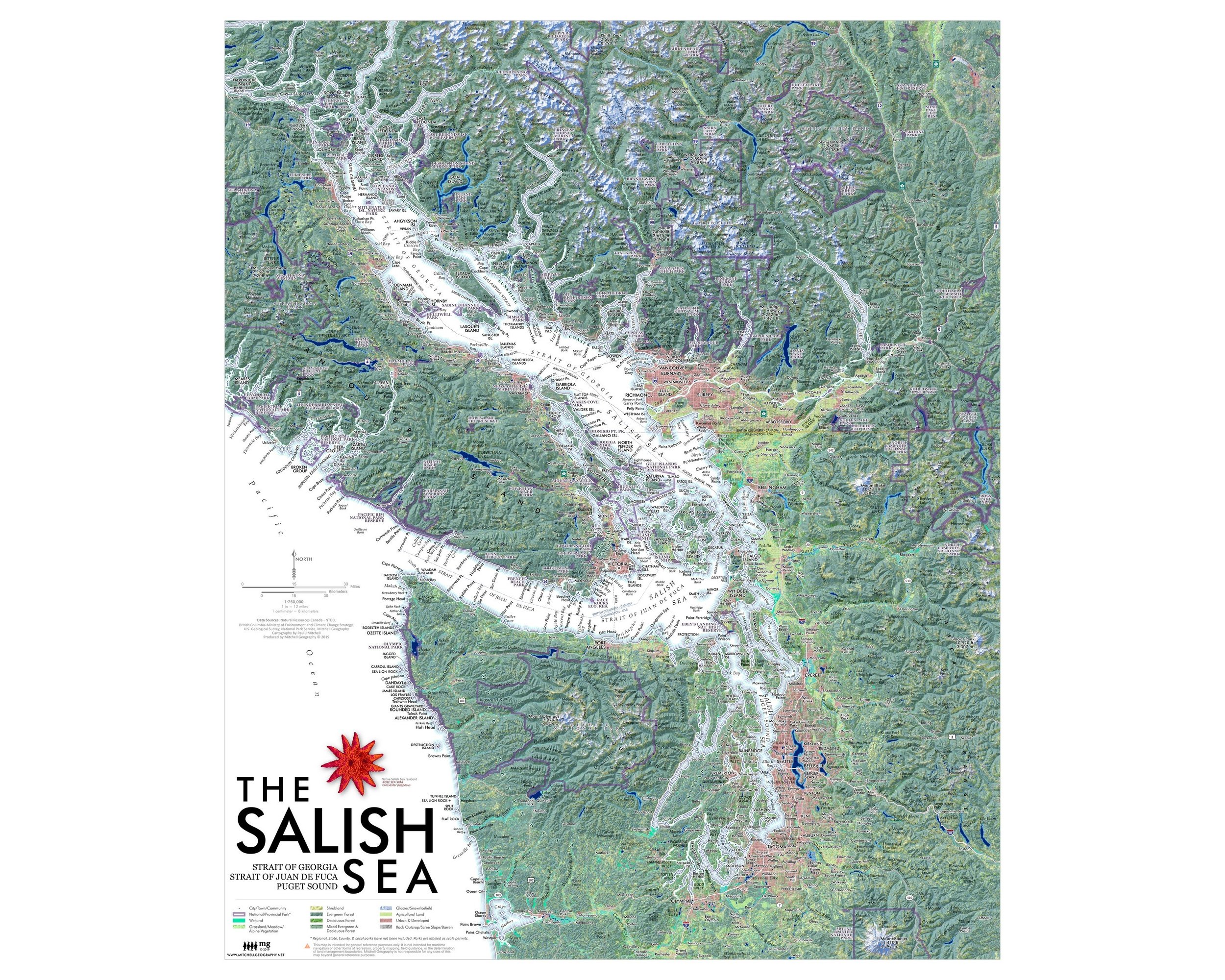
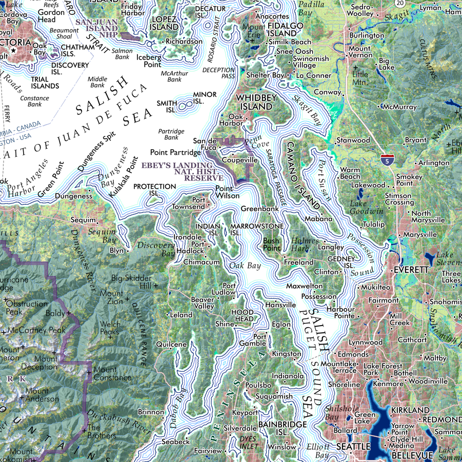
1:1,100,000
20 inch x 24 inch — flat wall map, printed on a heavy fine paper — shipped rolled.
General reference map of Washington State. Detailed annotations include cities/towns/places, state parks, alpine ski areas, highways/major roads, prominent summits of interest, landforms of significance, National Park units, Indian Reservations, and National Wildlife Refuges. The Pacific Crest Trail and Pacific Northwest Trail are also featured.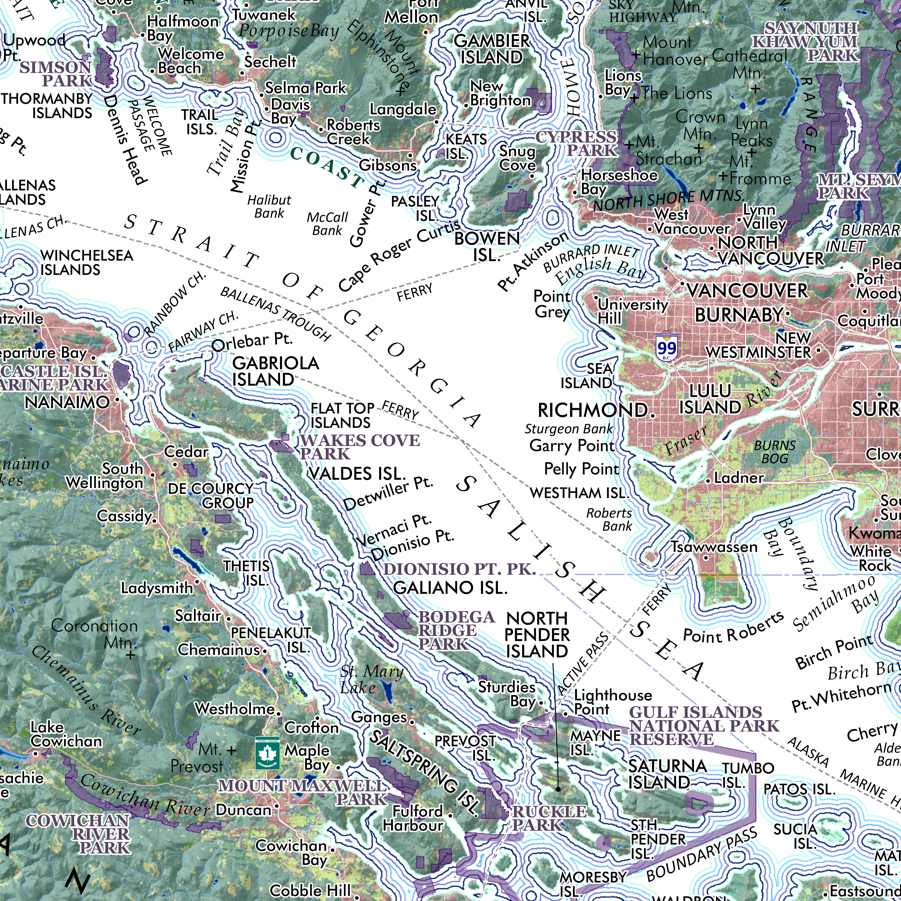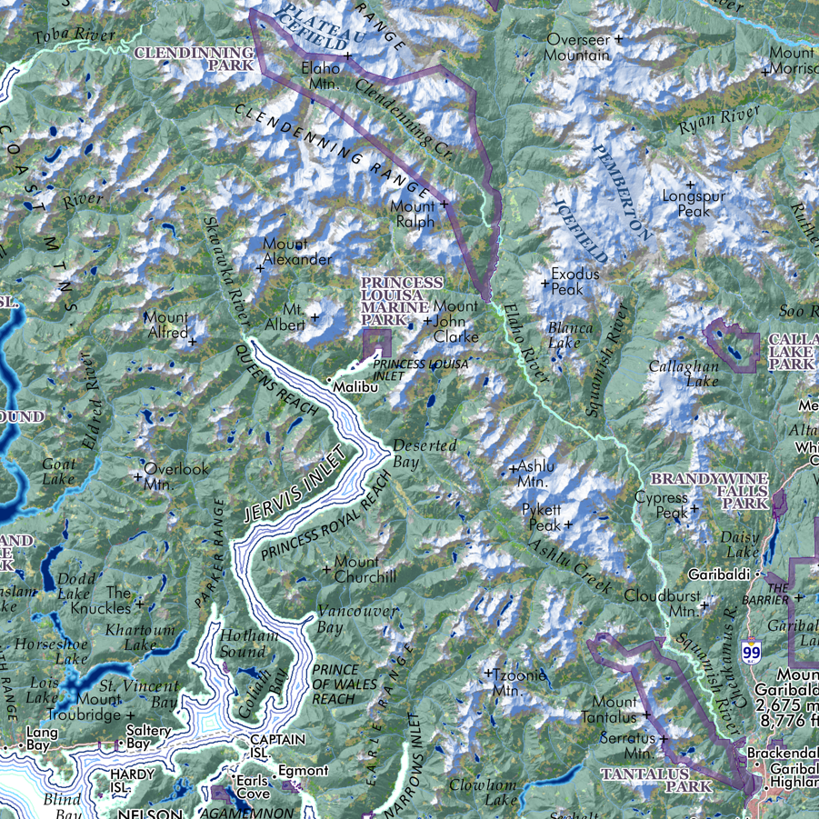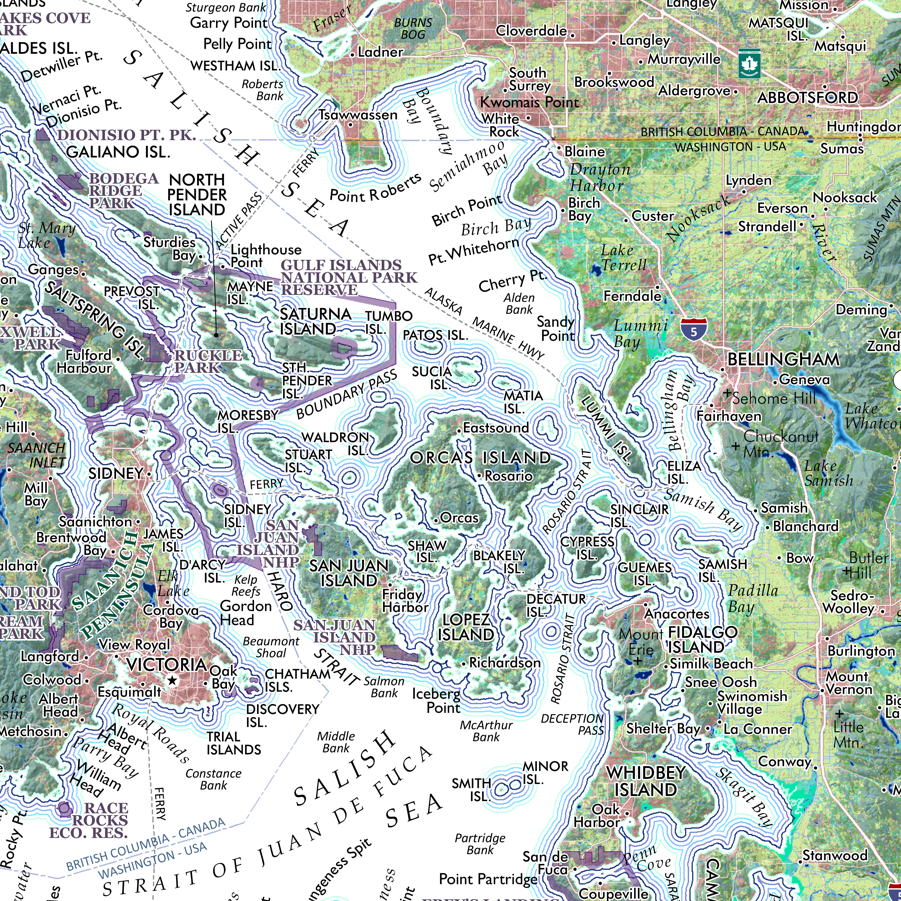