


PRINTABLE 36" x 48" Western Maine Mountains - Digital PDF Instant Download
36 inches wide x 48 inches long
DIGITAL DOWNLOAD ONLY. (96MB PDF instant download following checkout - image is 300 dpi)
You are responsible for printing and any associated printing costs. NOT TO BE RESOLD.
1:70,000
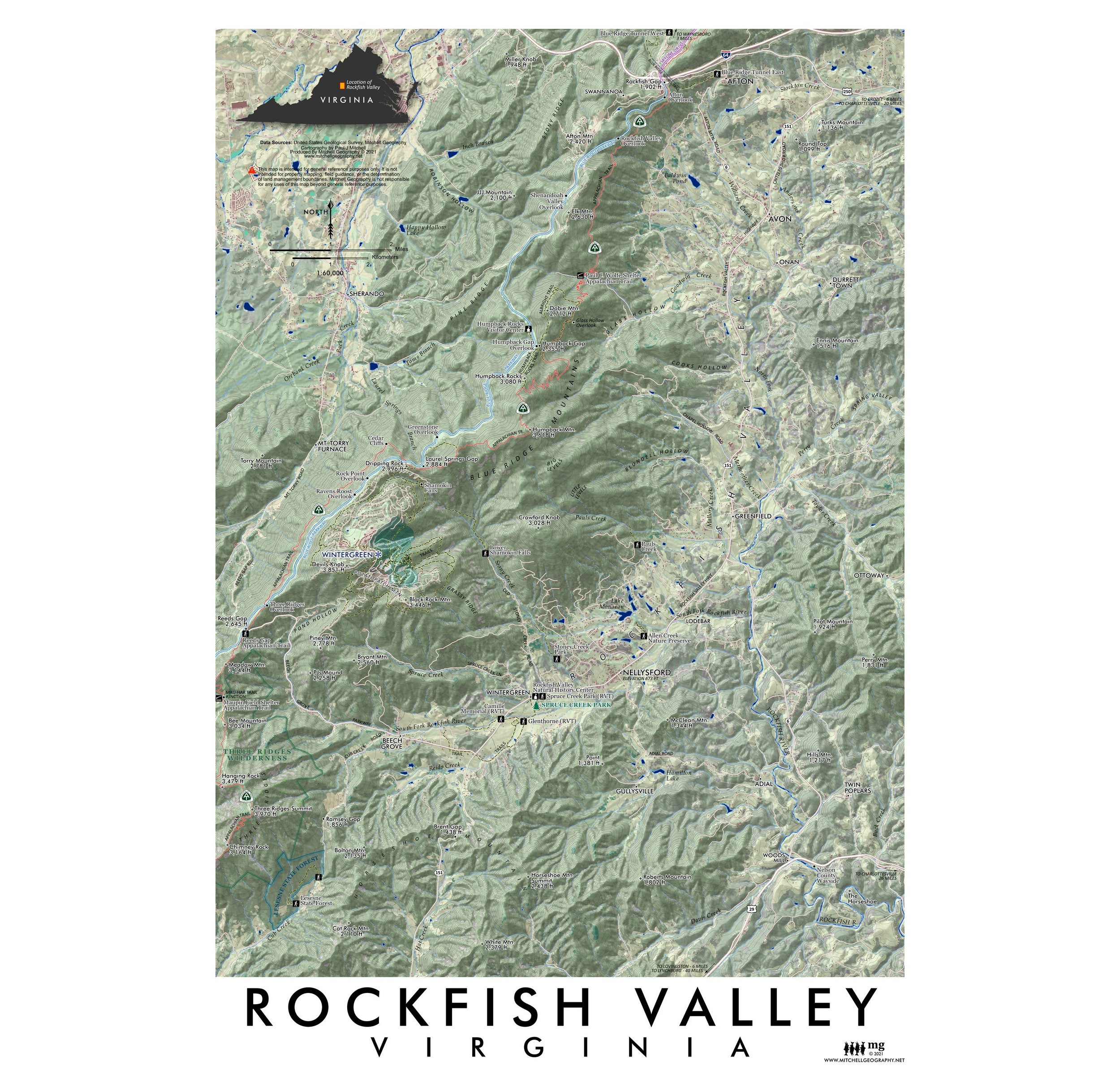
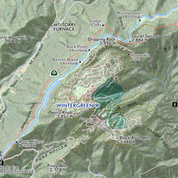
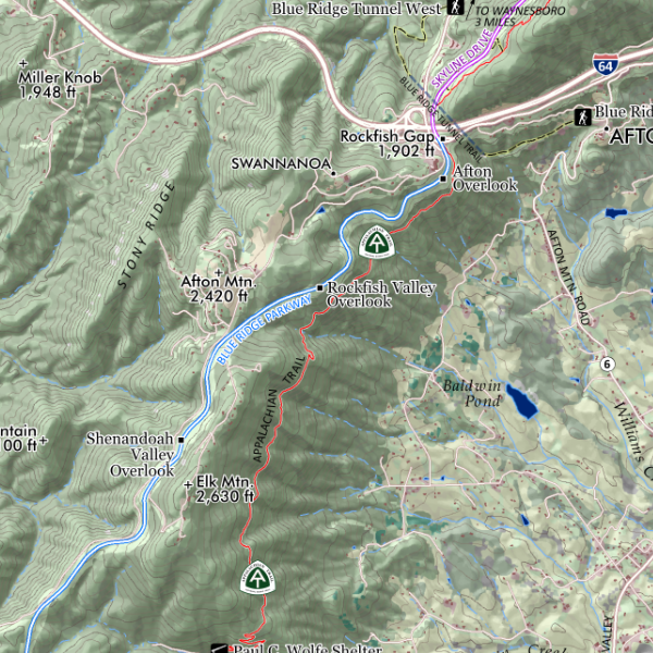
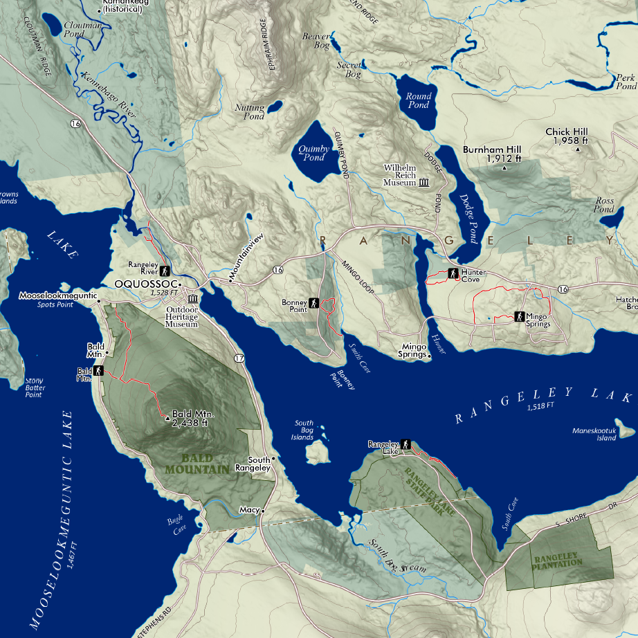
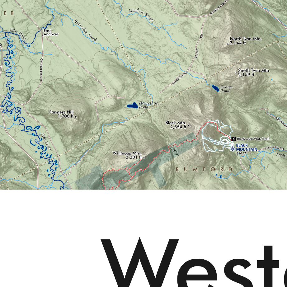
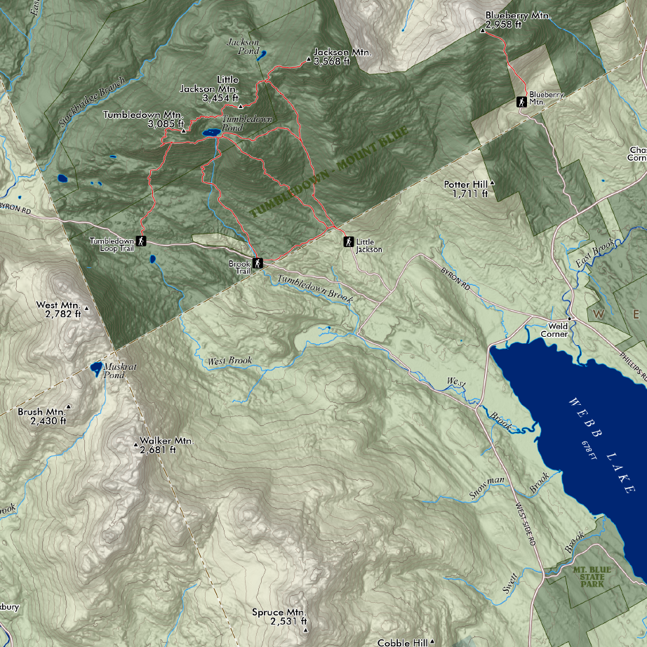
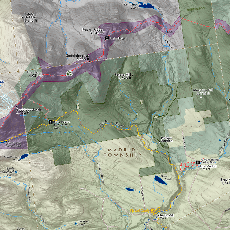
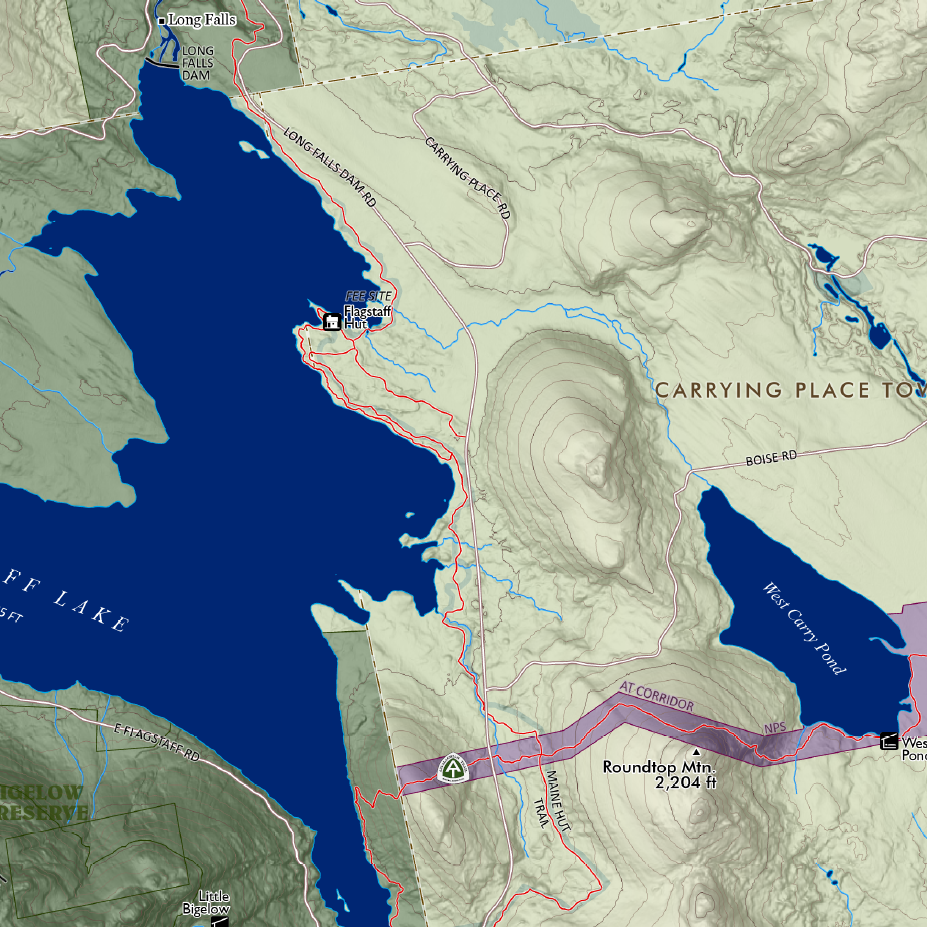
The Western Maine Mountains region. Feature overview and general reference map of the Western Maine Mountains (not including the Boundary Range or the Mahoosucs) — this map is intended to capture the Bigelow Range, Saddleback/Sugarloaf vicinity, and the Weld/Mt Blue/Tumbledown area. This extent includes the section of the Appalachian Trail north of Andover from Old Blue/Elephant/Bemis > Saddleback > Mt. Abraham > Sugarloaf > The Crockers > the Bigelow Range > Carrying Place Township ending at Pierce Pond. The extent also includes the regional towns of Farmington, Wilton, New Vineyard, New Portland, Strong, Phillips, Kingfield, Carrabassett Valley, Stratton/Eustis, Rangeley, Oquossoc, Kennebago Lake, Byron, Andover and the northern edges of Rumford/Mexico.
Labeled for reference -- trails (e.g. the AT, Fly Rod Crosby, Maine Huts & Trails, Maine BPL), trailheads, alpine ski slopes (Saddleback, Sugarloaf, Black Mtn., Titcomb Mtn.), landmarks (Wire Bridge, Wilhelm Reich Museum, etc.), place names, summits with elevations, rivers, lakes, ponds, highway and road names. Fee owned public lands -- the National Park Service's Appalachian Trail Corridor and Maine BPL (Bureau of Parks and Lands) preserves (e.g. Bigelow) are mapped and labeled including the very recent Cascades addition along the Orbeton and Perham Streams (non-profit conserved lands are not mapped, though some of their trails are included). Fee sites included are labeled accordingly.
The Western Maine Mountains have been an important part of my life. While thru-hiking the Appalachian Trail in 2005 I distinctly recall an immediate affinity for the area while approaching Saddleback's alpine ridge and the joy of continuing through the Bigelow Range under stunning weather and pleasant temperatures. It seemed there was a great place to swim and relax at the end of every day's giant rewarding climbs and descents. A year later I found a job in Farmington and constantly explored the area, climbing Little Jackson & Tumbledown every day I could, retracing the nearby AT sections, skinning up Saddleback and Sugarloaf past the season's end to telemark the spring corn with new friends. Eventually reality set in and I knew I'd have to move away to finally pay off my student loans. This map captures all the places and names that I know have brought so many others fantastic memories and experiences.
36 inches wide x 48 inches long
DIGITAL DOWNLOAD ONLY. (96MB PDF instant download following checkout - image is 300 dpi)
You are responsible for printing and any associated printing costs. NOT TO BE RESOLD.
1:70,000
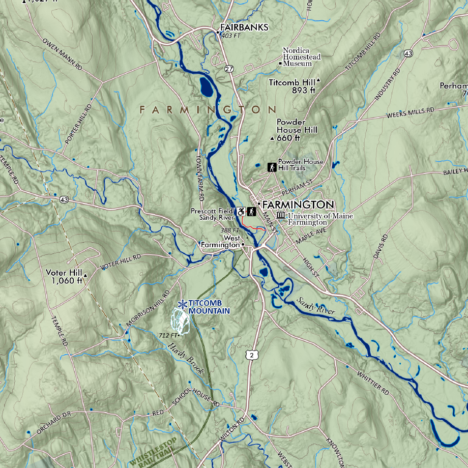
The Western Maine Mountains region. Feature overview and general reference map of the Western Maine Mountains (not including the Boundary Range or the Mahoosucs) — this map is intended to capture the Bigelow Range, Saddleback/Sugarloaf vicinity, and the Weld/Mt Blue/Tumbledown area. This extent includes the section of the Appalachian Trail north of Andover from Old Blue/Elephant/Bemis > Saddleback > Mt. Abraham > Sugarloaf > The Crockers > the Bigelow Range > Carrying Place Township ending at Pierce Pond. The extent also includes the regional towns of Farmington, Wilton, New Vineyard, New Portland, Strong, Phillips, Kingfield, Carrabassett Valley, Stratton/Eustis, Rangeley, Oquossoc, Kennebago Lake, Byron, Andover and the northern edges of Rumford/Mexico.
Labeled for reference -- trails (e.g. the AT, Fly Rod Crosby, Maine Huts & Trails, Maine BPL), trailheads, alpine ski slopes (Saddleback, Sugarloaf, Black Mtn., Titcomb Mtn.), landmarks (Wire Bridge, Wilhelm Reich Museum, etc.), place names, summits with elevations, rivers, lakes, ponds, highway and road names. Fee owned public lands -- the National Park Service's Appalachian Trail Corridor and Maine BPL (Bureau of Parks and Lands) preserves (e.g. Bigelow) are mapped and labeled including the very recent Cascades addition along the Orbeton and Perham Streams (non-profit conserved lands are not mapped, though some of their trails are included). Fee sites included are labeled accordingly.
The Western Maine Mountains have been an important part of my life. While thru-hiking the Appalachian Trail in 2005 I distinctly recall an immediate affinity for the area while approaching Saddleback's alpine ridge and the joy of continuing through the Bigelow Range under stunning weather and pleasant temperatures. It seemed there was a great place to swim and relax at the end of every day's giant rewarding climbs and descents. A year later I found a job in Farmington and constantly explored the area, climbing Little Jackson & Tumbledown every day I could, retracing the nearby AT sections, skinning up Saddleback and Sugarloaf past the season's end to telemark the spring corn with new friends. Eventually reality set in and I knew I'd have to move away to finally pay off my student loans. This map captures all the places and names that I know have brought so many others fantastic memories and experiences.