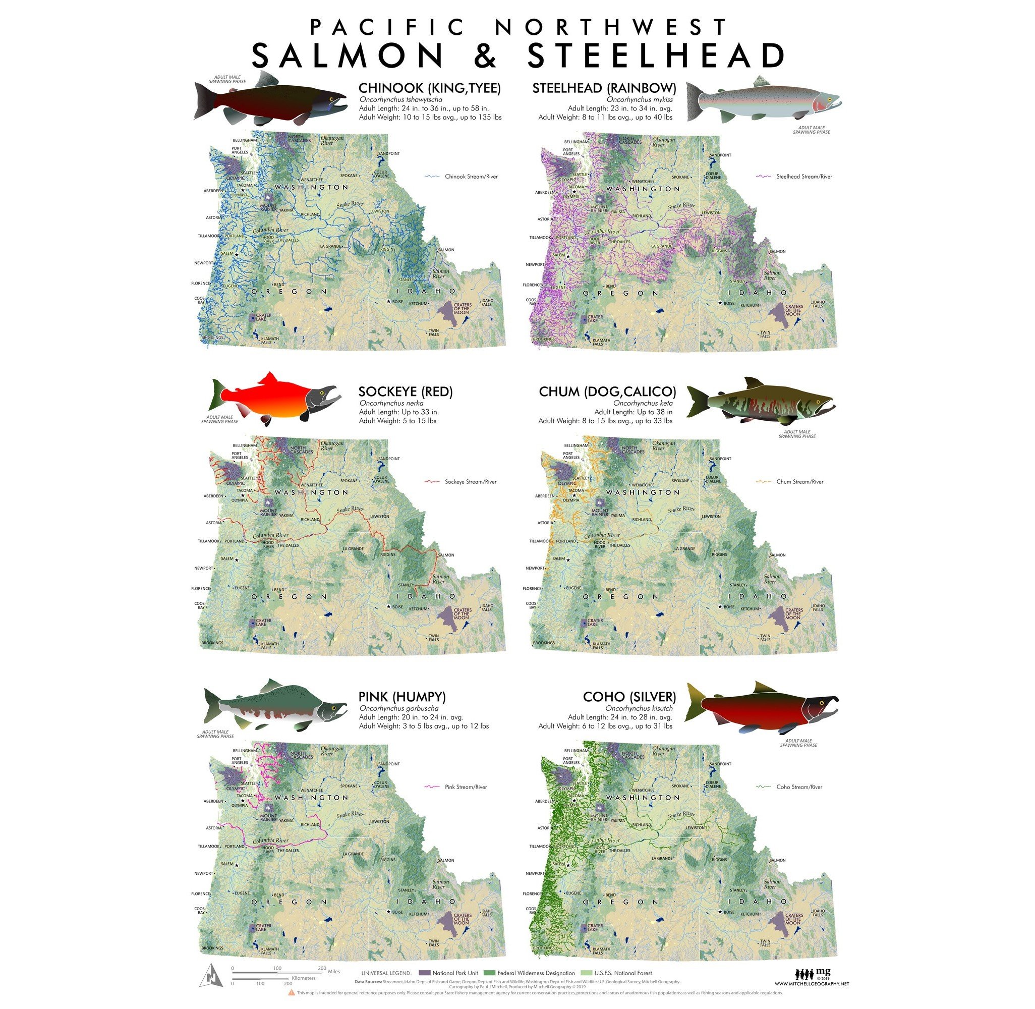
The Enchantments Washington (19 in x 13 in)
1:32,000
13 inch by 19 inch flat wall map, printed on heavy fine paper. Packed and shipped flat.
Map is rotated 30 degrees northeast to make the most of the scale at the the page dimension.
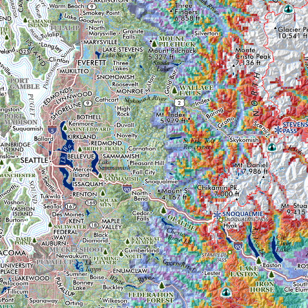
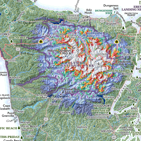
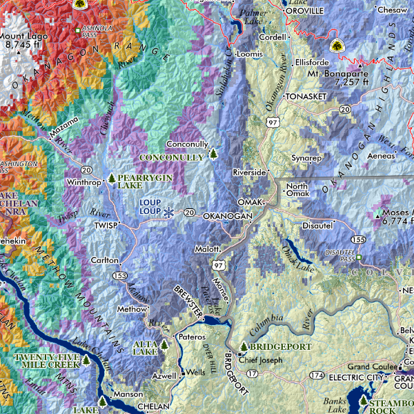
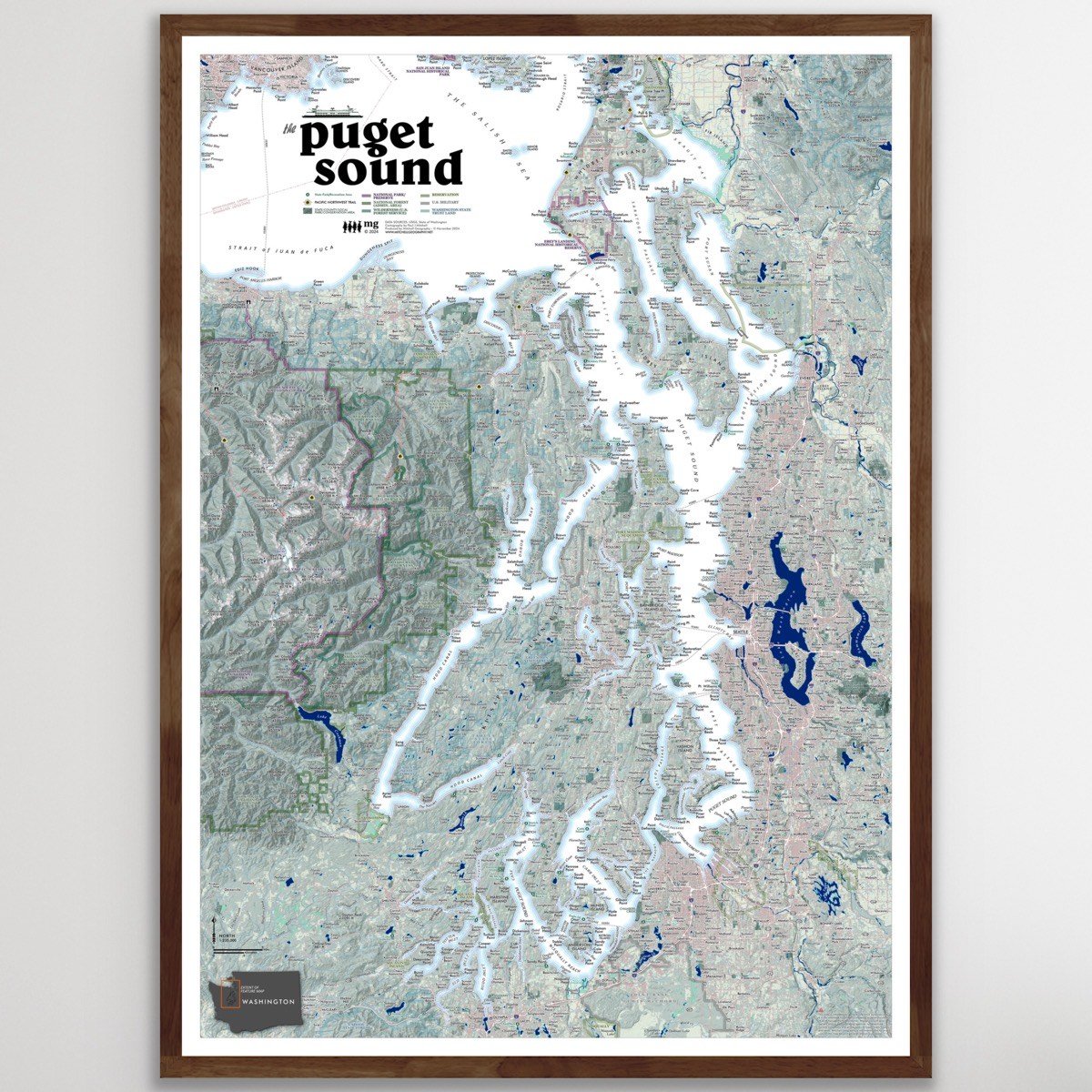
Feature map of the Enchantments vicinity of the Stuart Range in central Washington, just south of Leavenworth and contained within the federal designated Alpine Lakes Wilderness. Includes lakes, glacier features, trails, and an assortment of both the official and provincial place names including many of the Stark’s now adopted Norse and assorted fantastical names, as well as alpine references for previously unlabeled spires, etc. Elevations for primary summits and major passes are labeled.
1:32,000
13 inch by 19 inch flat wall map, printed on heavy fine paper. Packed and shipped flat.
Map is rotated 30 degrees northeast to make the most of the scale at the the page dimension.
Feature map of the Enchantments vicinity of the Stuart Range in central Washington, just south of Leavenworth and contained within the federal designated Alpine Lakes Wilderness. Includes lakes, glacier features, trails, and an assortment of both the official and provincial place names including many of the Stark’s now adopted Norse and assorted fantastical names, as well as alpine references for previously unlabeled spires, etc. Elevations for primary summits and major passes are labeled.