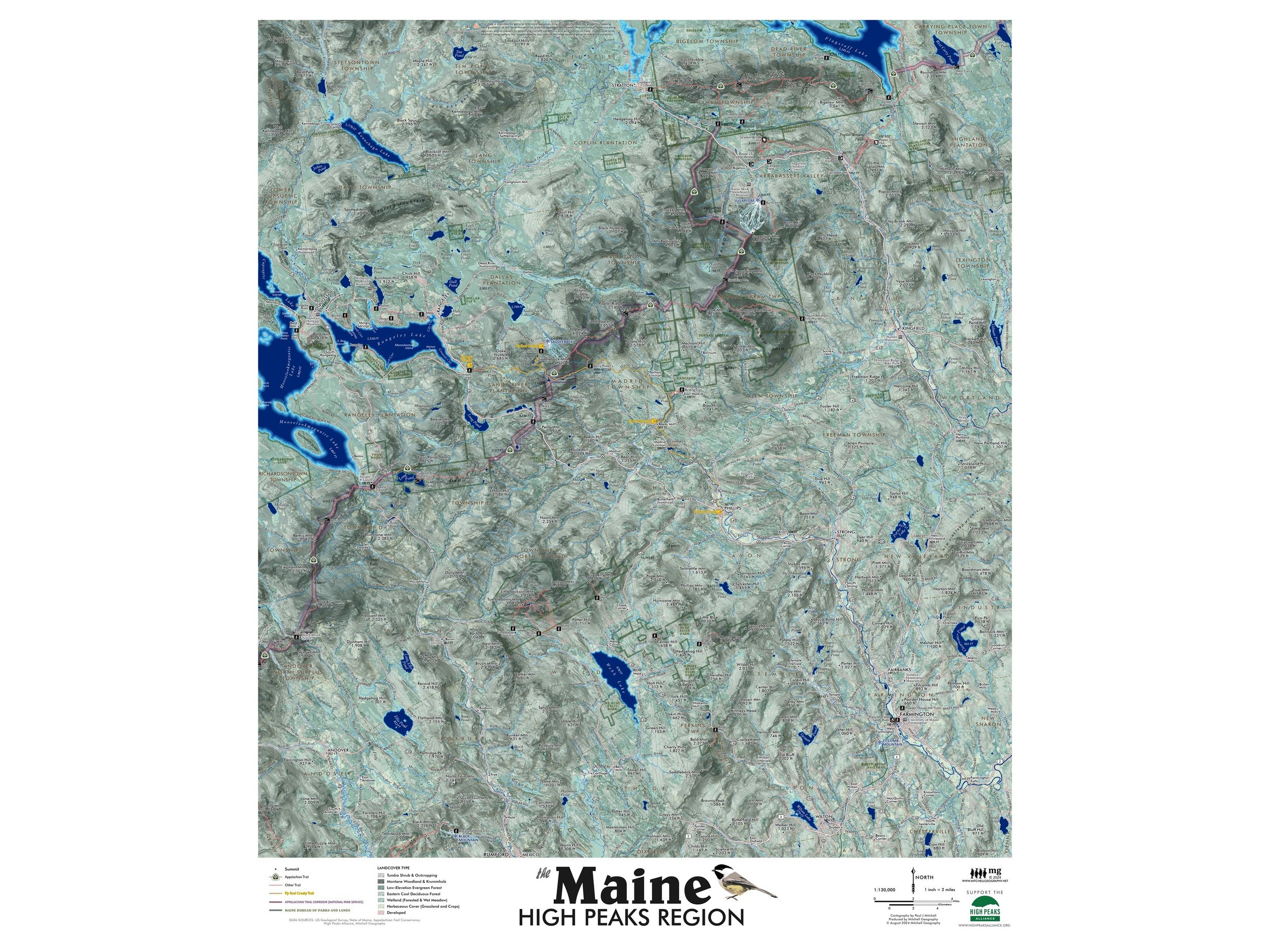
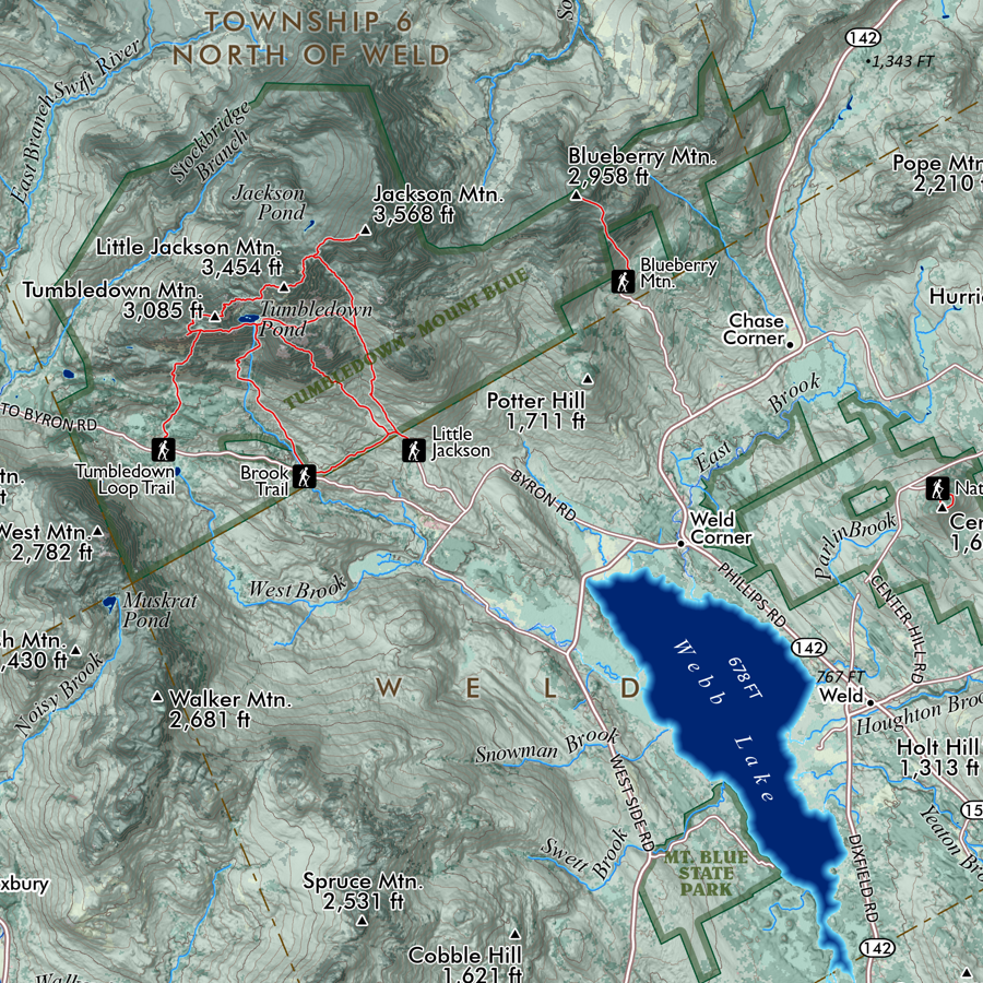
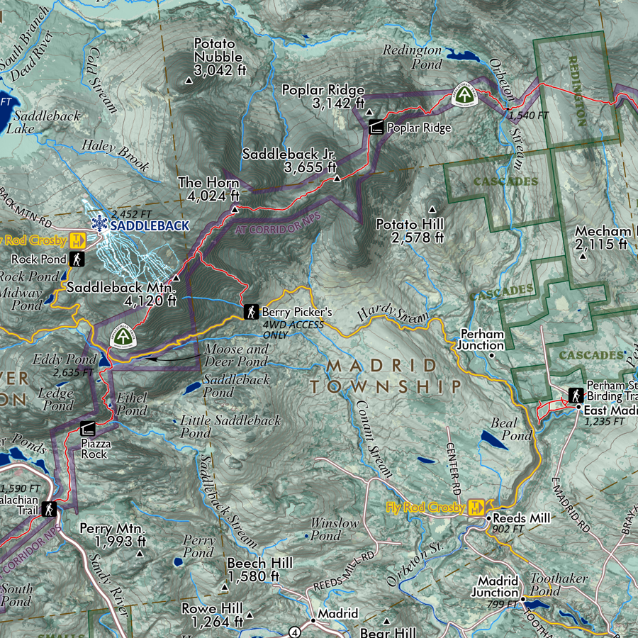
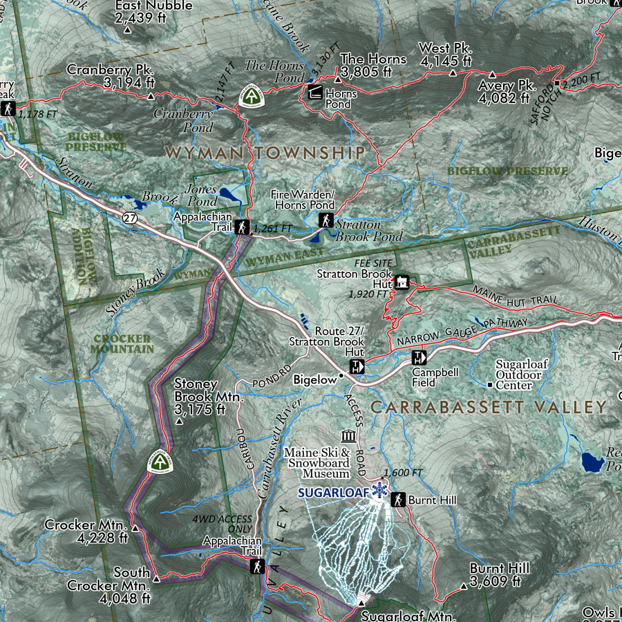
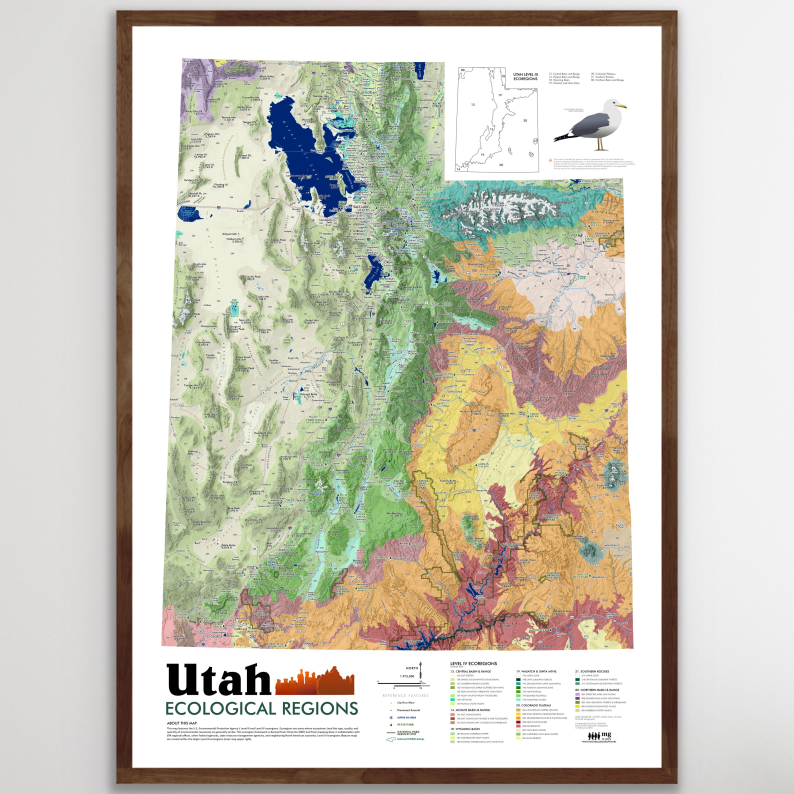
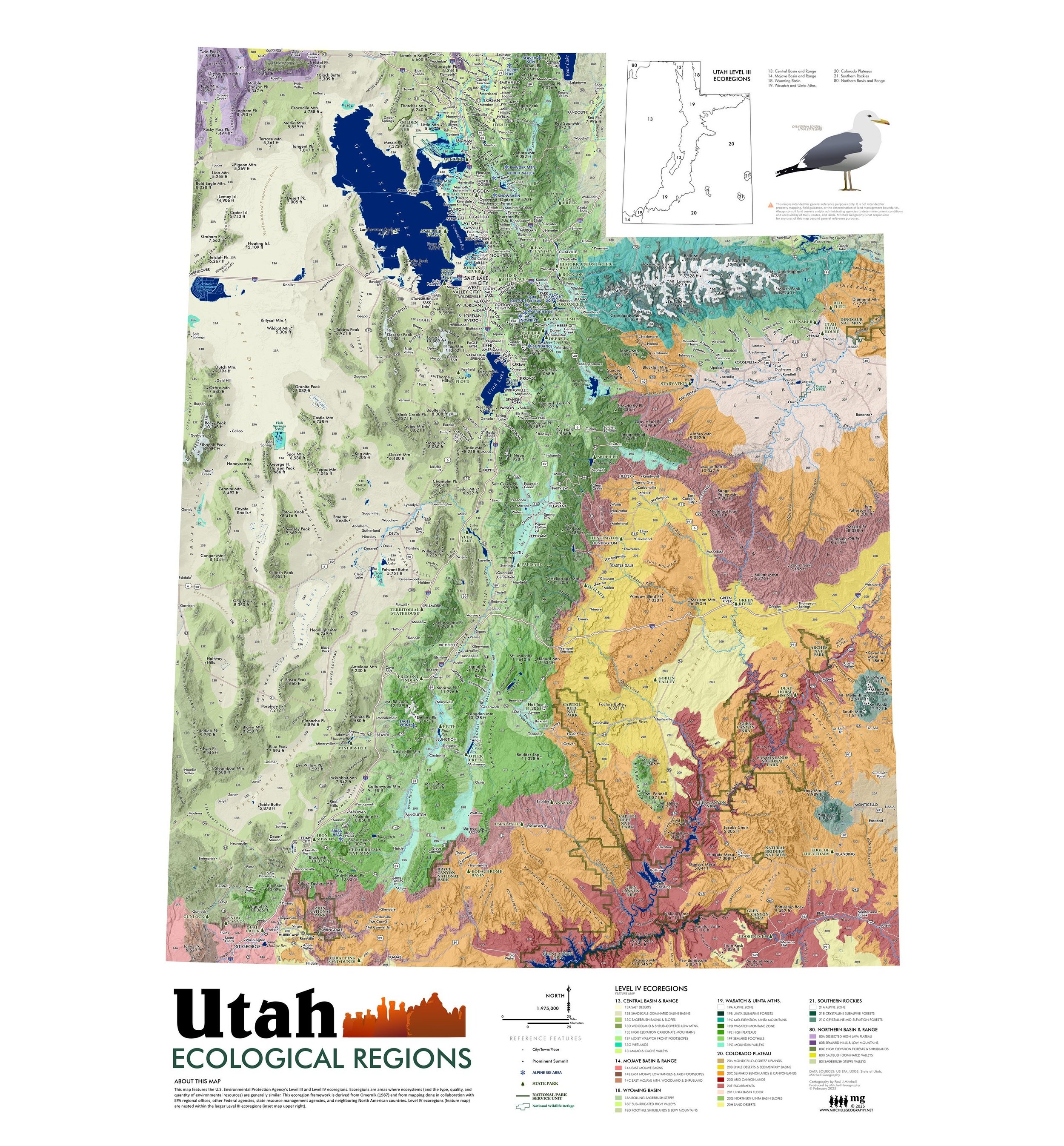
Lake Bonneville Utah (19 in x 13 in)
19 in. x 13 in. flat wall map. Packed and shipped flat.
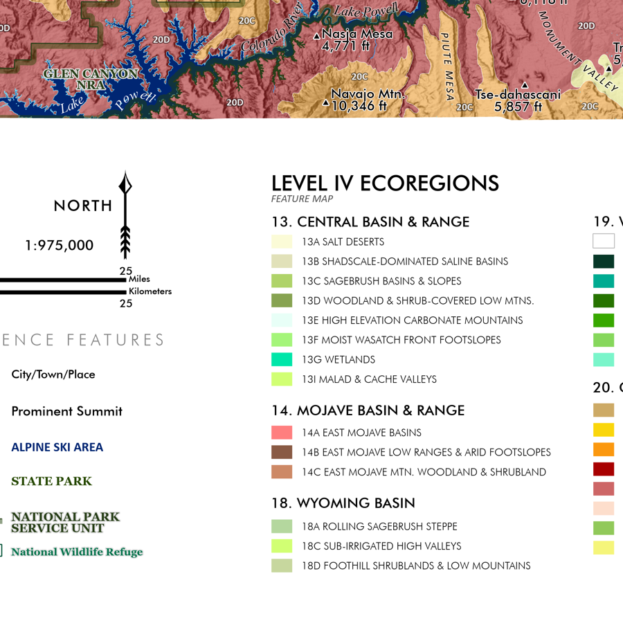
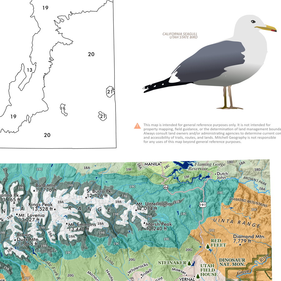
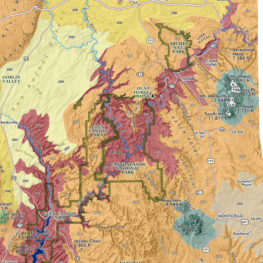
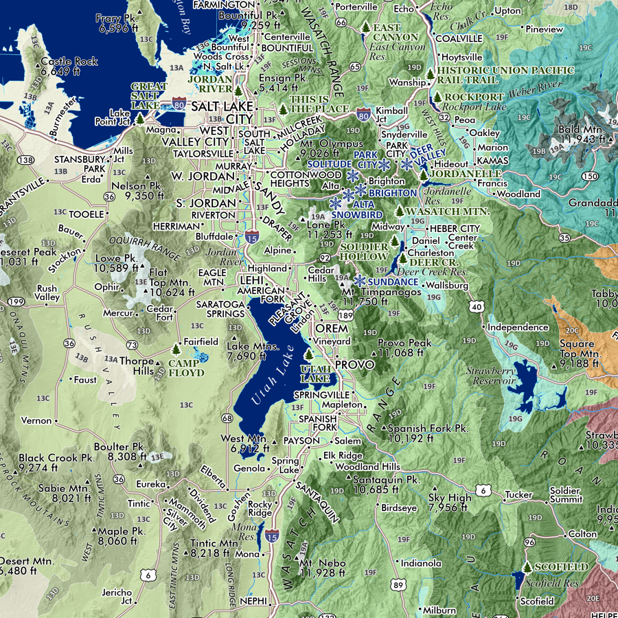
Lake Bonneville, Utah. Feature map of the historic glacial Lake Bonneville and it's notable shoreline levels subsequent to breaking through Red Rock Pass until it's current incarnation as the Great Salt Lake. Town and location features are included for reference.
19 in. x 13 in. flat wall map. Packed and shipped flat.
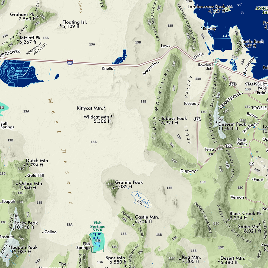
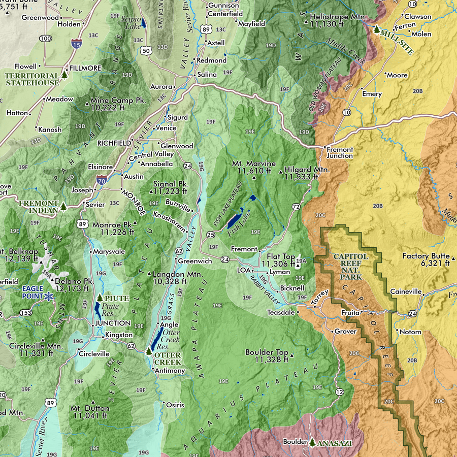
Lake Bonneville, Utah. Feature map of the historic glacial Lake Bonneville and it's notable shoreline levels subsequent to breaking through Red Rock Pass until it's current incarnation as the Great Salt Lake. Town and location features are included for reference.