Mt. Baker Glaciers (24 in x 20 in)
1:23,000
20 inch by 24 inch flat wall map, printed on heavy fine paper; shipped rolled.
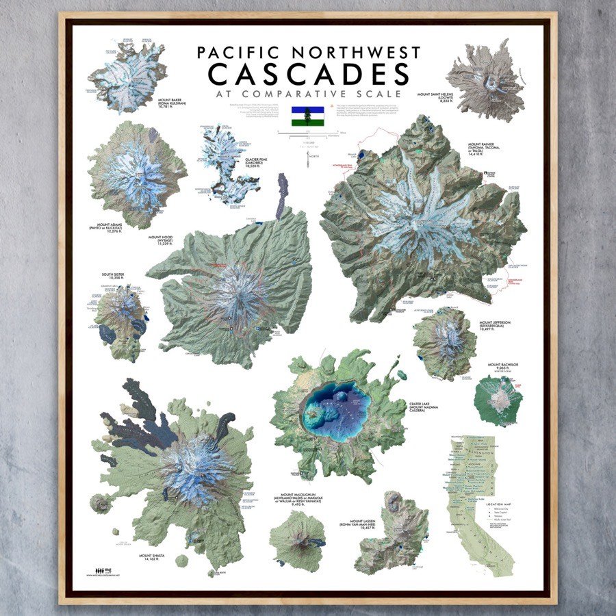
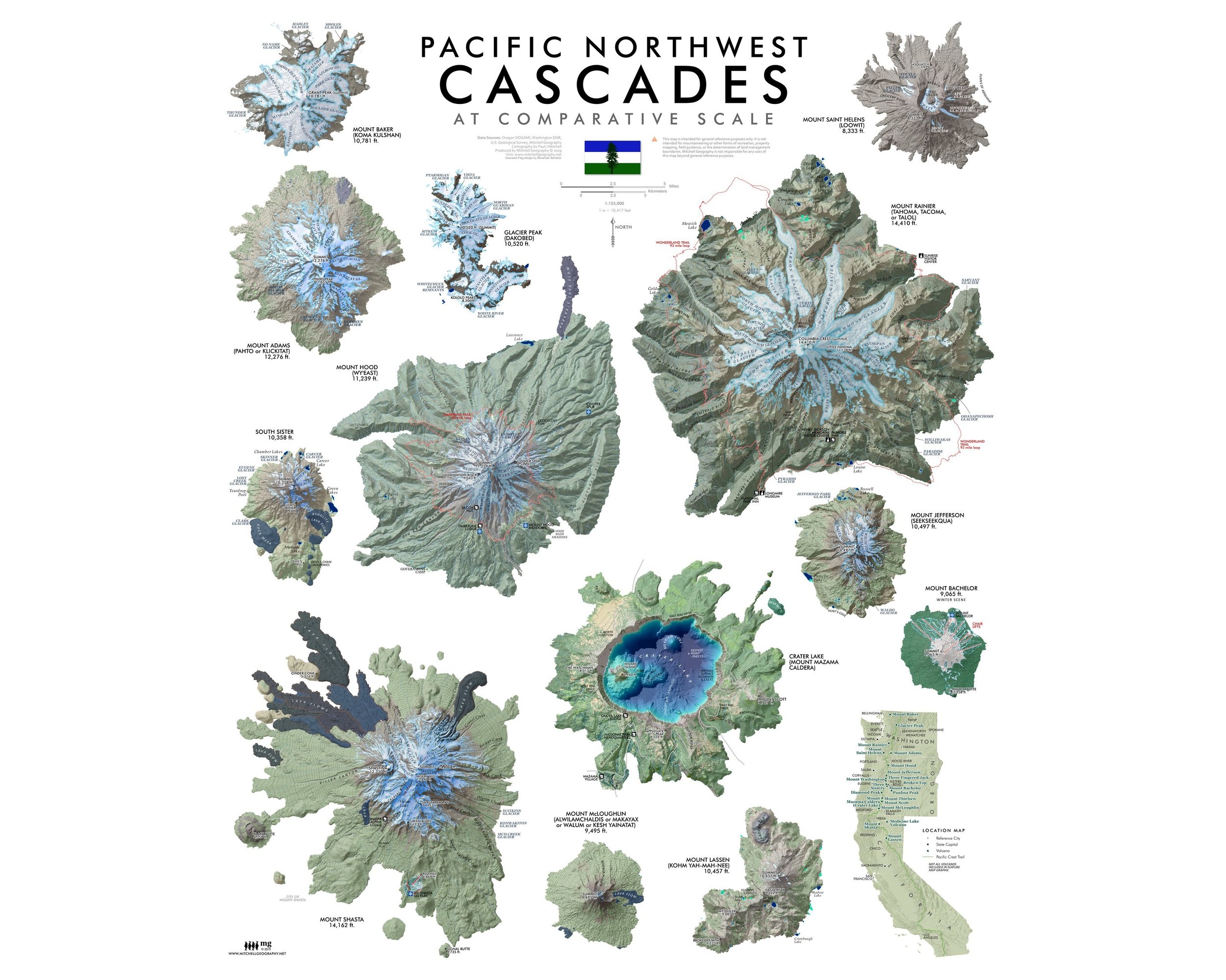
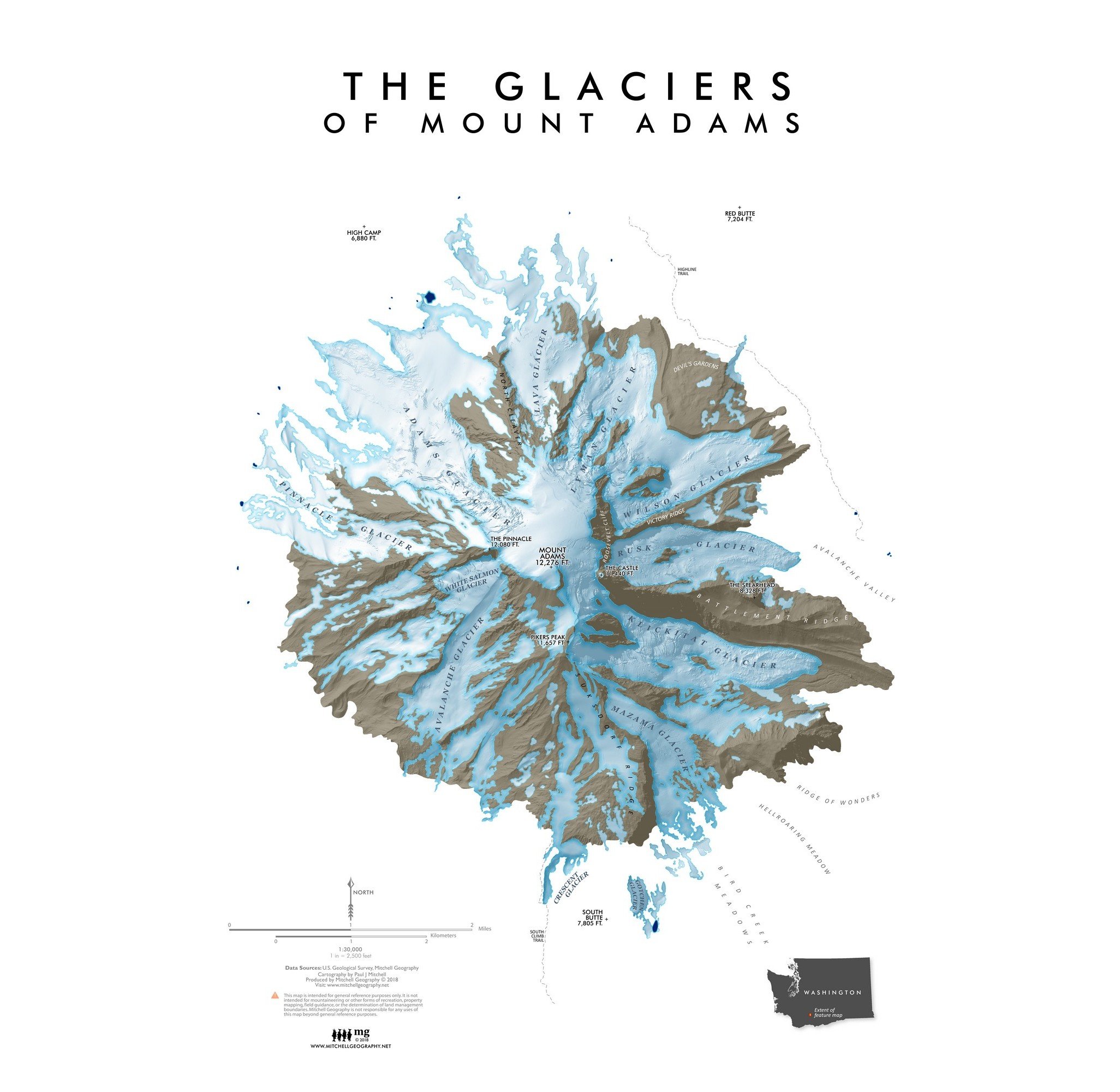
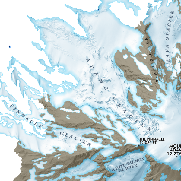
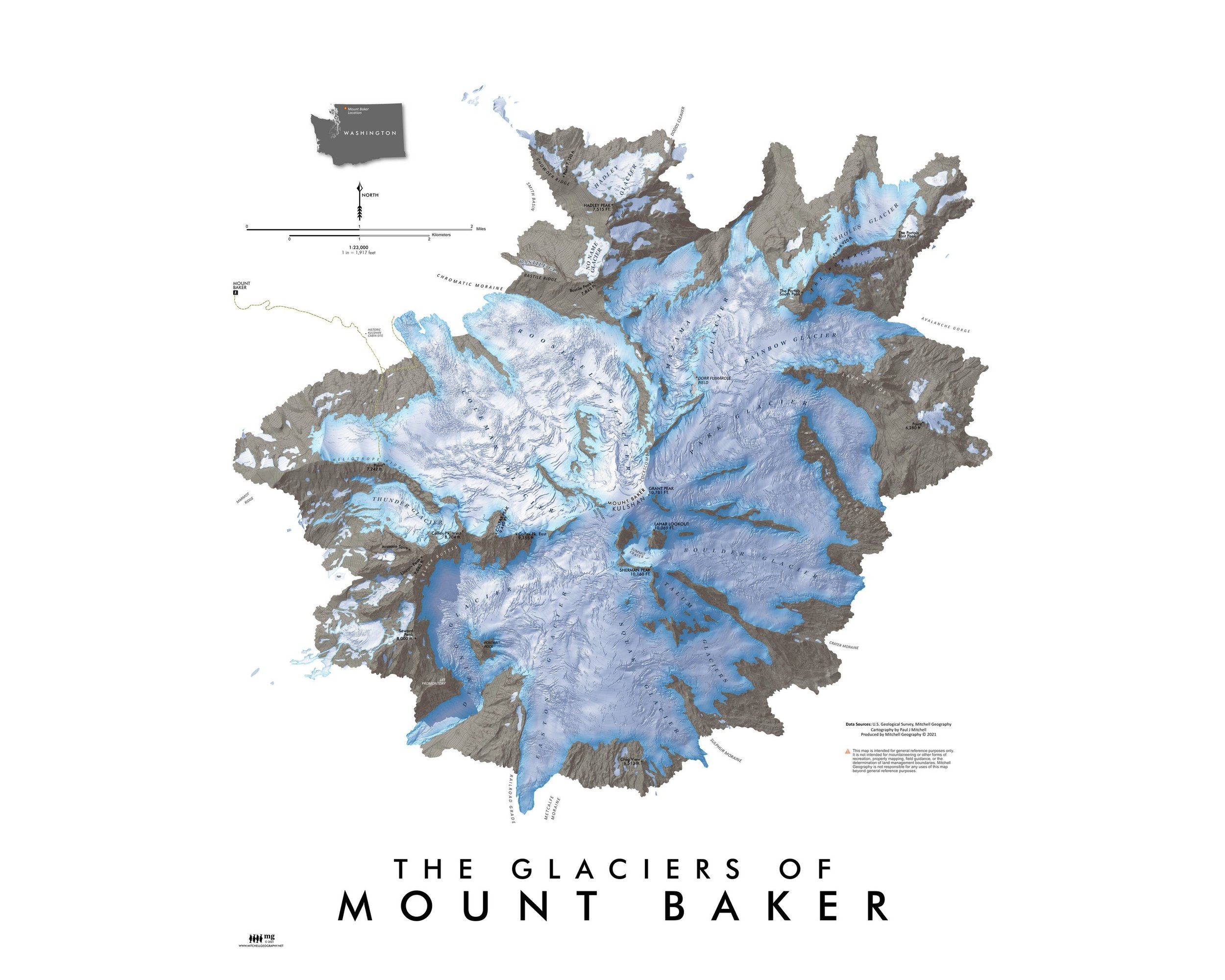
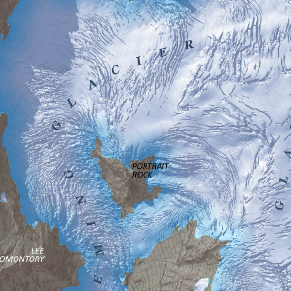
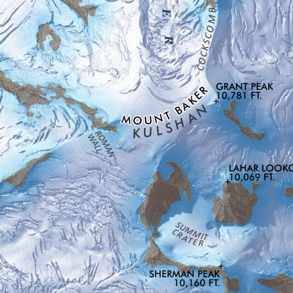
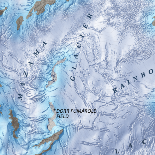
Mount Baker, Washington. Feature map of Mount Baker/Kulshan's massive glaciers and alpine landforms. Making use of a 3 foot resolution Lidar derived terrain model, this map displays in rich detail a recent snapshot in time of Baker's glacial extent, icefall, endless crevasses and bergschrunds. Ridges, moraines, and sub-peaks are also labeled for reference.
1:23,000
20 inch by 24 inch flat wall map, printed on heavy fine paper; shipped rolled.
Mount Baker, Washington. Feature map of Mount Baker/Kulshan's massive glaciers and alpine landforms. Making use of a 3 foot resolution Lidar derived terrain model, this map displays in rich detail a recent snapshot in time of Baker's glacial extent, icefall, endless crevasses and bergschrunds. Ridges, moraines, and sub-peaks are also labeled for reference.