
Mt. Hood Slope Aspect (24 in x 20 in)
20 inch x 24 inch — flat wall map, printed on a heavy fine paper — shipped rolled.
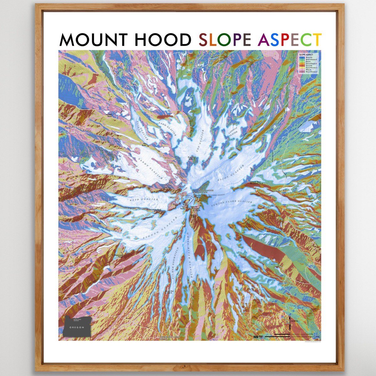
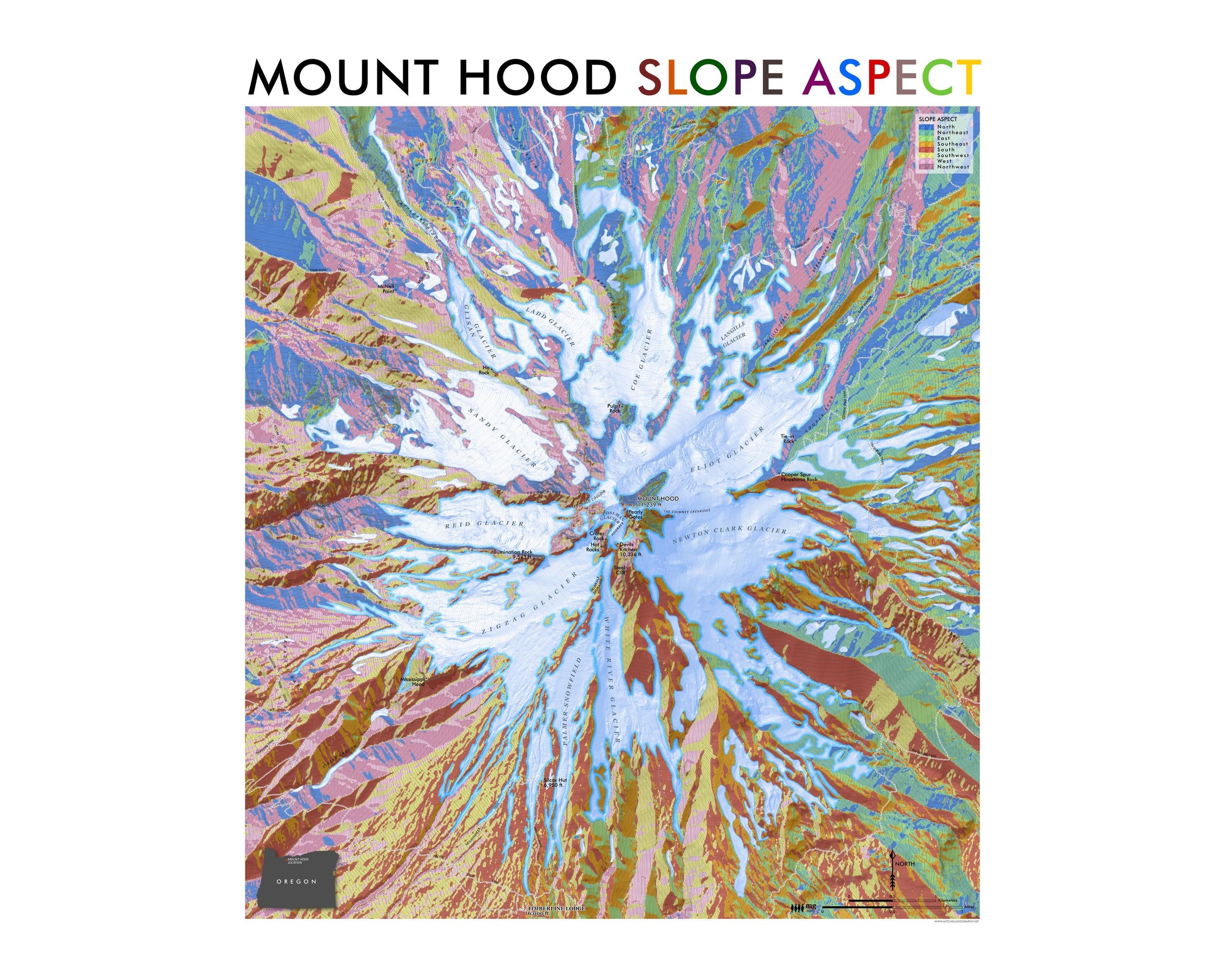
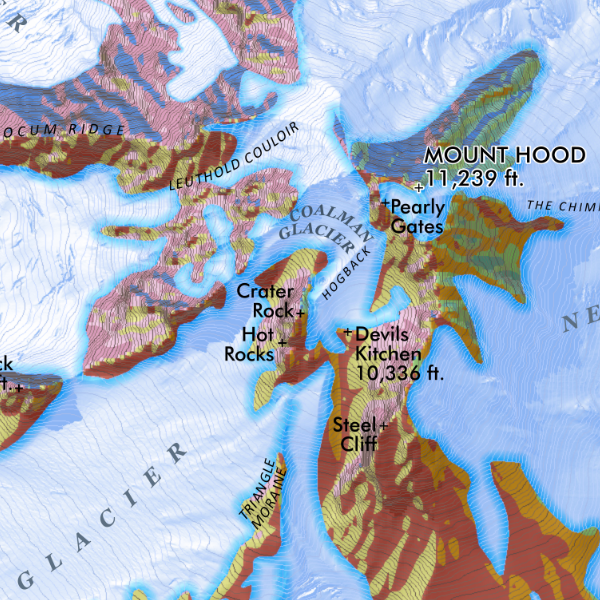
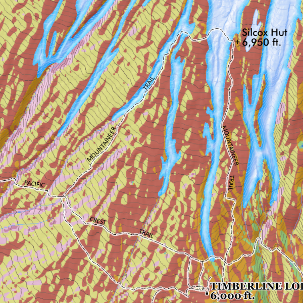
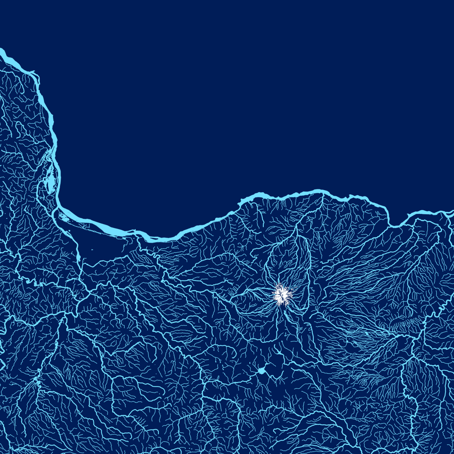
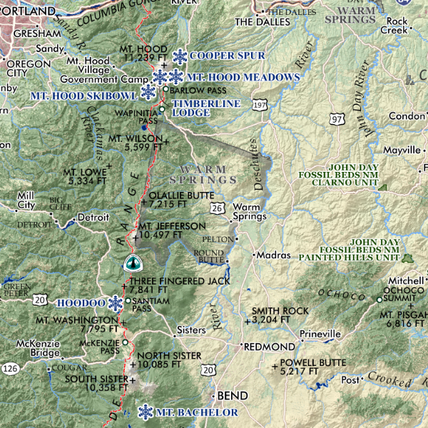
Mount Hood Slope Aspect, Oregon. Slope aspect map of Oregon’s highest and prominent Cascade, Mount Hood. Trail systems and features are labeled for reference. The direction of slope is symbolized and noted in the legend.
20 inch x 24 inch — flat wall map, printed on a heavy fine paper — shipped rolled.
Mount Hood Slope Aspect, Oregon. Slope aspect map of Oregon’s highest and prominent Cascade, Mount Hood. Trail systems and features are labeled for reference. The direction of slope is symbolized and noted in the legend.


![Mt. Hood Slope Aspect [Japanese language] (24 in x 20 in)](https://images.squarespace-cdn.com/content/v1/64dfe5c447627a1ab4b29d07/1695326601172-WPM6DJNFTOKJ9NON7B4M/MtHood_Japanese_framed.jpeg)


