Mount Rainier Glaciers (19 in x 13 in)
1:55,000
13 inch by 19 inch flat wall map, printed on heavy fine paper. Packed and shipped flat.
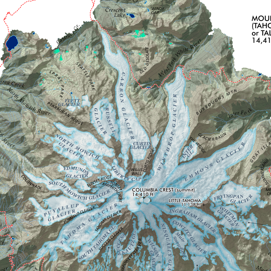
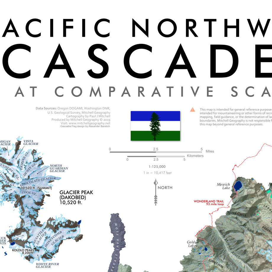
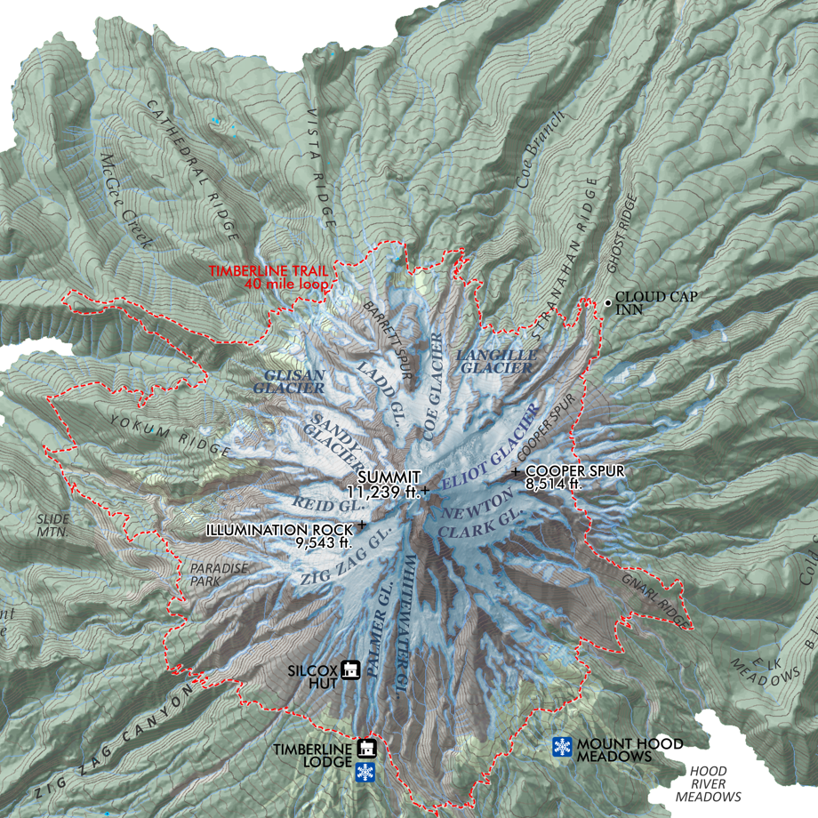
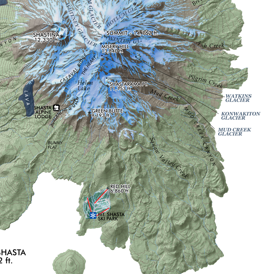
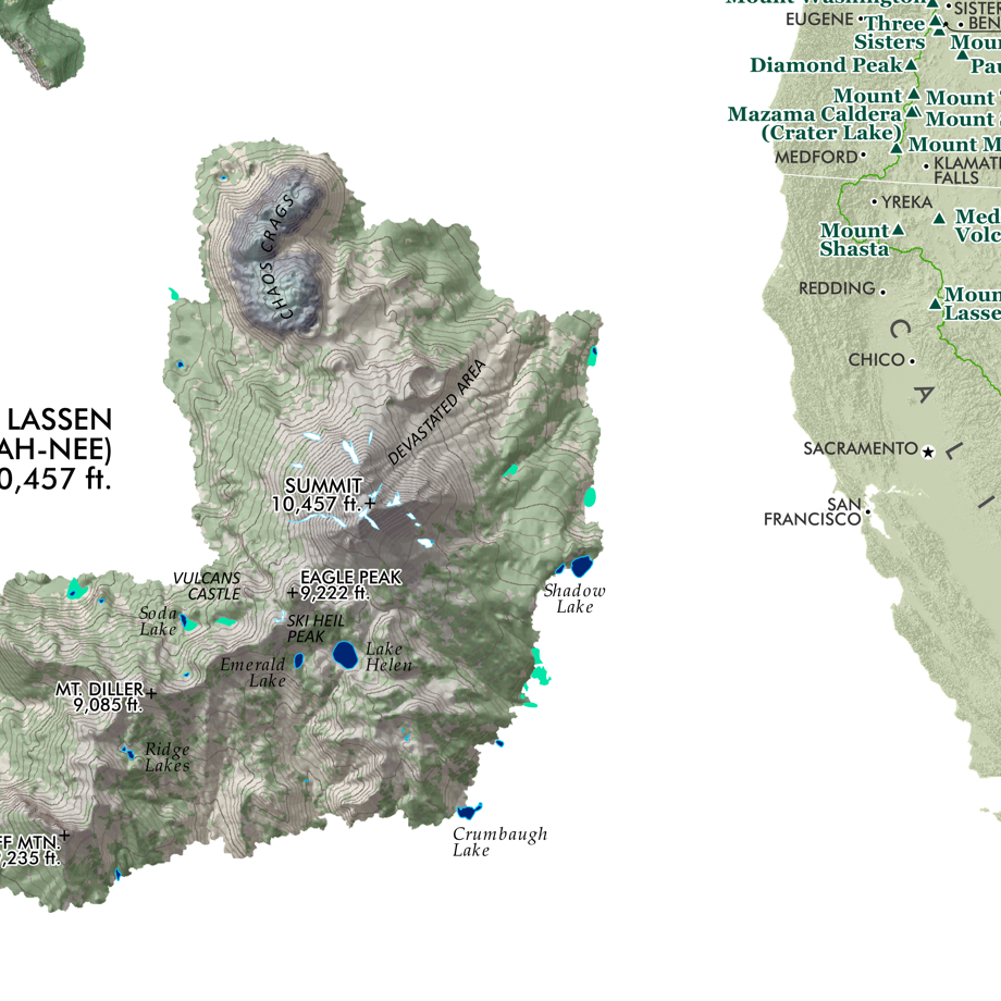
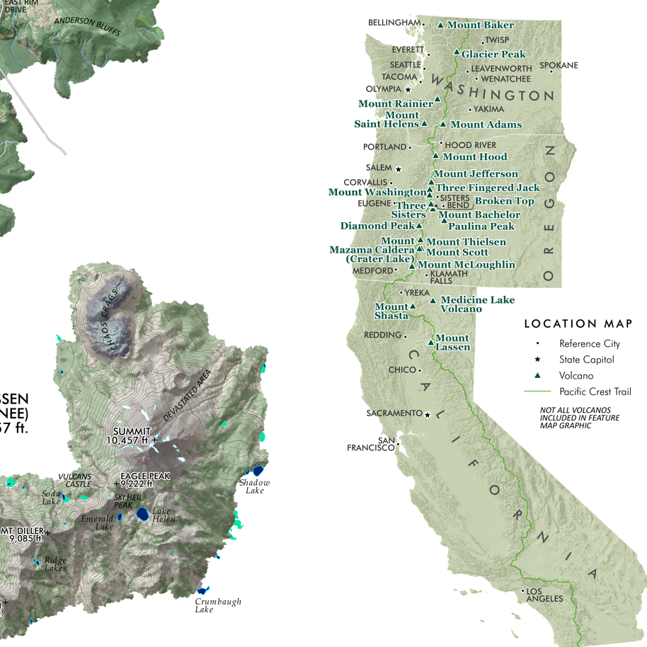
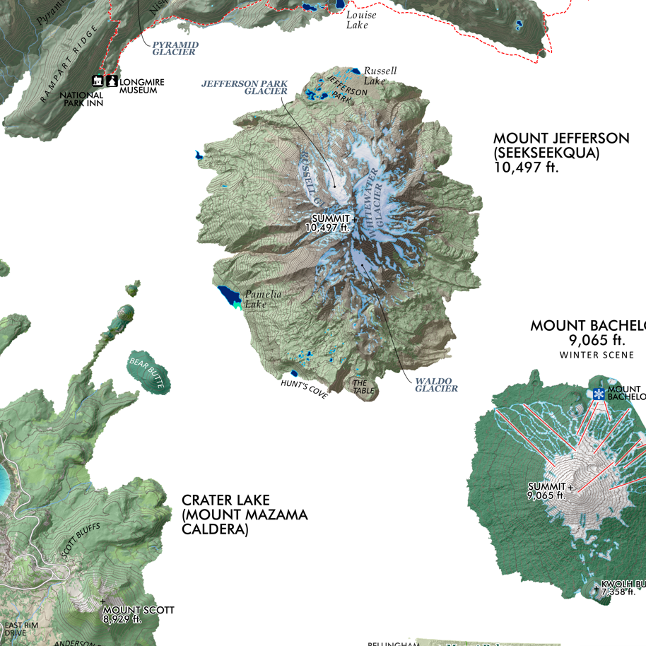
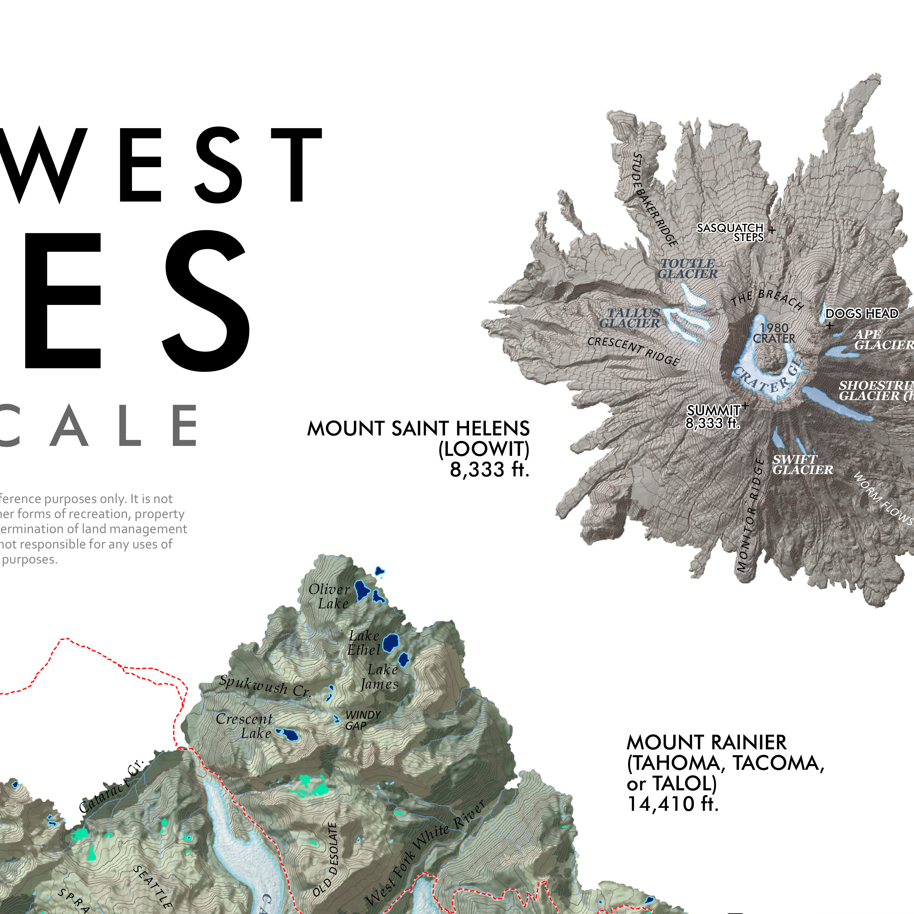
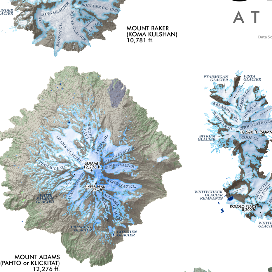
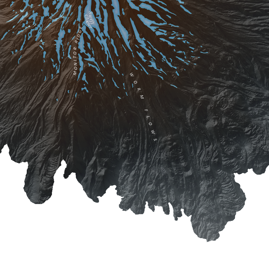
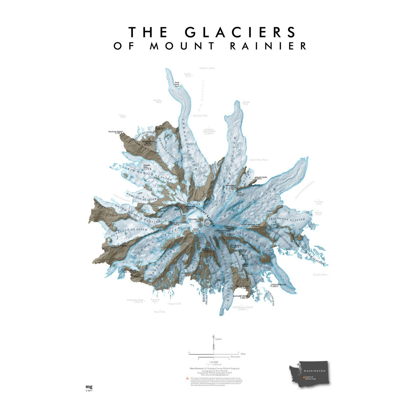
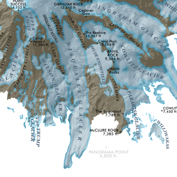
Mount Rainier, Washington. Smaller feature map of Rainier’s alpine summit area including glaciers, ridges, cleavers, and most secondary summit features.
A larger 24 x 20 inch Rainier Glaciers map is also available.
1:55,000
13 inch by 19 inch flat wall map, printed on heavy fine paper. Packed and shipped flat.
Mount Rainier, Washington. Smaller feature map of Rainier’s alpine summit area including glaciers, ridges, cleavers, and most secondary summit features.
A larger 24 x 20 inch Rainier Glaciers map is also available.