Ski Areas of Idaho (19 in x 13 in)
1: 34,000
13 inch by 19 inch flat wall map, printed on heavy fine paper. Packed and shipped flat.
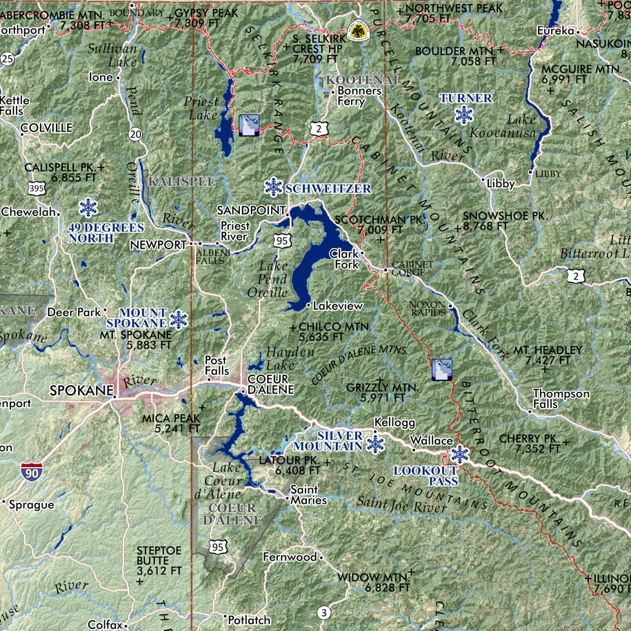
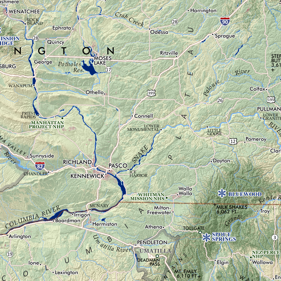
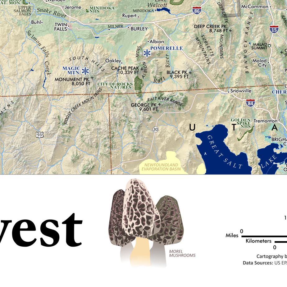
Ski Areas of Idaho. Comparative taxonomic style graphic of Idaho’s 18 ski areas. Little bits of ski area information included, average annual snowfall, vertical drop and skiable acreage (as conveyed by resorts, in some cases it would seem this statistic references lift served acreage). Location map included. (Yes to Grand Targhee).
1: 34,000
13 inch by 19 inch flat wall map, printed on heavy fine paper. Packed and shipped flat.
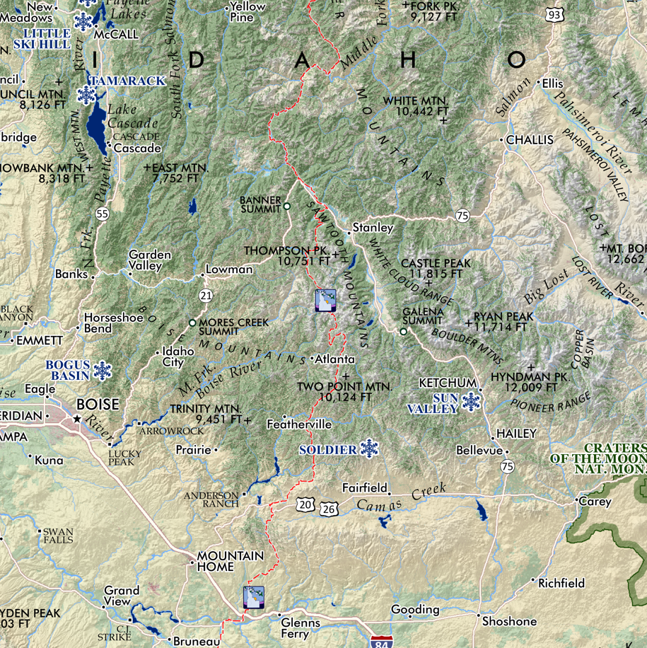
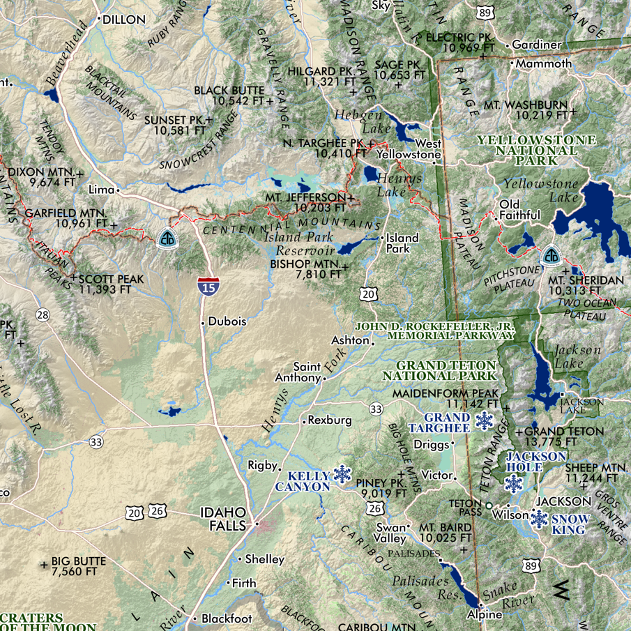
Ski Areas of Idaho. Comparative taxonomic style graphic of Idaho’s 18 ski areas. Little bits of ski area information included, average annual snowfall, vertical drop and skiable acreage (as conveyed by resorts, in some cases it would seem this statistic references lift served acreage). Location map included. (Yes to Grand Targhee).