Tacoma Washington (24 in x 20 in)
1:34,000
20 inch by 24 inch flat wall map, printed on heavy fine paper, shipped rolled.
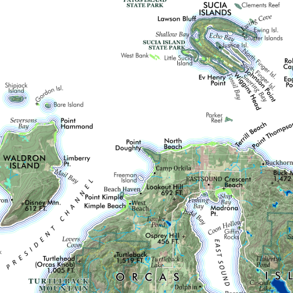
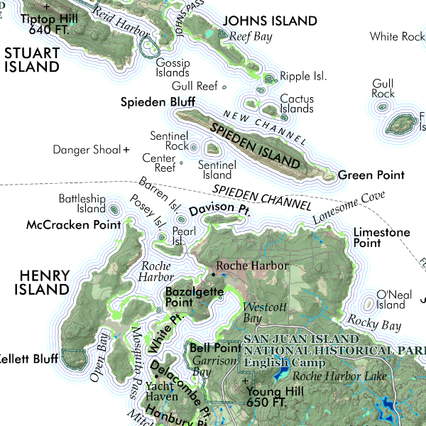
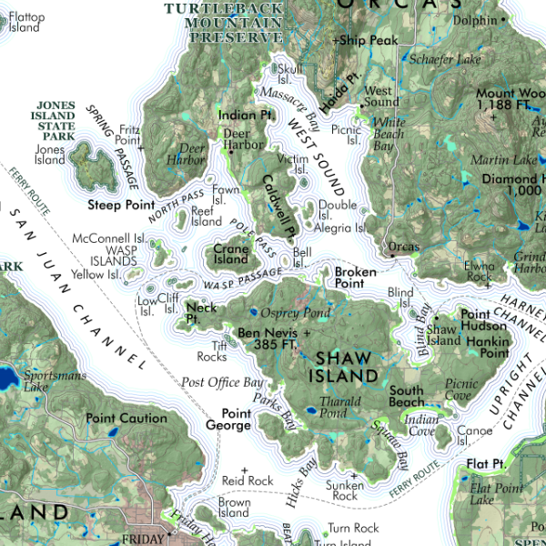
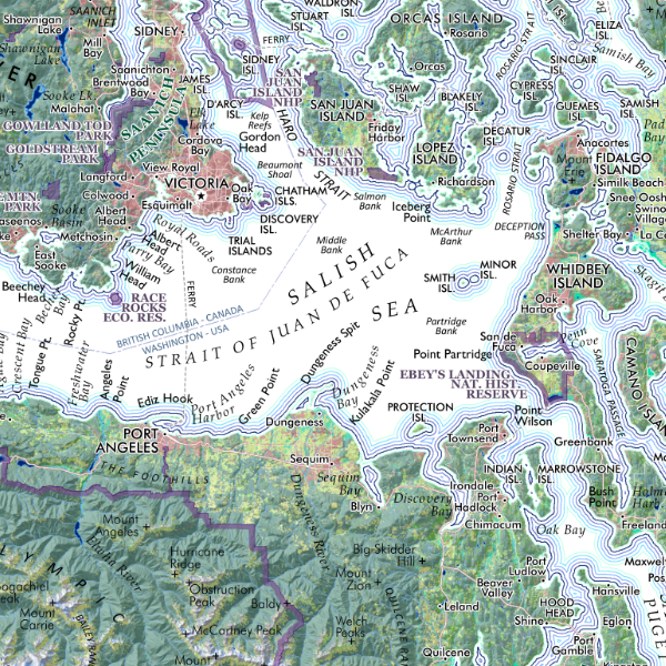
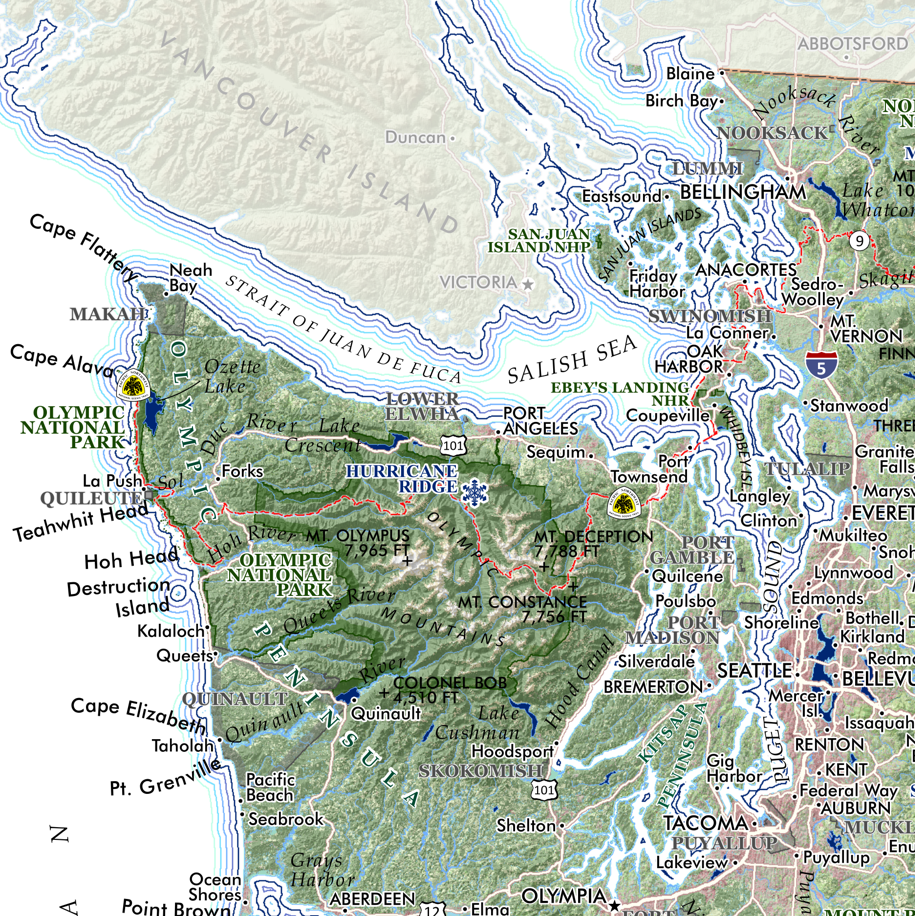
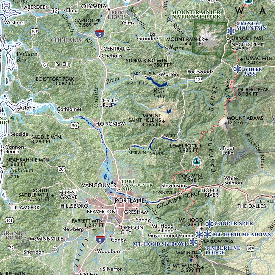
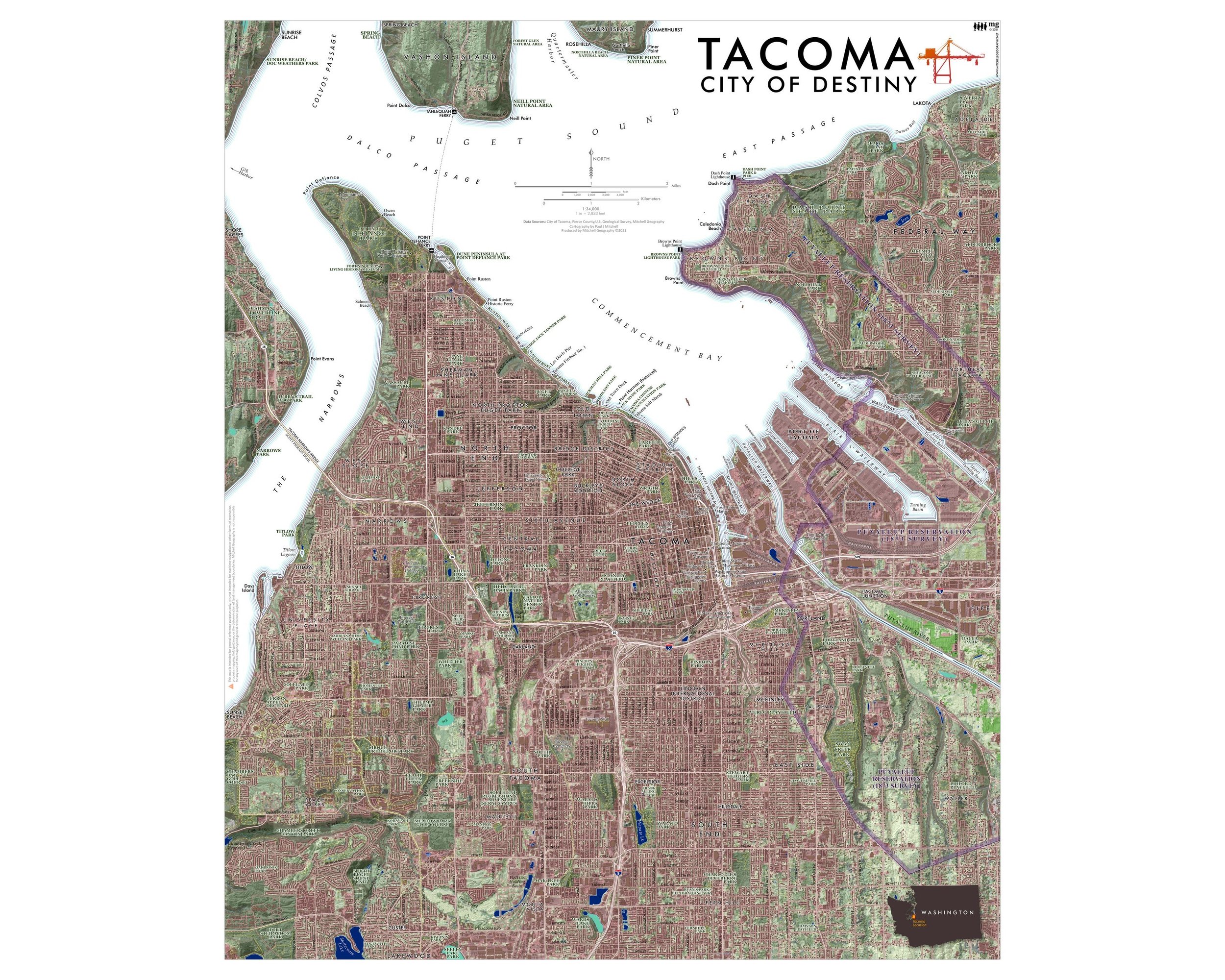
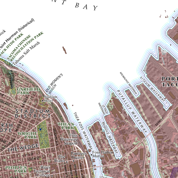
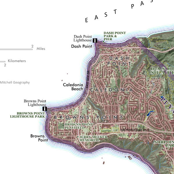
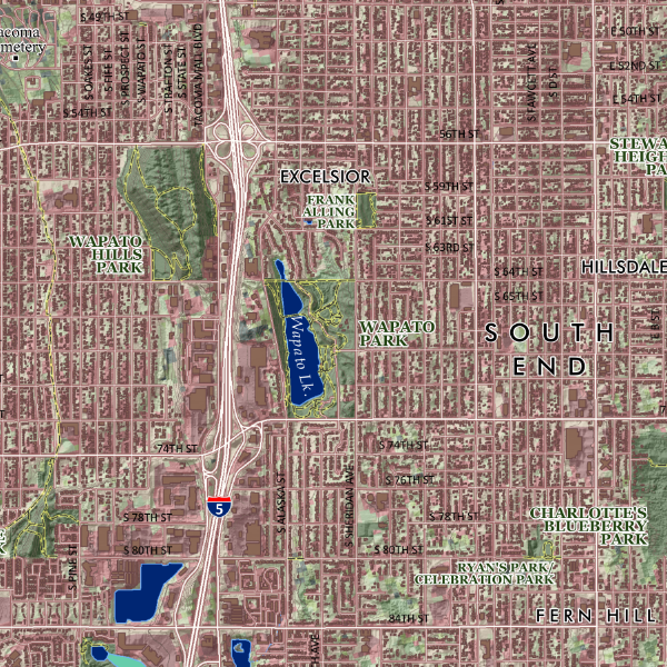
Tacoma, Washington. This map is centered upon Tacoma’s downtown the Port of Tacoma, but includes the entire incorporated area of the City and a wide extent of the surrounding vicinity to capture the prominent Puget Sound passes and bays, adjacent cities/towns (Federal Way, Fircrest, University Place, Titlow, northern Lakewood, much of the Puyallup Reservation), the southern nubs of Vashon/Maury Islands, and shores surrounding Gig Harbor. Parklands, features of interest, Puyallup Reservation boundary, hydrology, building footprints, streets and park/open space trails are depicted. Landforms, hydrology, neighborhoods and other familiar vicinity place names are labeled for reference.
Mapmaker’s choice of one my favorite cities in the northwest.
1:34,000
20 inch by 24 inch flat wall map, printed on heavy fine paper, shipped rolled.
Tacoma, Washington. This map is centered upon Tacoma’s downtown the Port of Tacoma, but includes the entire incorporated area of the City and a wide extent of the surrounding vicinity to capture the prominent Puget Sound passes and bays, adjacent cities/towns (Federal Way, Fircrest, University Place, Titlow, northern Lakewood, much of the Puyallup Reservation), the southern nubs of Vashon/Maury Islands, and shores surrounding Gig Harbor. Parklands, features of interest, Puyallup Reservation boundary, hydrology, building footprints, streets and park/open space trails are depicted. Landforms, hydrology, neighborhoods and other familiar vicinity place names are labeled for reference.
Mapmaker’s choice of one my favorite cities in the northwest.