

Cascades (GEOFOLD)
1:125,000
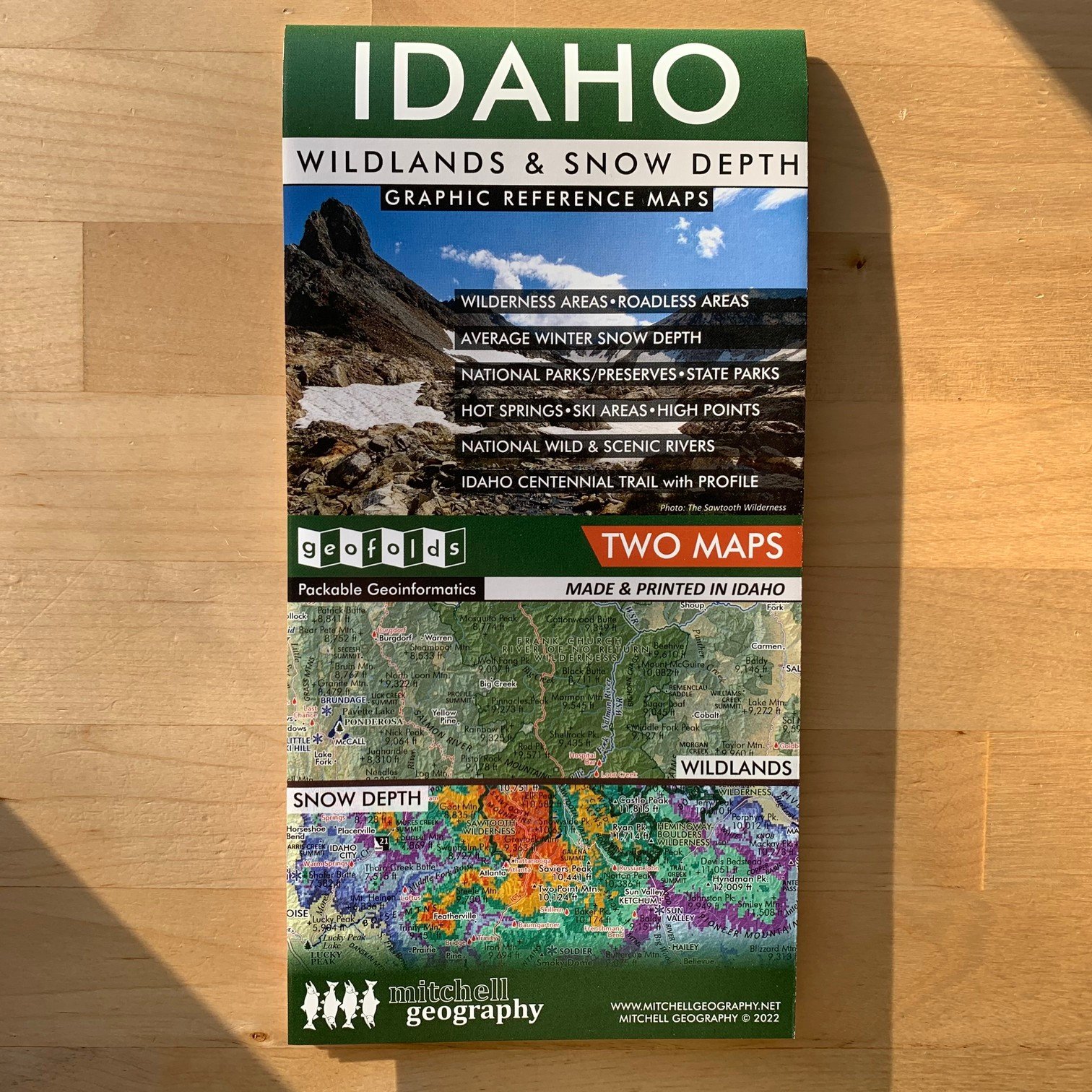
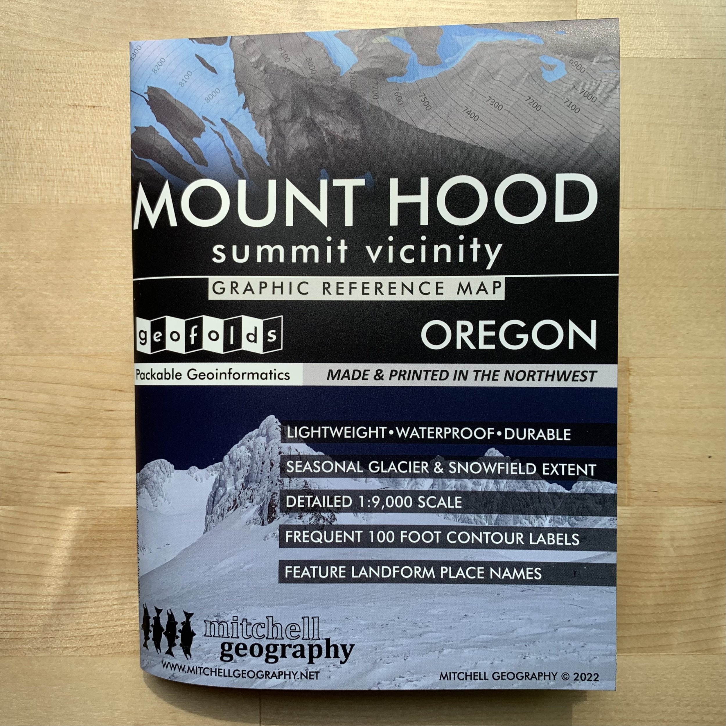
Two sided waterproof and tearproof, lightweight, packable folded map. Printed on French made POLYART biodegradable synthetic paper. Folded 4.5 x 6 inches, unfolded 12 x 18 inches. Shipped in mailer envelope, uninsured, by USPS stamped mail.
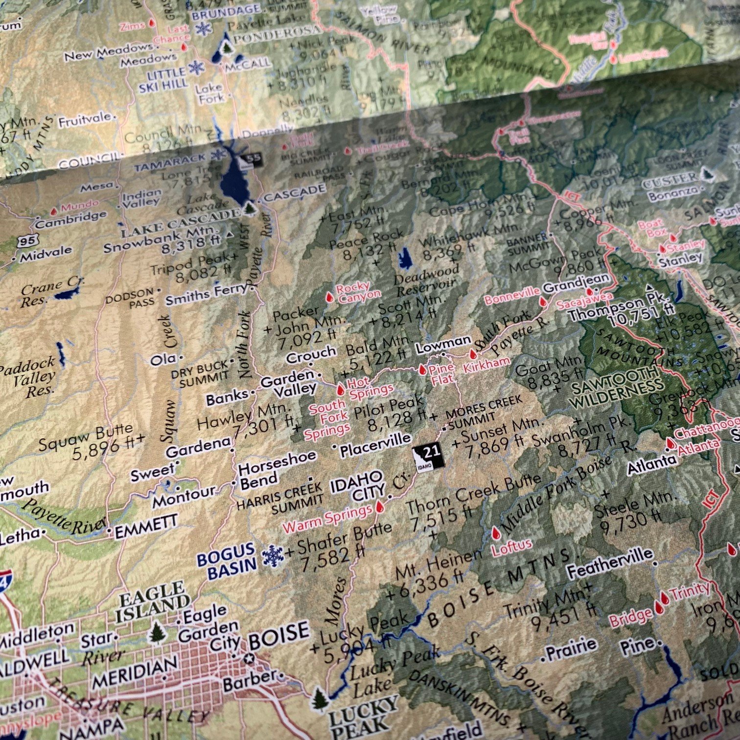
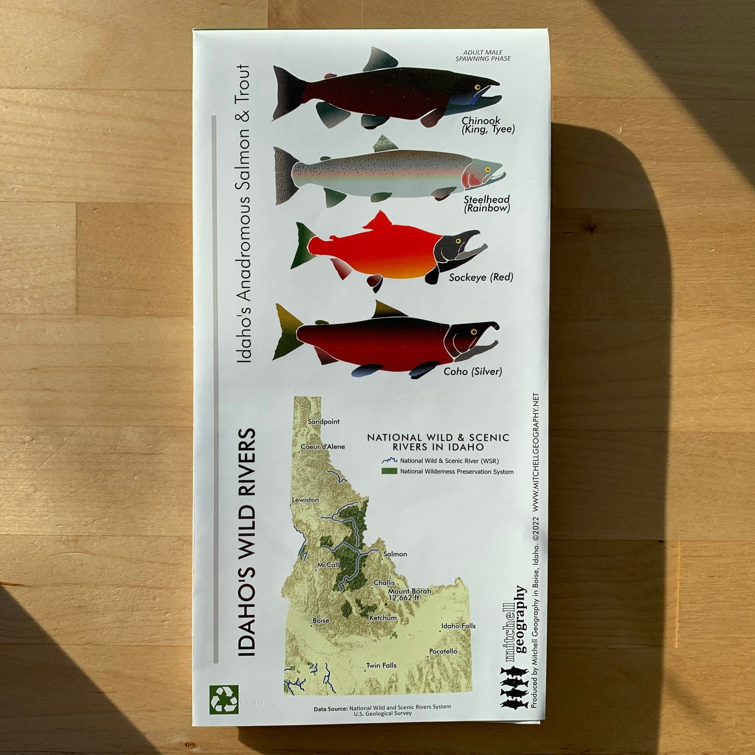
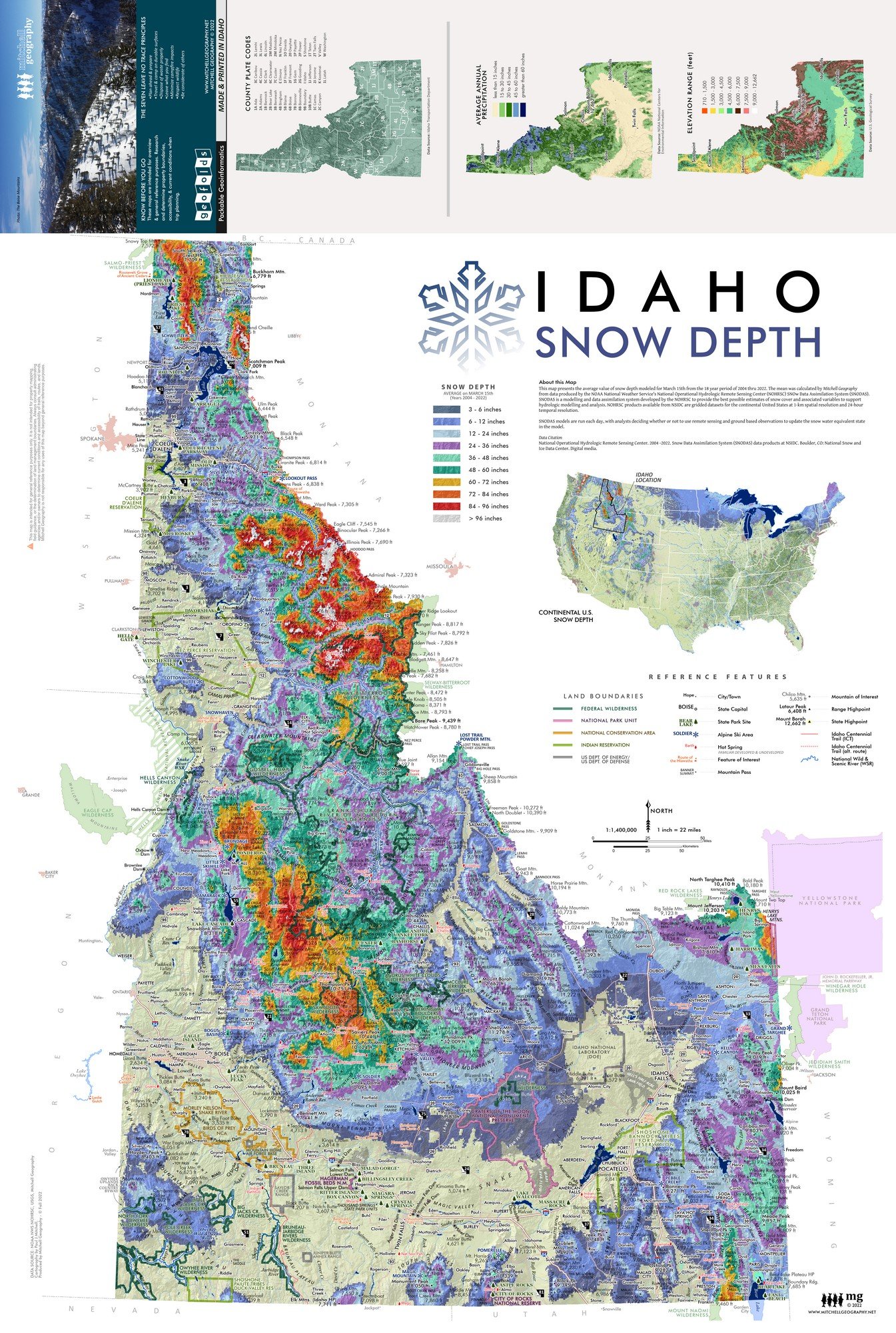
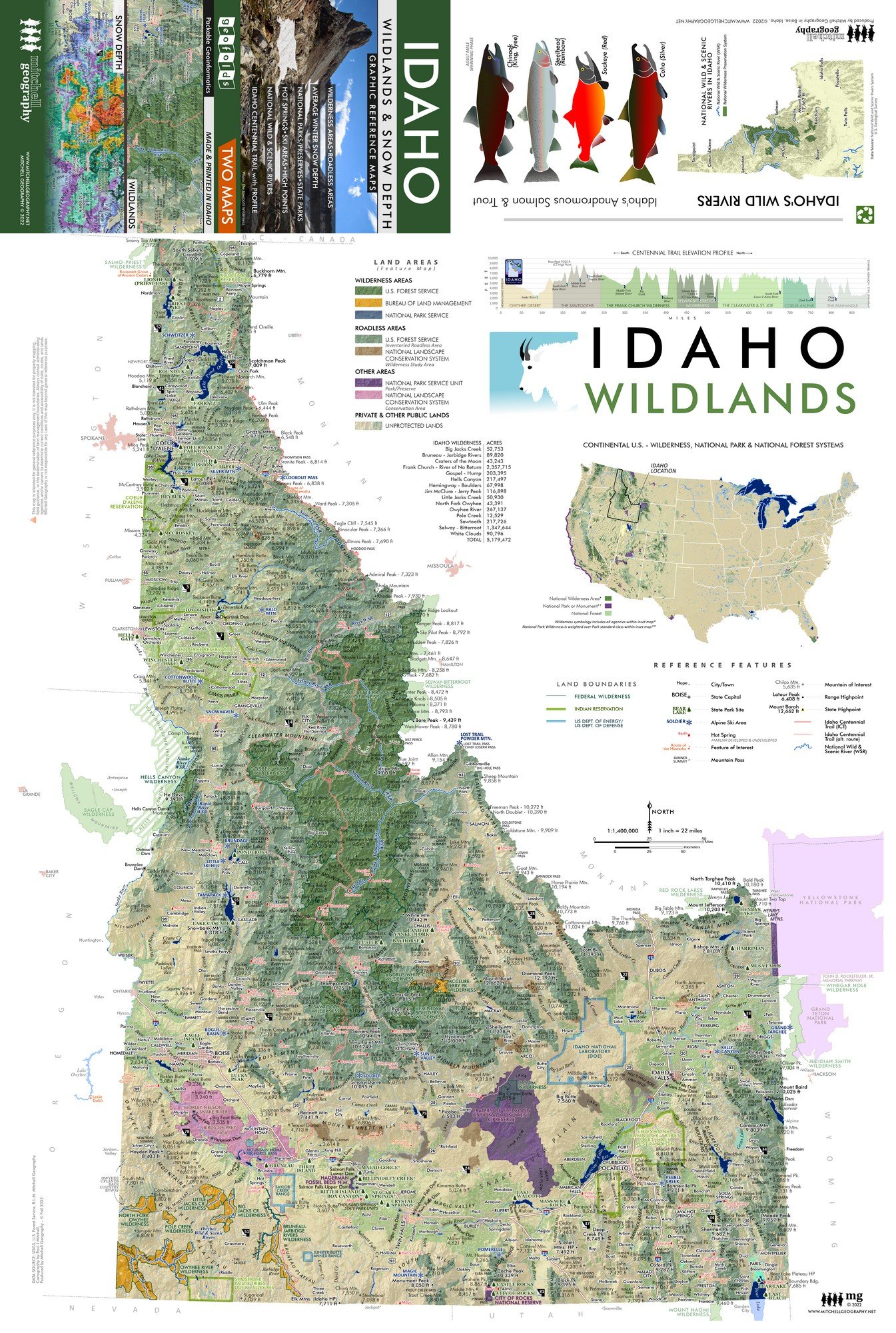
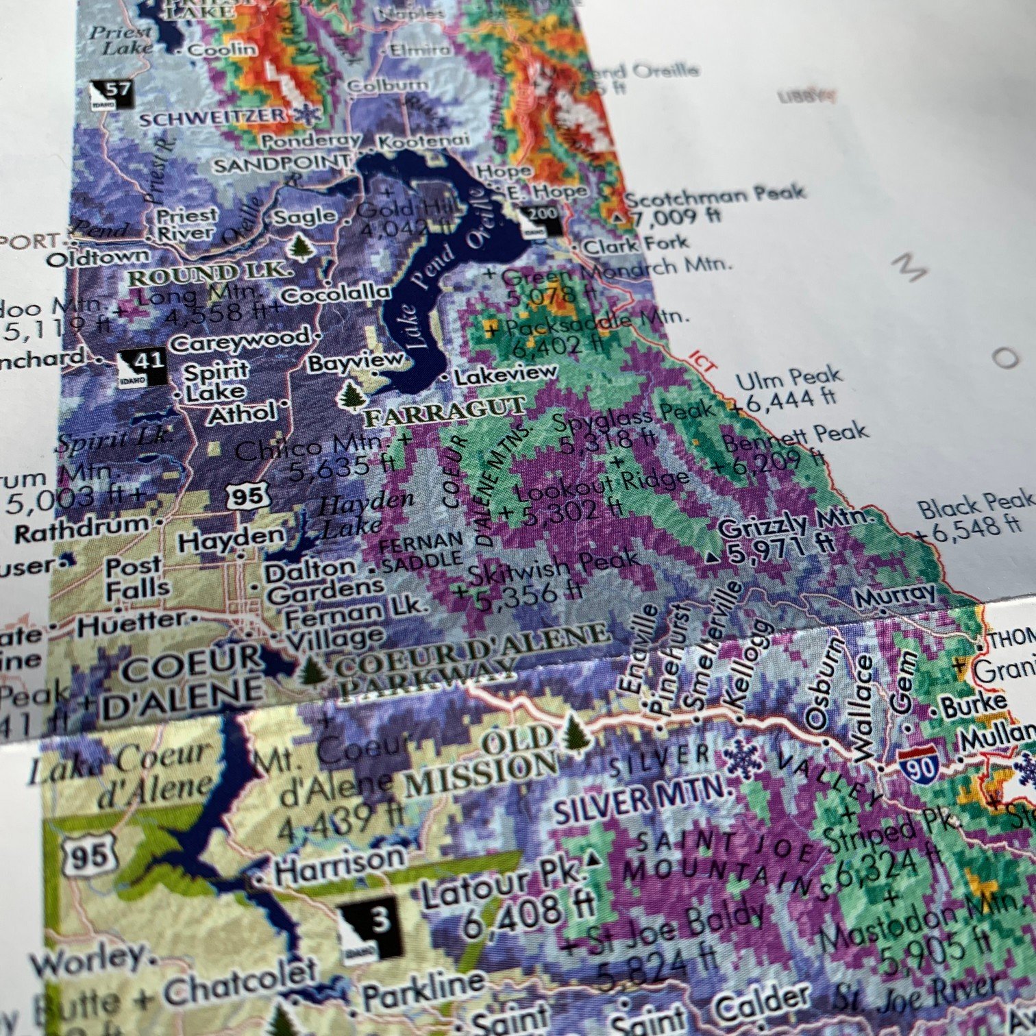
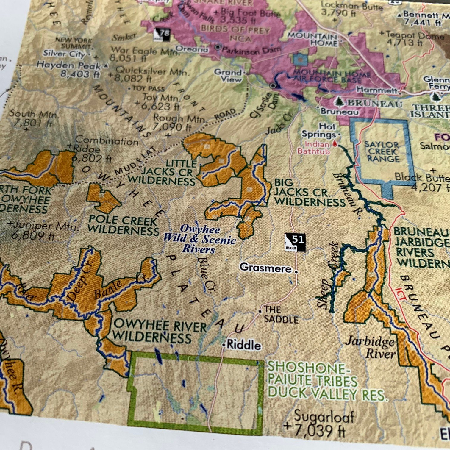
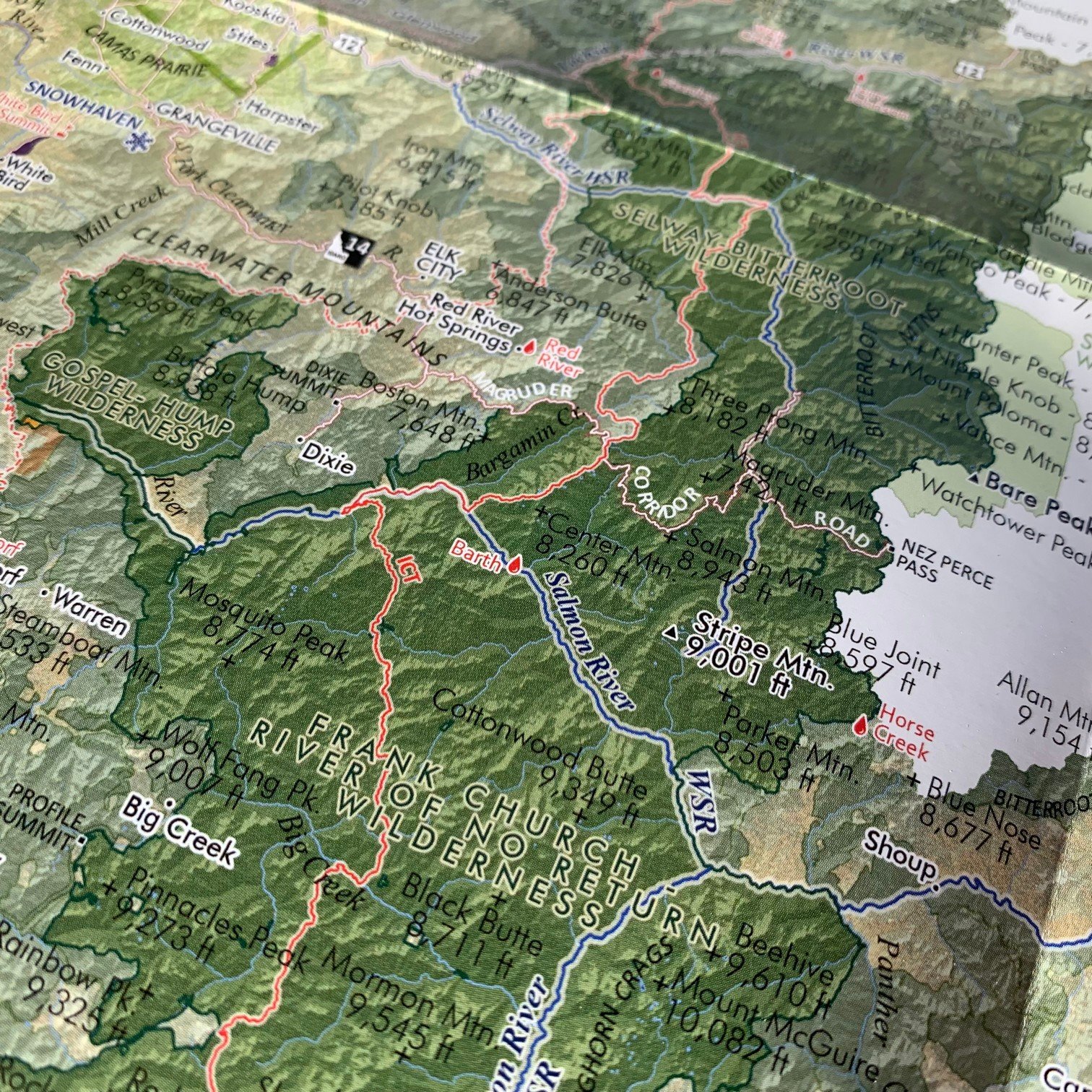
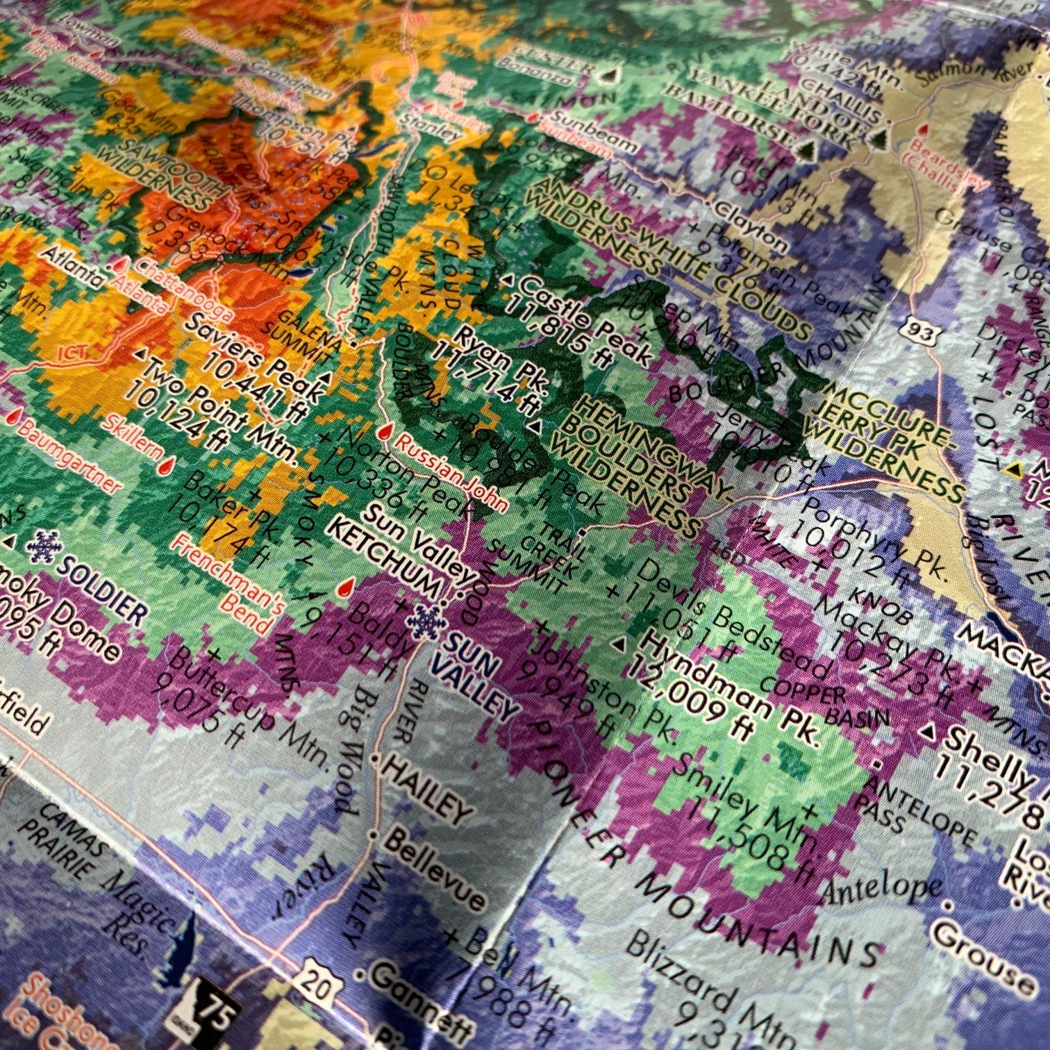
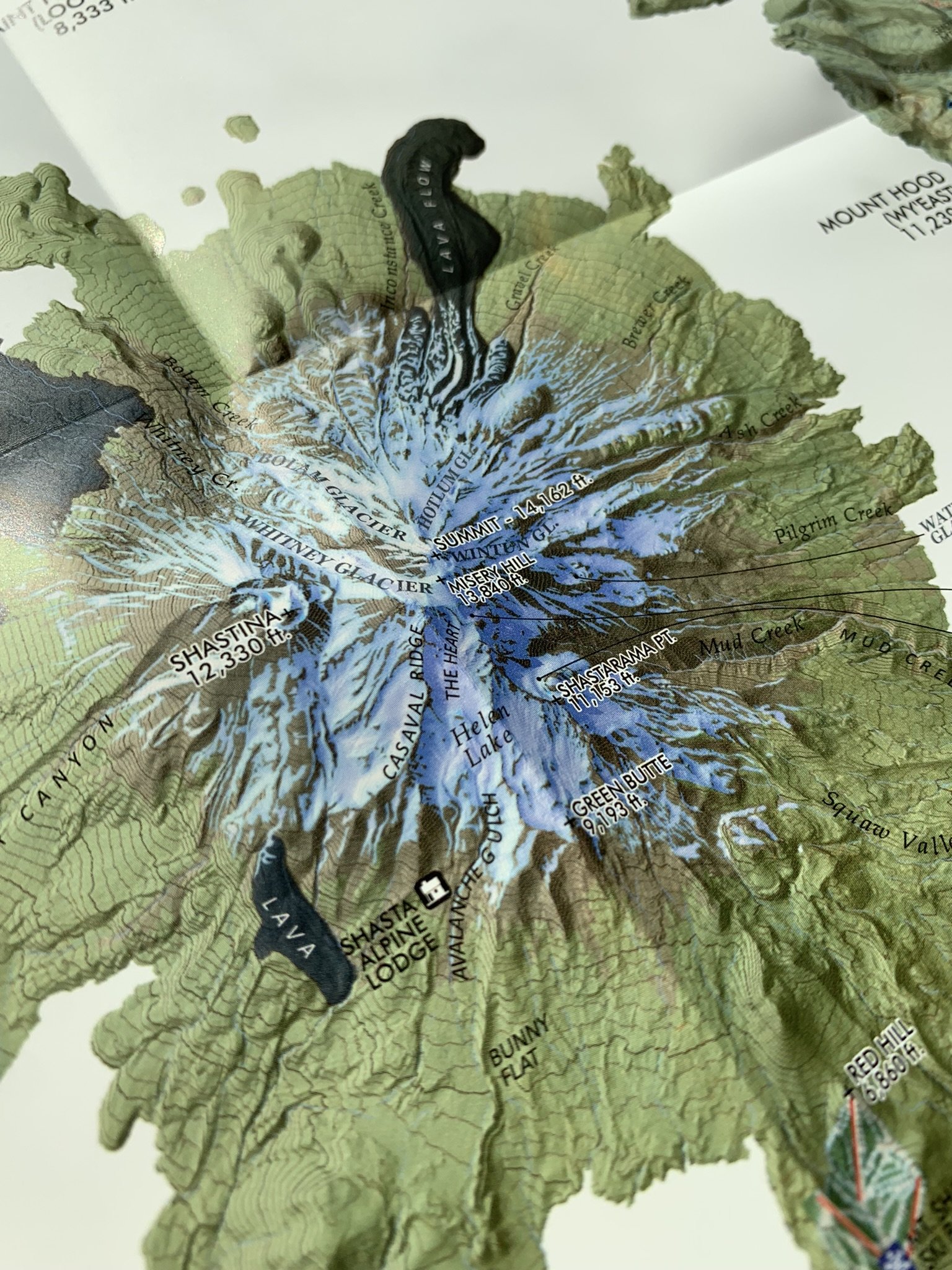
Pacific Northwest Cascades at Comparative Scale. Comparative taxonomic style reference map graphic of the Cascades. Featuring most of the prominent and popular American Cascade peaks from Lassen in the South to Baker in the North; including: Lassen, Shasta, McLoughlin, Crater Lake/Mt. Mazama Caldera, Bachelor, South Sister, Jefferson, Hood, Adams, St. Helens, Rainier, Glacier Peak, & Baker). A nifty west coast states location map features the PCT winding it’s way through these scenic volcanic peaks.
The full-size 24 x 20 inch Cascades flat wall map version is also available.
1:125,000
Two sided waterproof and tearproof, lightweight, packable folded map. Printed on French made POLYART biodegradable synthetic paper. Folded 4.5 x 6 inches, unfolded 12 x 18 inches. Shipped in mailer envelope, uninsured, by USPS stamped mail.
Pacific Northwest Cascades at Comparative Scale. Comparative taxonomic style reference map graphic of the Cascades. Featuring most of the prominent and popular American Cascade peaks from Lassen in the South to Baker in the North; including: Lassen, Shasta, McLoughlin, Crater Lake/Mt. Mazama Caldera, Bachelor, South Sister, Jefferson, Hood, Adams, St. Helens, Rainier, Glacier Peak, & Baker). A nifty west coast states location map features the PCT winding it’s way through these scenic volcanic peaks.
The full-size 24 x 20 inch Cascades flat wall map version is also available.