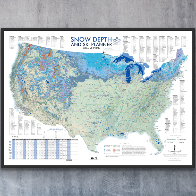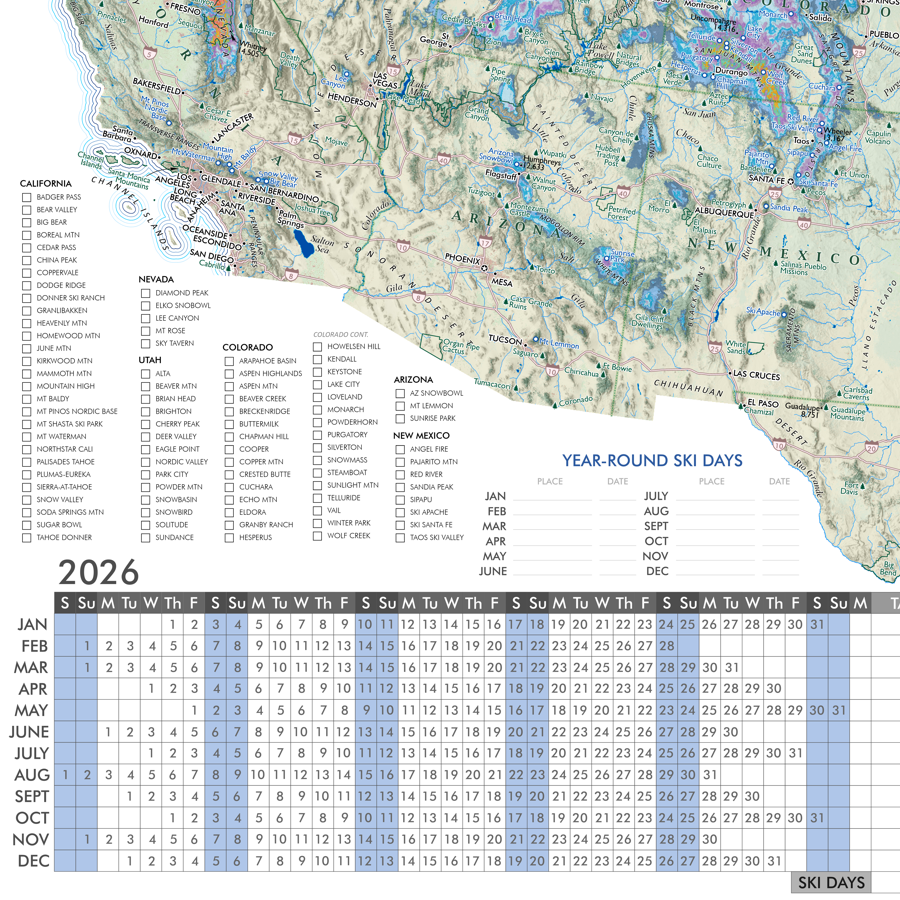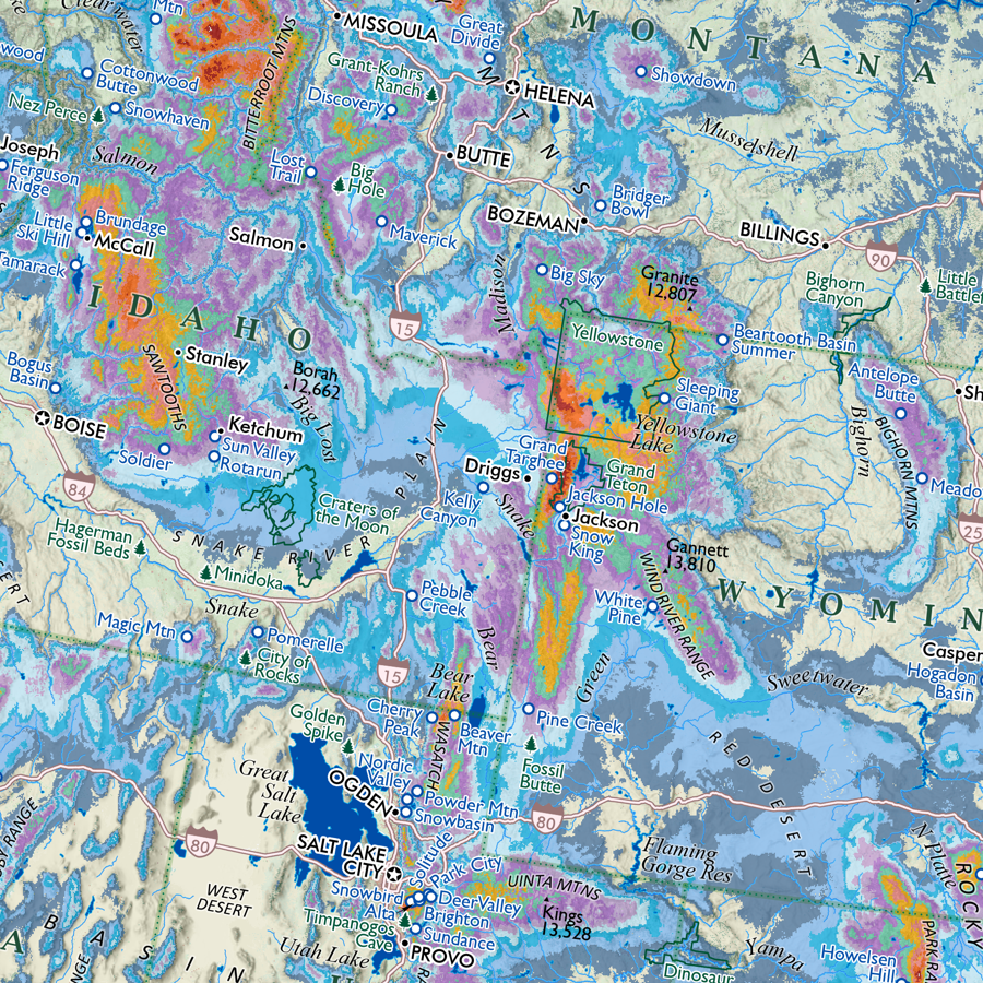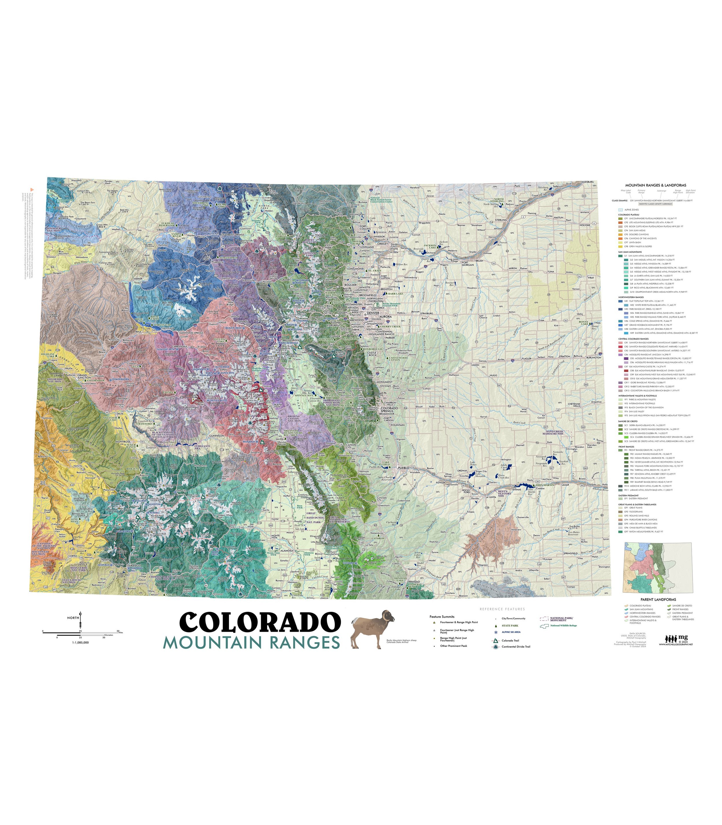

Colorado Mountain Ranges (28 in x 20 in)
1:1,085,000
28 inch x 20 inch — flat wall map, printed on a heavy fine paper — ships rolled.
UPDATED SPRING 2025
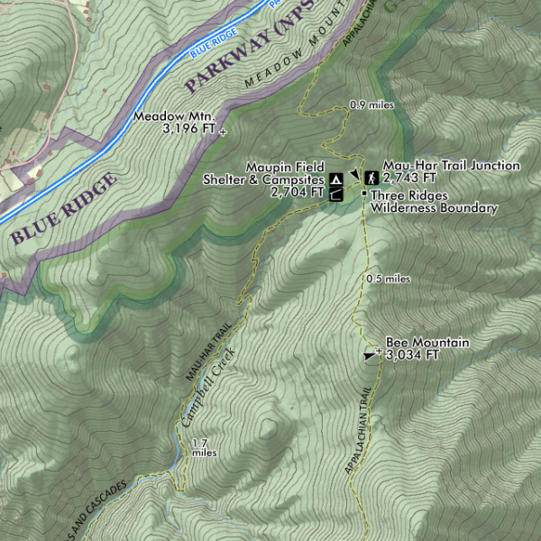
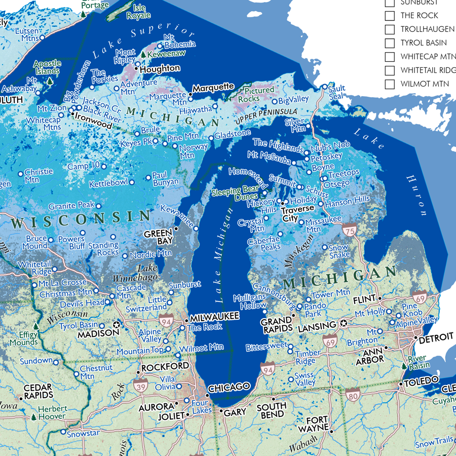
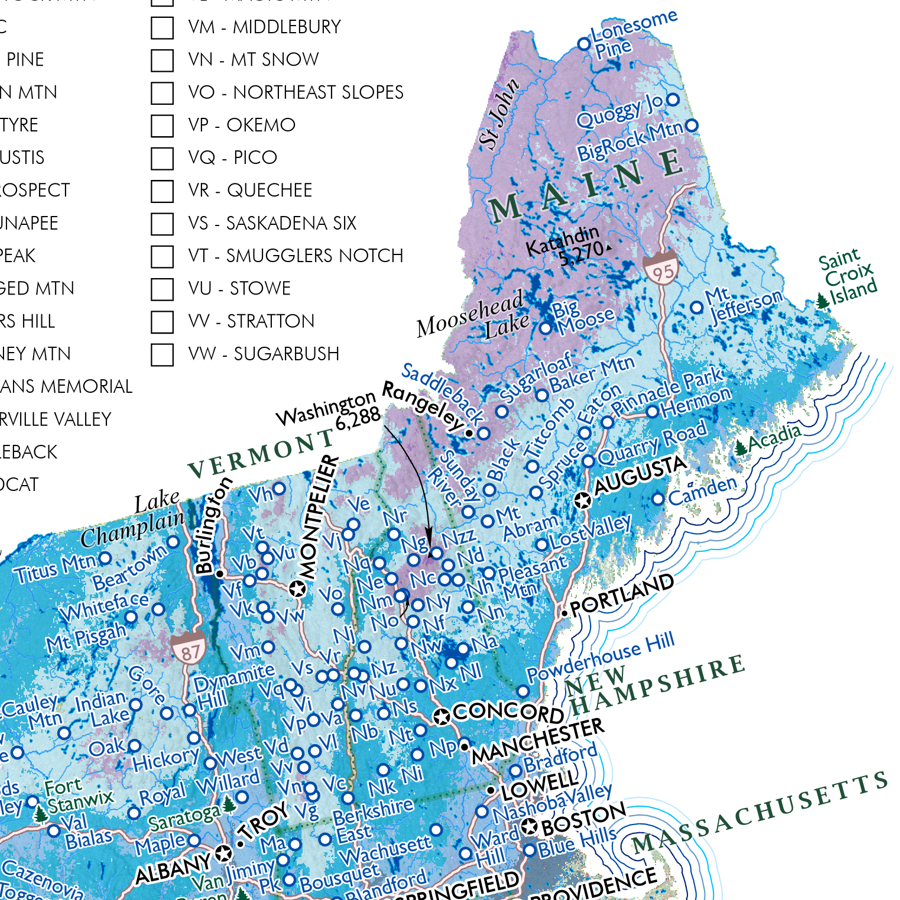
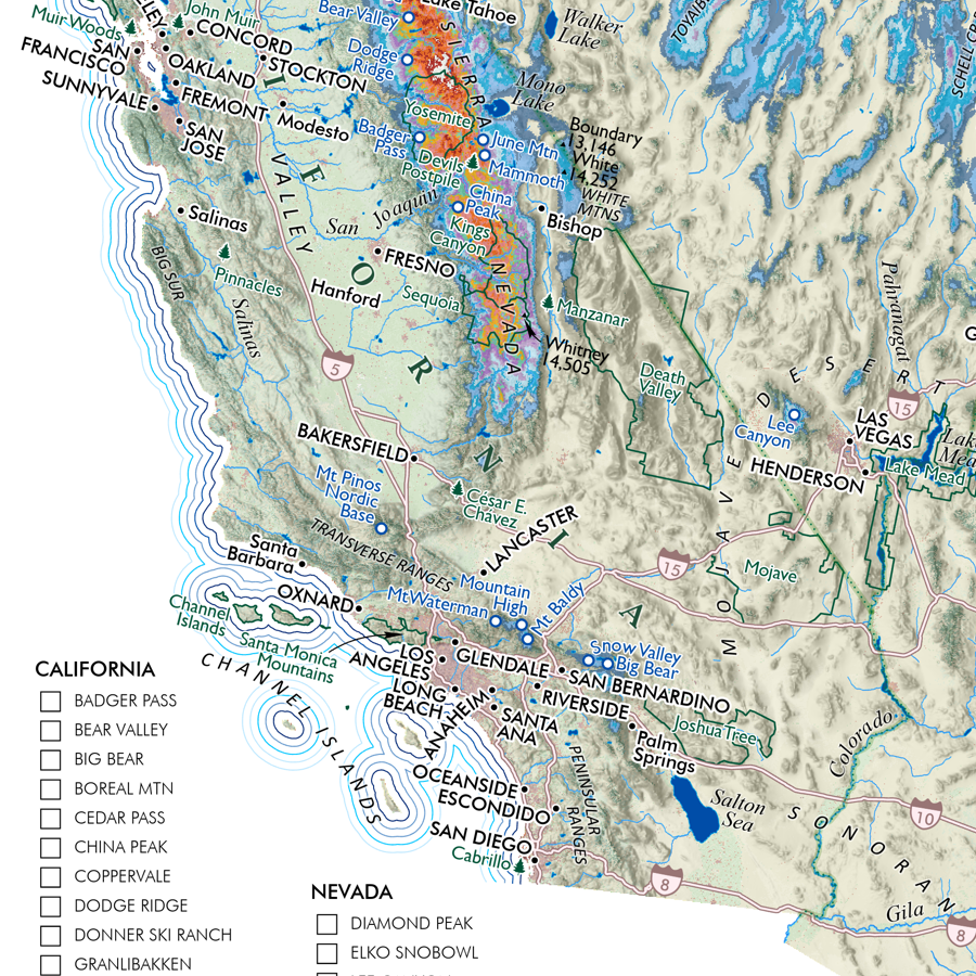
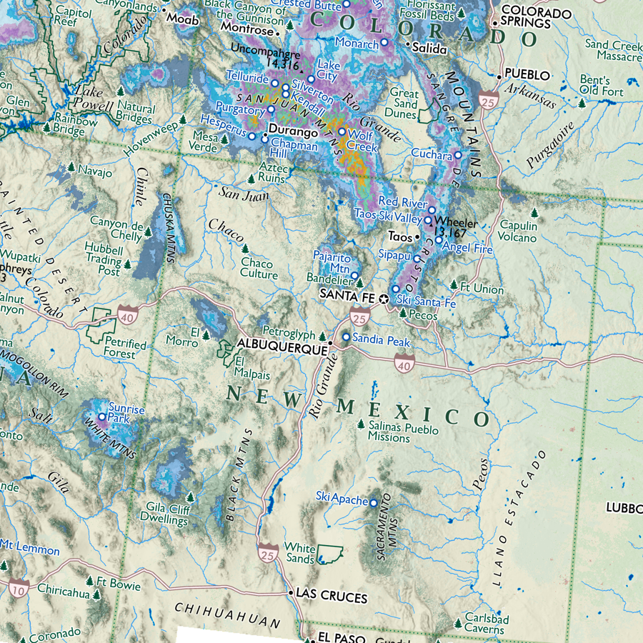
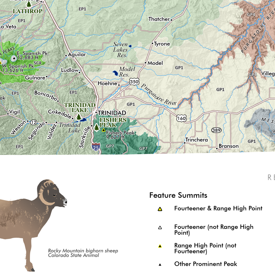
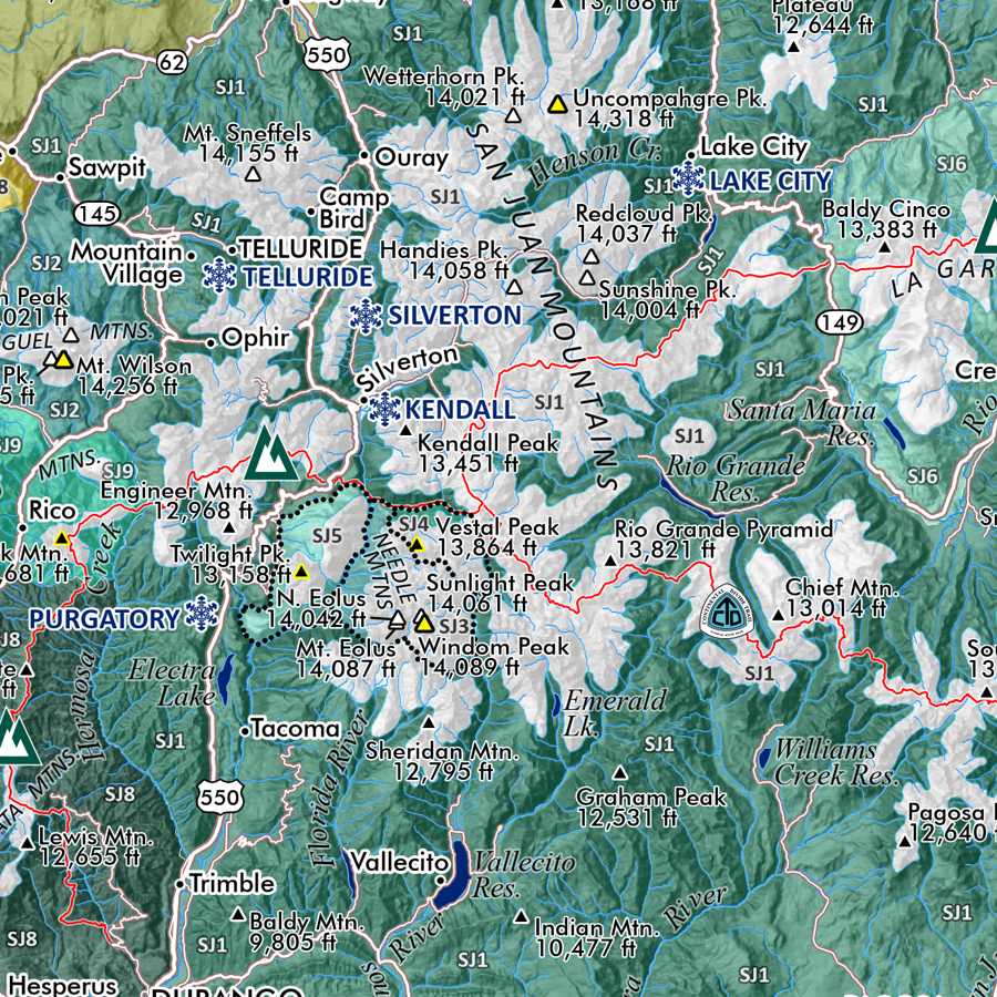
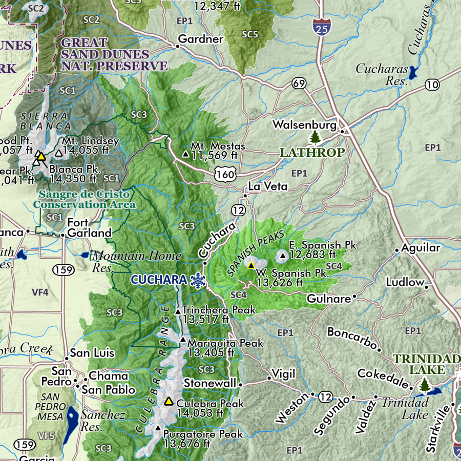
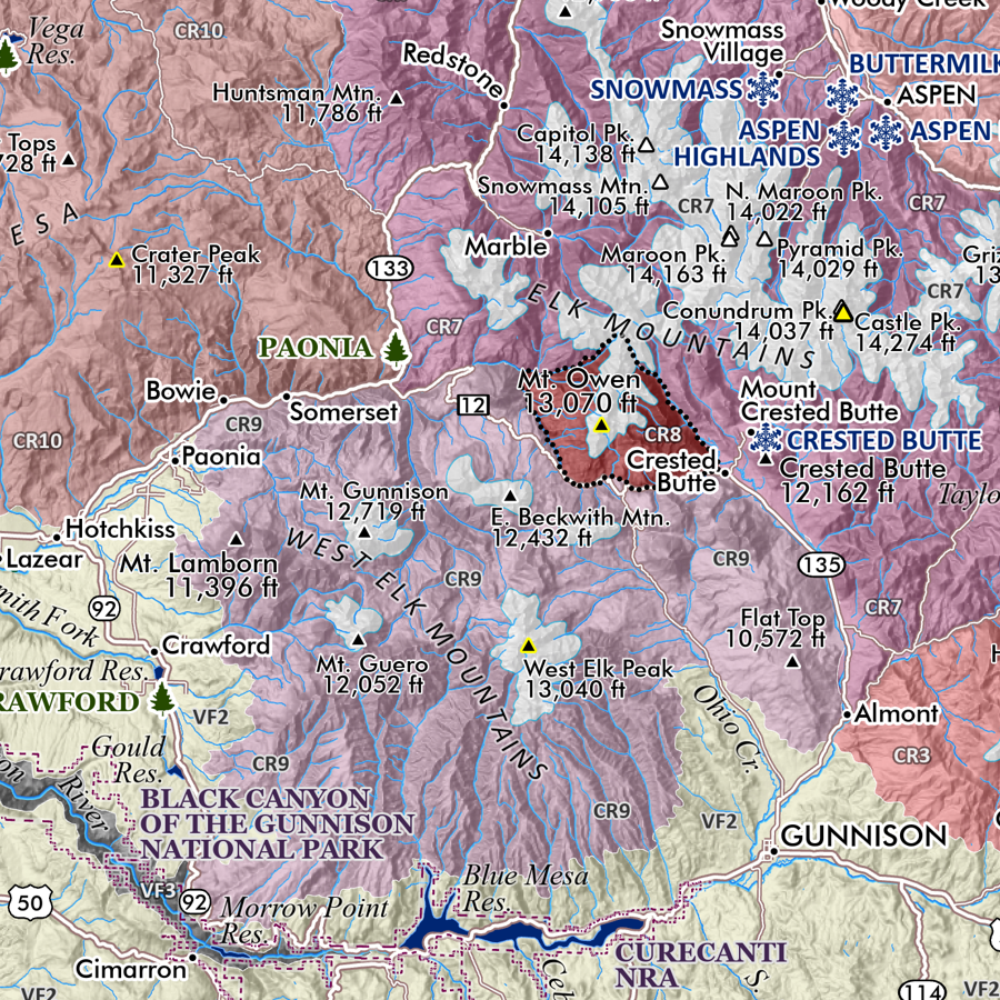
Colorado Mountain Ranges. This is a taxonomic styled and statewide general reference map of Colorado’s primary mountain systems and subranges, as well as other basin and plains landform features. Packed with details considering it’s scale and sheet size - you will need good map reading skills to fully enjoy the fine print and occasionally small typefaces.
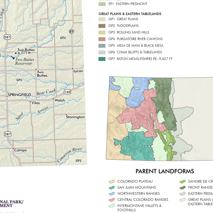
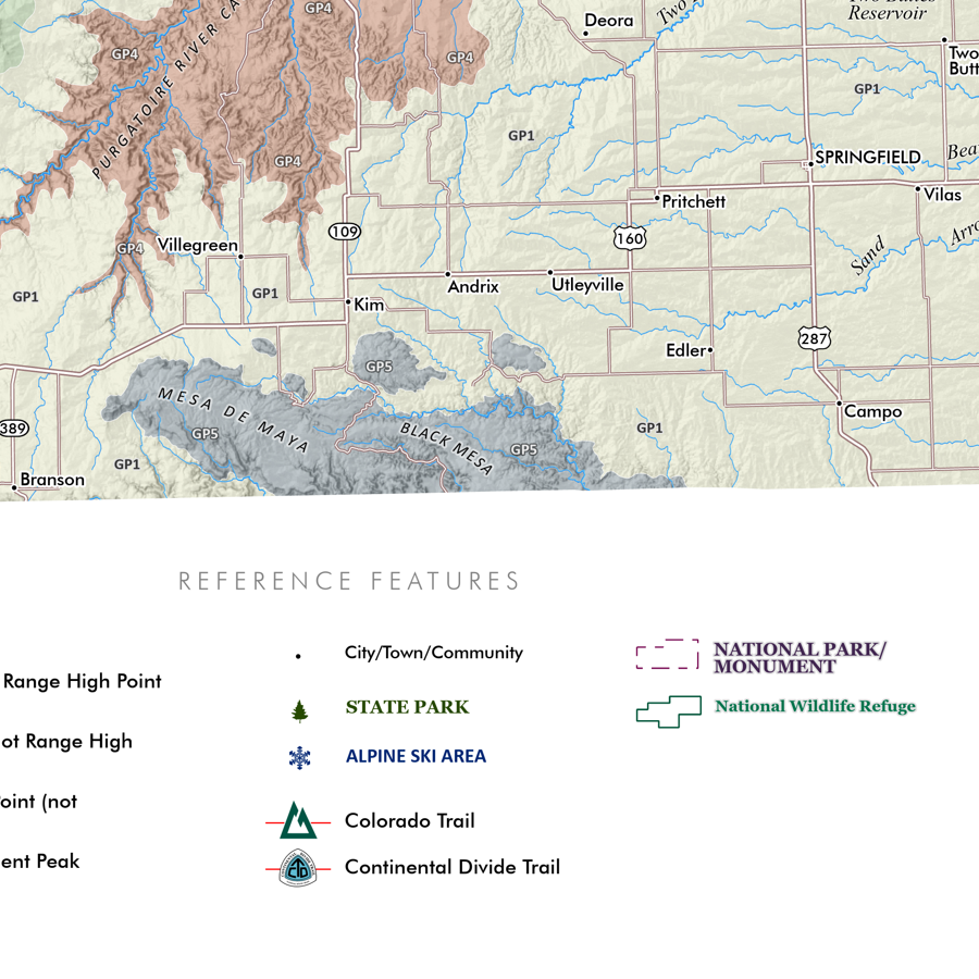
Featuring Colorado’s many mountain ranges and primary subranges — all delineated, colored and keyed to a detailed legend that identifies range and sub-range high point names and elevations in feet. Other landform features such as the plains, mountain parks, open slopes, plateaus, and foothill features are also classed and keyed within the legend (high points of these features are noted as appropriate). An inset map portrays the generalized parent landforms.
Spring 2025 Update:
Increased hash line weight for smaller ranges to increase readability (Never Summer Range, Mummy Range, Indian Peaks, Ruby Range, Needle Ranges, Ten Mile Range)
Corrected Pikes Peak symbology
Added Lake City ski area label
Reference features include:
City/Town/Community place names
Feature Summits
Fourteeners
Fourteener range high points
Other Prominent Summits
Non-fourteener range high points
State Parks
Alpine Ski Areas
Colorado Trail route
Continental Divide Trail route
National Park/Monument
National Wildlife Refuge
1:1,085,000
28 inch x 20 inch — flat wall map, printed on a heavy fine paper — ships rolled.
UPDATED SPRING 2025
Colorado Mountain Ranges. This is a taxonomic styled and statewide general reference map of Colorado’s primary mountain systems and subranges, as well as other basin and plains landform features. Packed with details considering it’s scale and sheet size - you will need good map reading skills to fully enjoy the fine print and occasionally small typefaces.
Featuring Colorado’s many mountain ranges and primary subranges — all delineated, colored and keyed to a detailed legend that identifies range and sub-range high point names and elevations in feet. Other landform features such as the plains, mountain parks, open slopes, plateaus, and foothill features are also classed and keyed within the legend (high points of these features are noted as appropriate). An inset map portrays the generalized parent landforms.
Spring 2025 Update:
Increased hash line weight for smaller ranges to increase readability (Never Summer Range, Mummy Range, Indian Peaks, Ruby Range, Needle Ranges, Ten Mile Range)
Corrected Pikes Peak symbology
Added Lake City ski area label
Reference features include:
City/Town/Community place names
Feature Summits
Fourteeners
Fourteener range high points
Other Prominent Summits
Non-fourteener range high points
State Parks
Alpine Ski Areas
Colorado Trail route
Continental Divide Trail route
National Park/Monument
National Wildlife Refuge