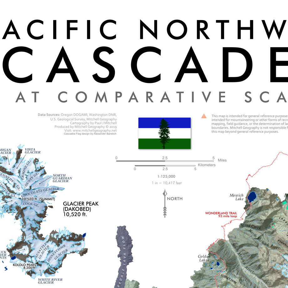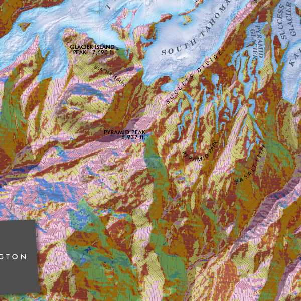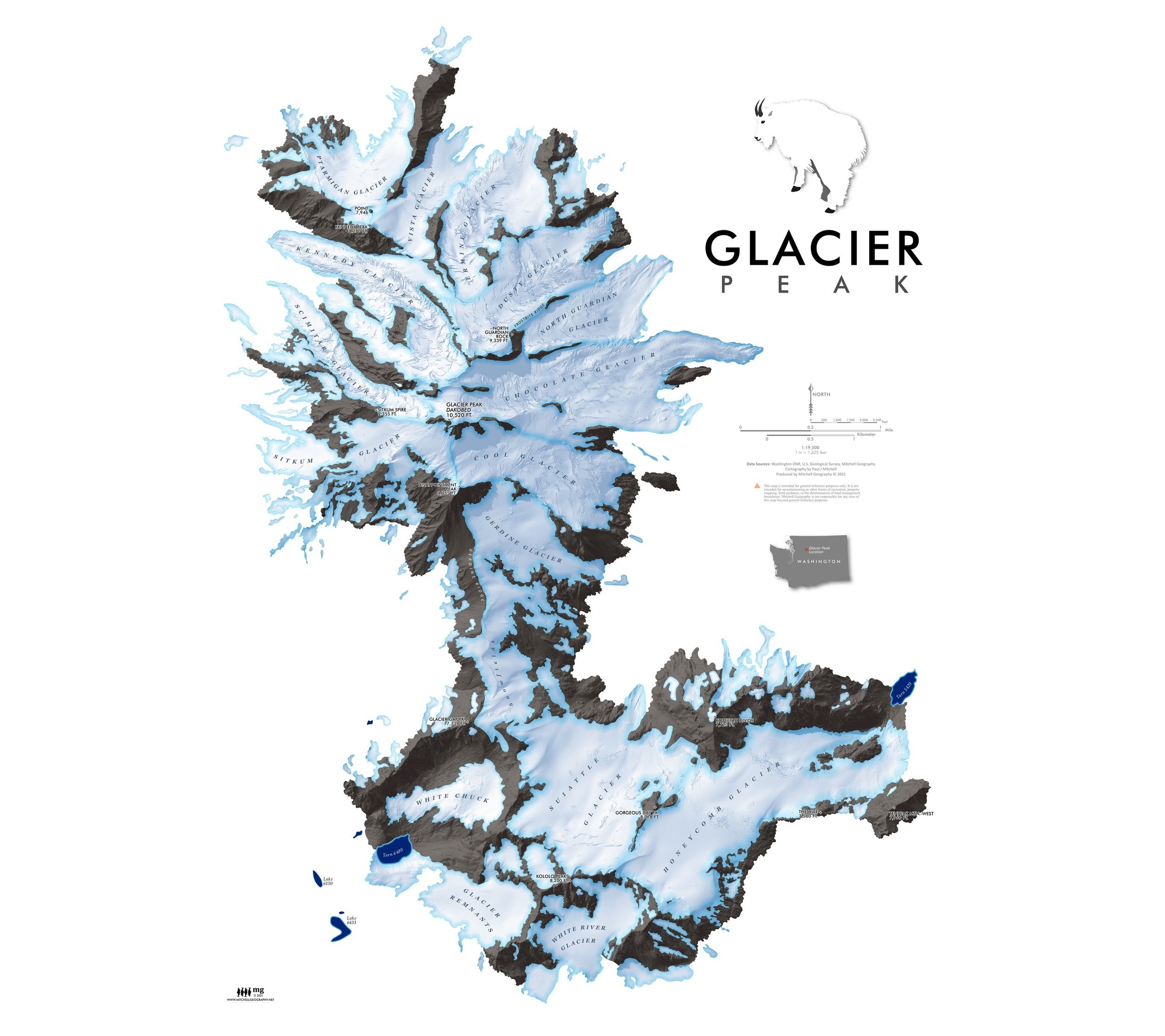
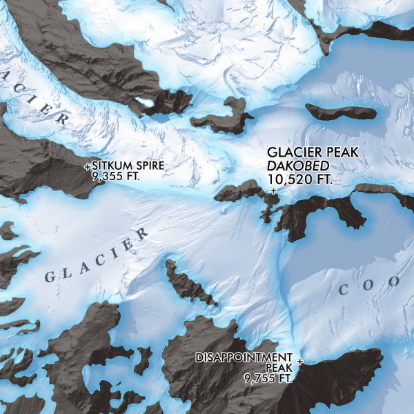
Glacier Peak Washington (24 in x 18 in)
1:19,500
18 inch by 24 inch flat wall map, printed on heavy fine paper, shipped rolled.
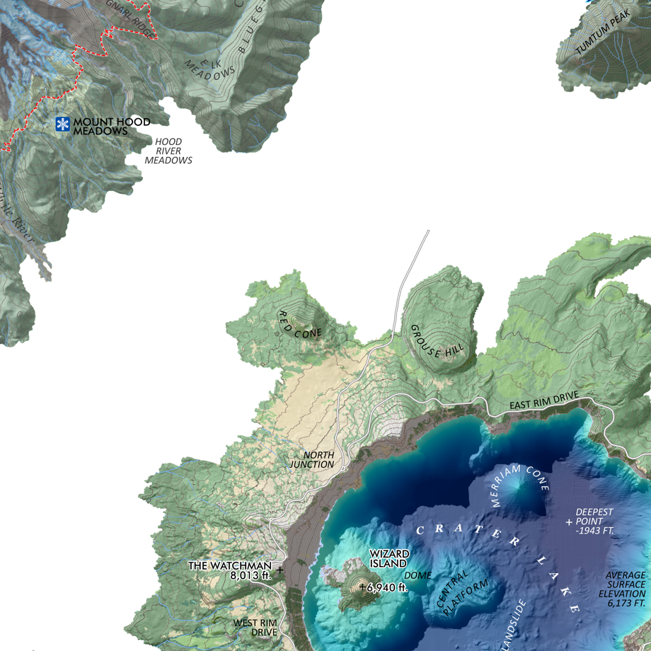
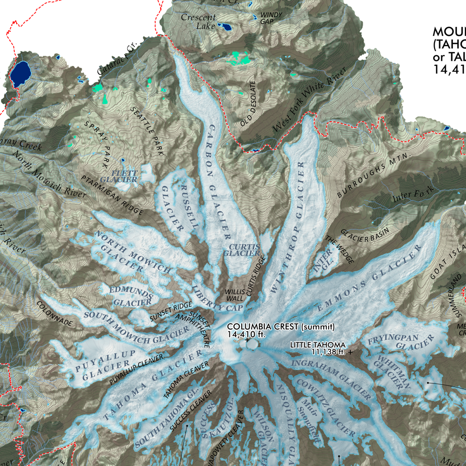
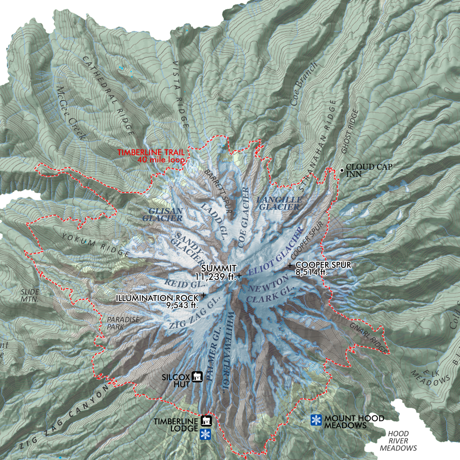
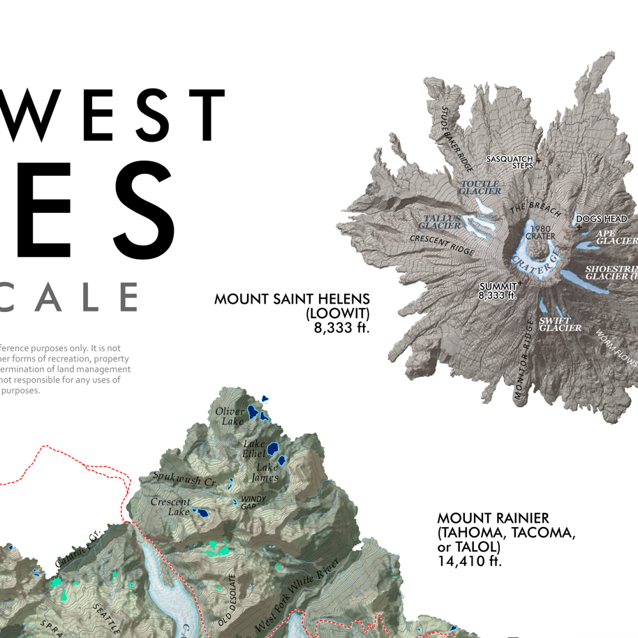
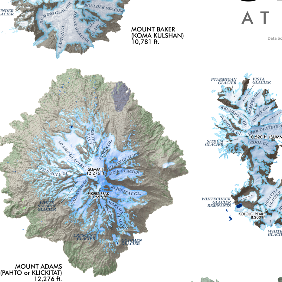
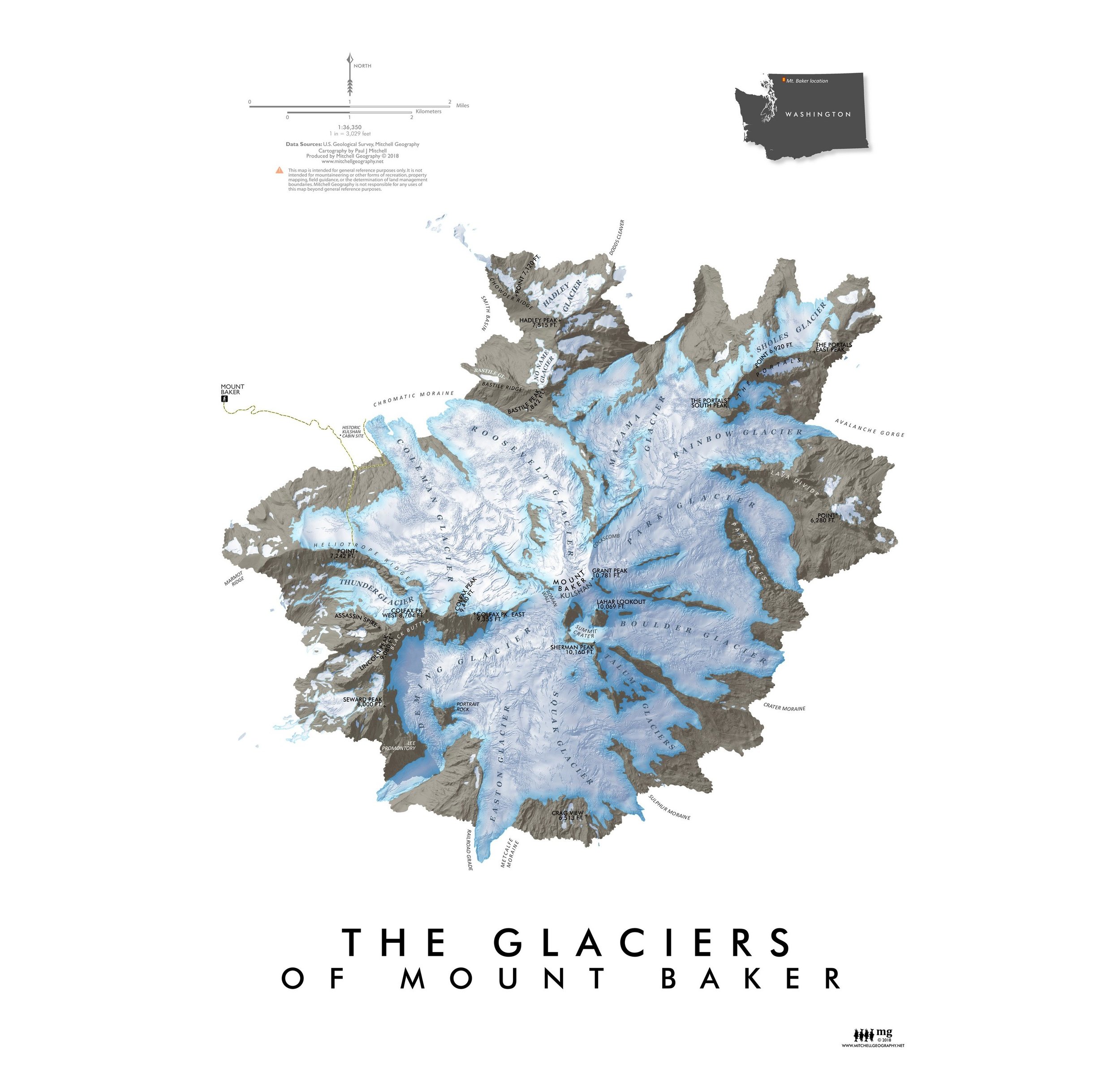
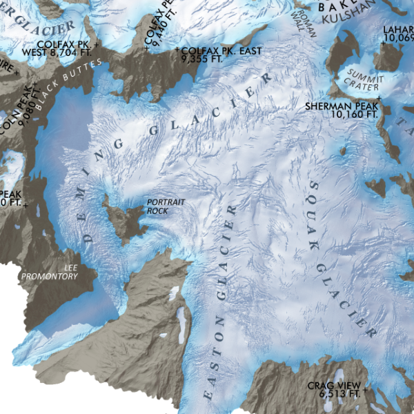
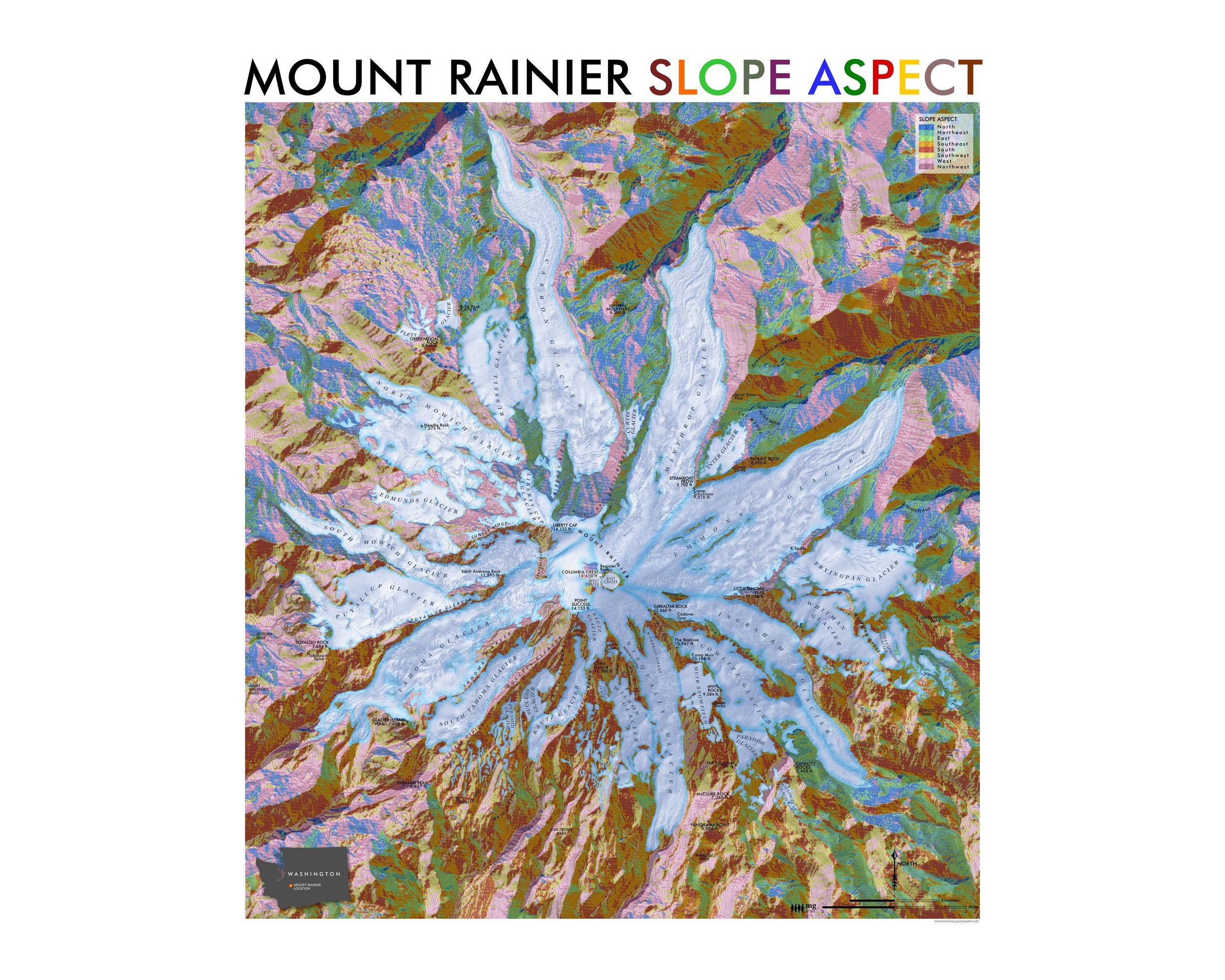
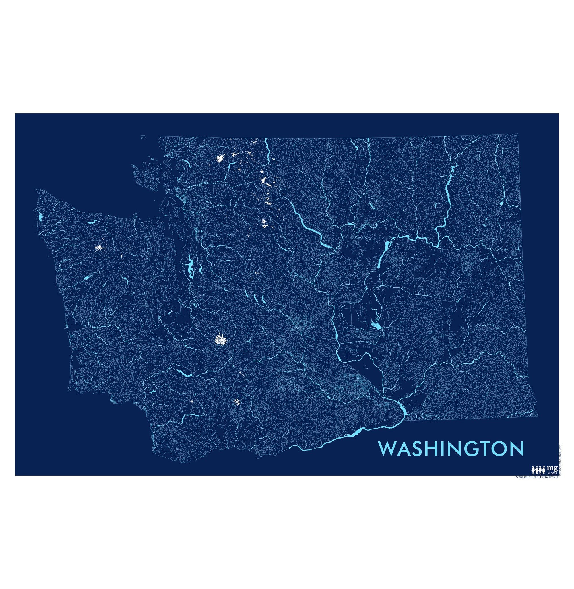
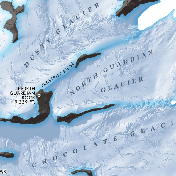
Feature map of the alpine landscapes of Glacier Peak south to the Kololo Peaks, including the glaciers, large snowfields and glacier remnants delineated with Washington State’s DNR published 3 foot lidar bare earth model.
1:19,500
18 inch by 24 inch flat wall map, printed on heavy fine paper, shipped rolled.
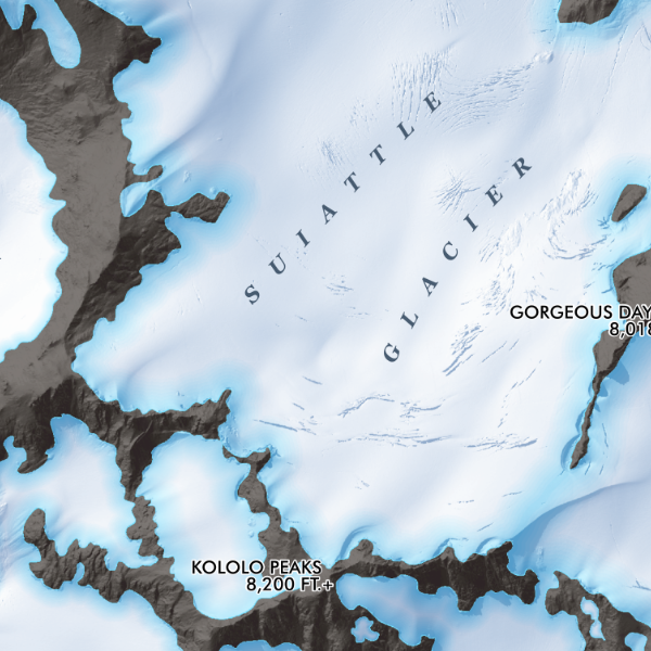
Feature map of the alpine landscapes of Glacier Peak south to the Kololo Peaks, including the glaciers, large snowfields and glacier remnants delineated with Washington State’s DNR published 3 foot lidar bare earth model.


1:19,500
18 inch by 24 inch flat wall map, printed on heavy fine paper, shipped rolled.
Feature map of the alpine landscapes of Glacier Peak south to the Kololo Peaks, including the glaciers, large snowfields and glacier remnants delineated with Washington State’s DNR published 3 foot lidar bare earth model.