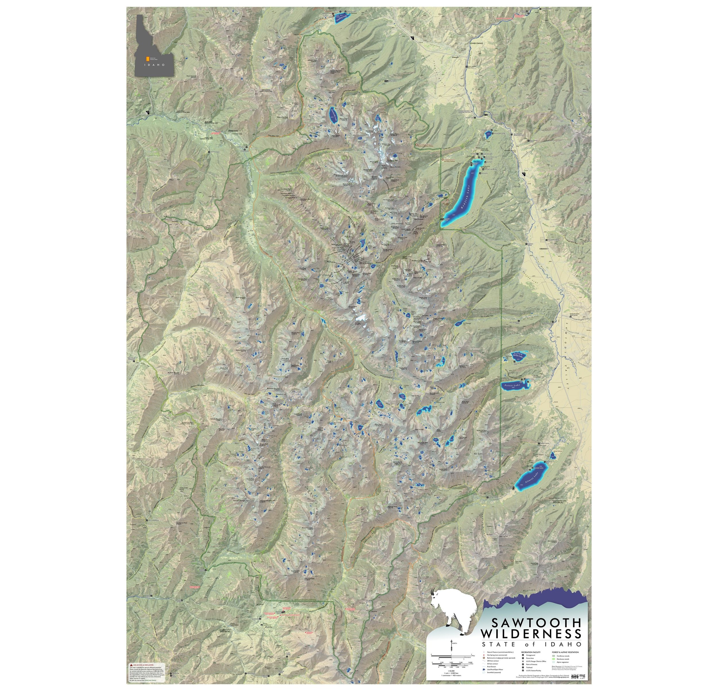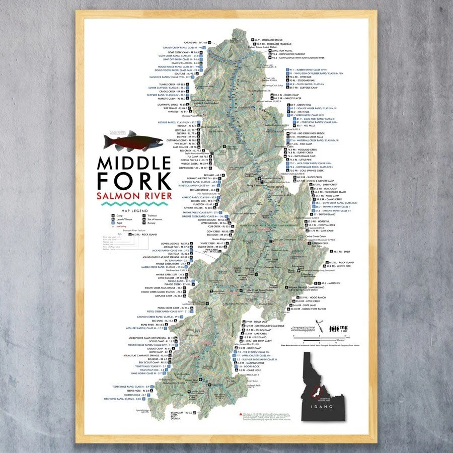
Middle Fork Salmon River Idaho
18 x 24 inch & 13 inch by 19 inch flat wall map, printed on heavy fine paper. 18 x 24 inch version is shipped rolled while the 13 x 19 inch version is shipped flat. (Not a waterproof float map).
Portraying one of Idaho's most well known rivers -- this map features the Middle Fork of the Salmon. The landscape is clipped to the HUC 12 watersheds which contribute to the Middle Fork; map also includes camps, most named rapids, runways, trails, and other place name features.
*Spring 2023 update added and updated features as needed, including new hot spring feature points and labels.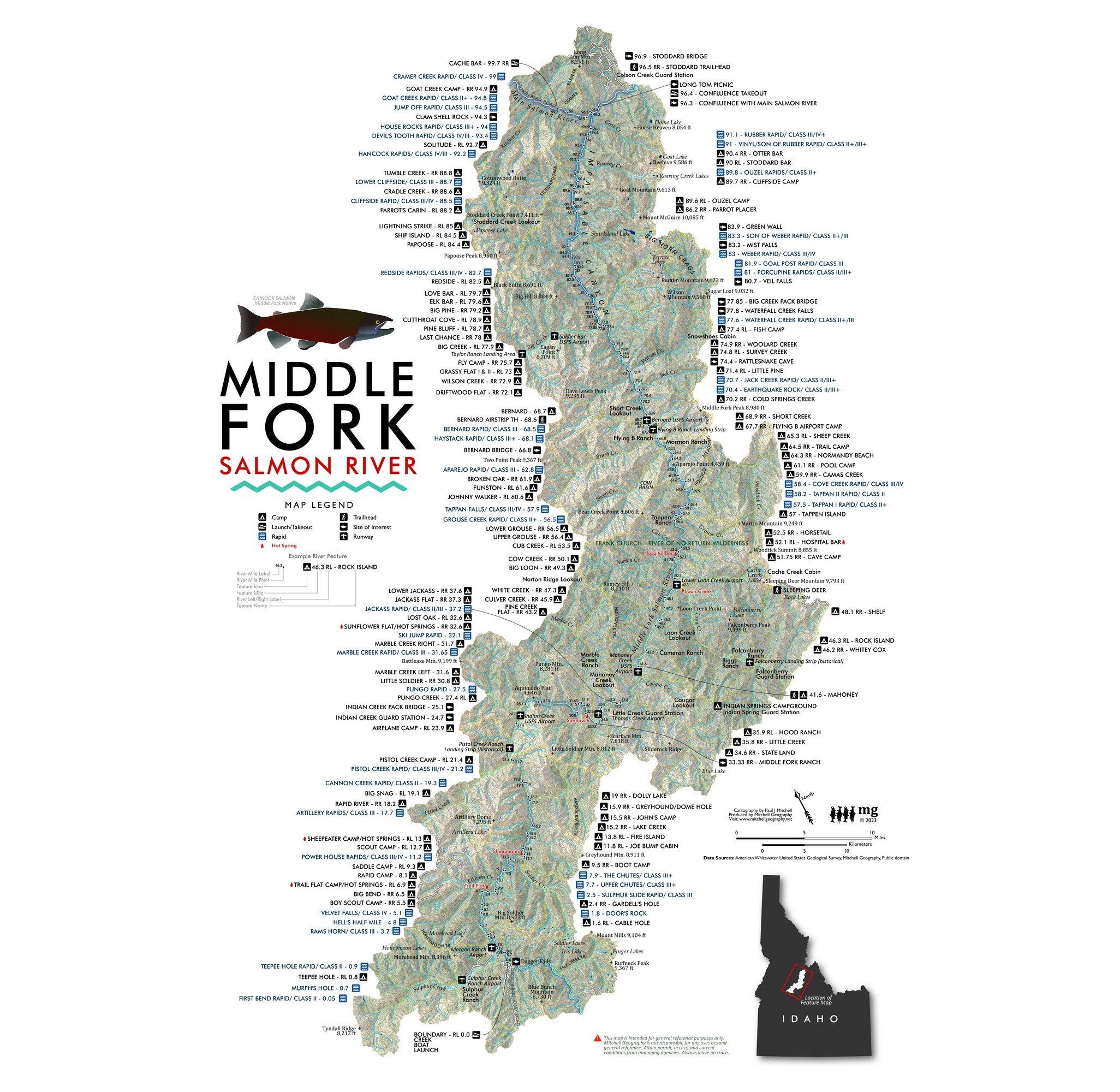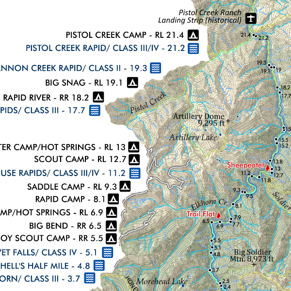


![Selkirk Range [North Idaho] (19 in x 13 in)](https://images.squarespace-cdn.com/content/v1/64dfe5c447627a1ab4b29d07/1694978585657-V3GADKP5FDUOUXPICRG9/Selkirk1319_framed.JPG)