South Sister Oregon (19 x 13 inch)
1:26,500
13 inch by 19 inch flat wall map, printed on heavy fine paper. Packed and shipped flat.
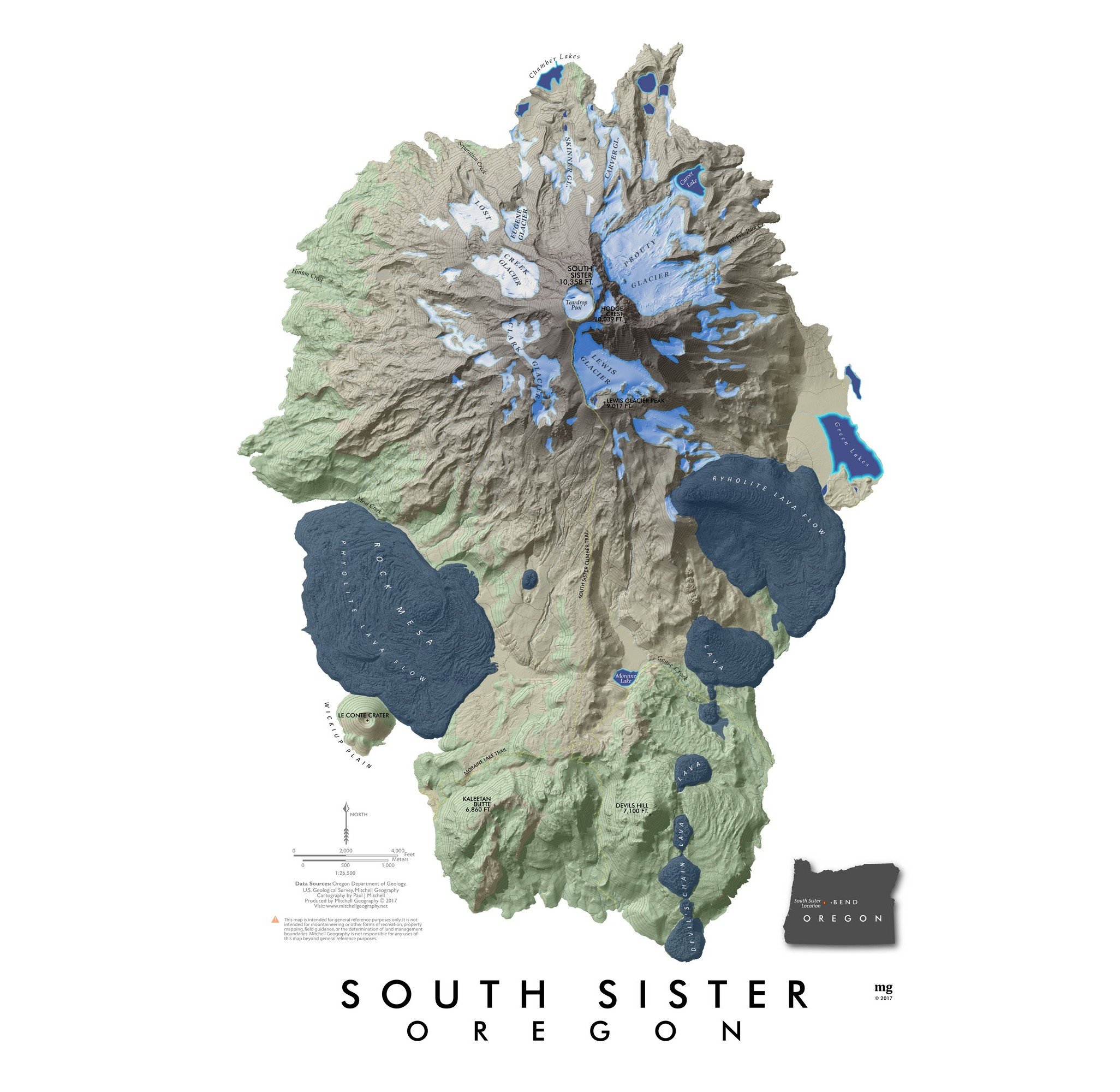
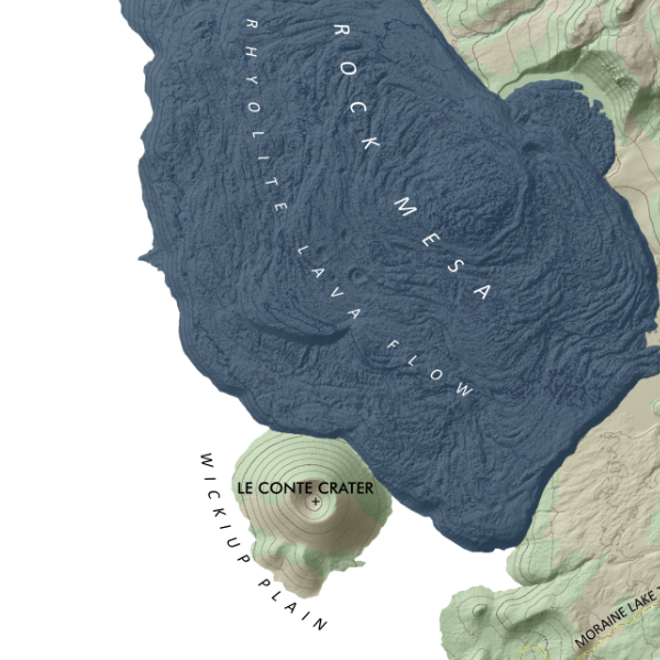
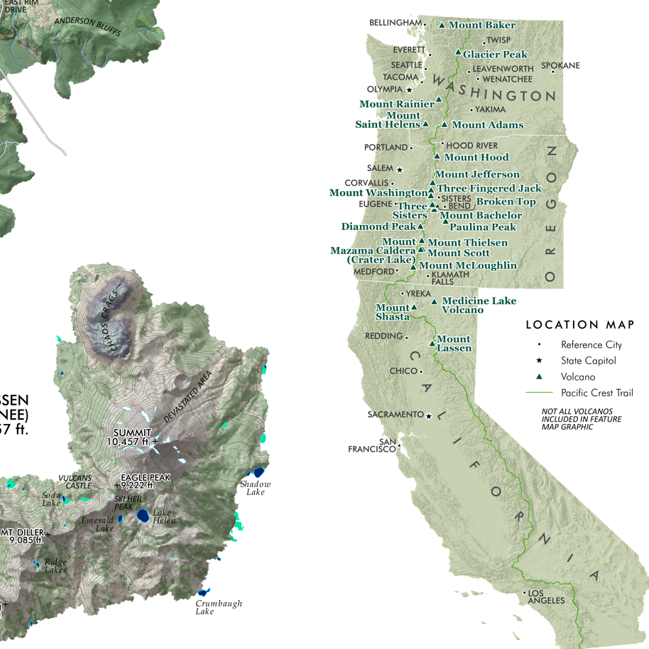
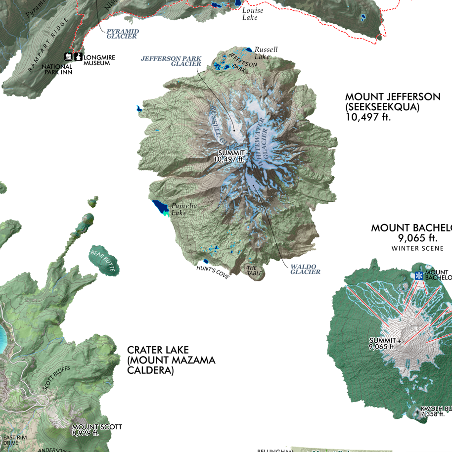
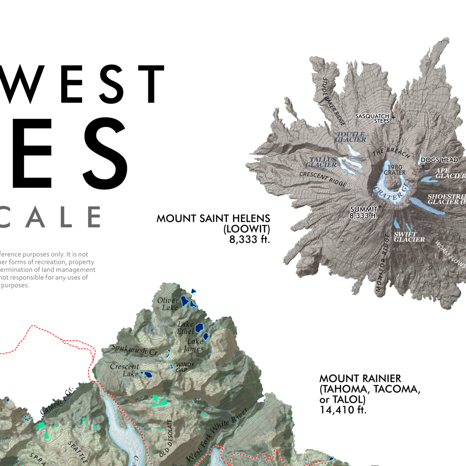
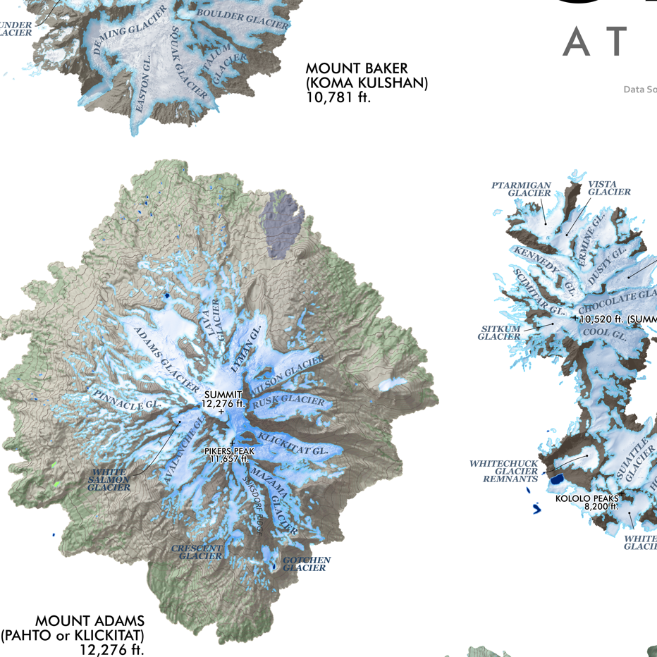
South Sister, Oregon. Lava flows, glaciers, massive summer snowfields, alpine lakes, exceptional scenery -- what's not to like about the tallest of the Three Sisters in Central Oregon. Tried to capture those feelings in this colorful map of the volcano that's based upon 3 foot resolution Lidar terrain data. South Sister Climbers and Moraine Lake Trails are included along with landform labels for reference.
1:26,500
13 inch by 19 inch flat wall map, printed on heavy fine paper. Packed and shipped flat.
South Sister, Oregon. Lava flows, glaciers, massive summer snowfields, alpine lakes, exceptional scenery -- what's not to like about the tallest of the Three Sisters in Central Oregon. Tried to capture those feelings in this colorful map of the volcano that's based upon 3 foot resolution Lidar terrain data. South Sister Climbers and Moraine Lake Trails are included along with landform labels for reference.


![Mt. Hood Slope Aspect [Japanese language] (24 in x 20 in)](https://images.squarespace-cdn.com/content/v1/64dfe5c447627a1ab4b29d07/1695326601172-WPM6DJNFTOKJ9NON7B4M/MtHood_Japanese_framed.jpeg)


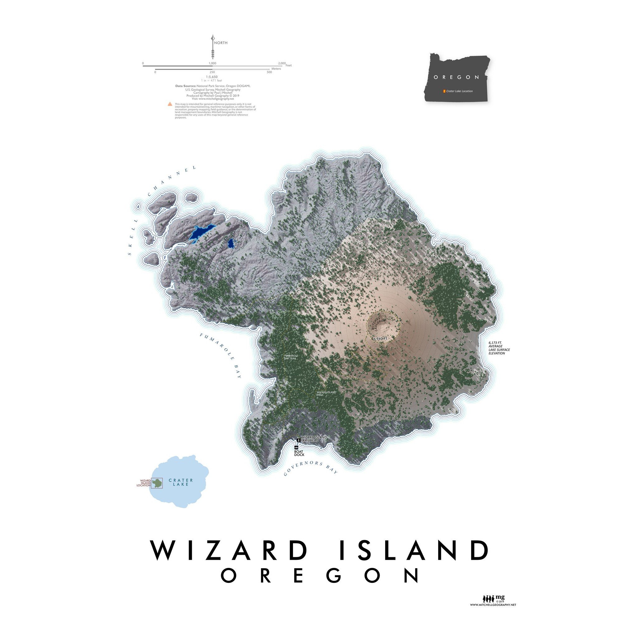
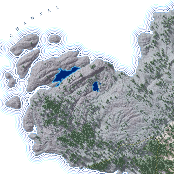
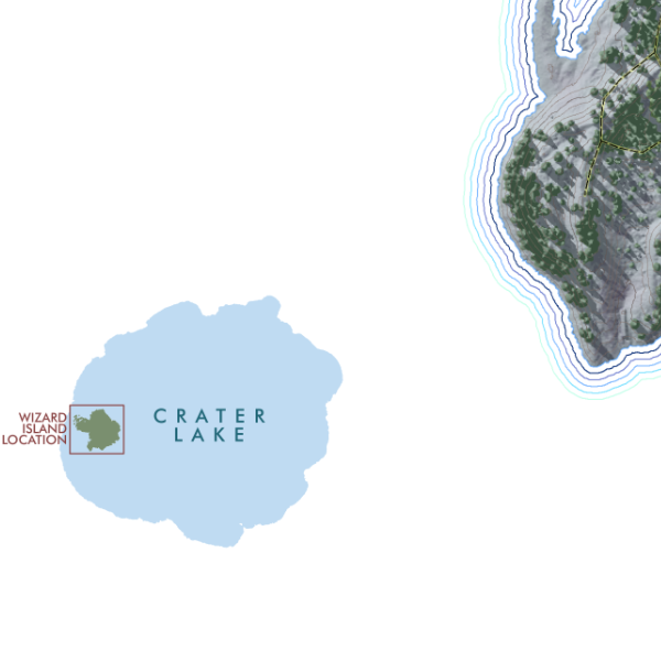
![Wizard Island [Oregon] (19 in x 13 in)](https://images.squarespace-cdn.com/content/v1/64dfe5c447627a1ab4b29d07/1695326300993-0JLTRQOZ5G9JXGTE15L1/WizardIsland1319_framed.JPG)