

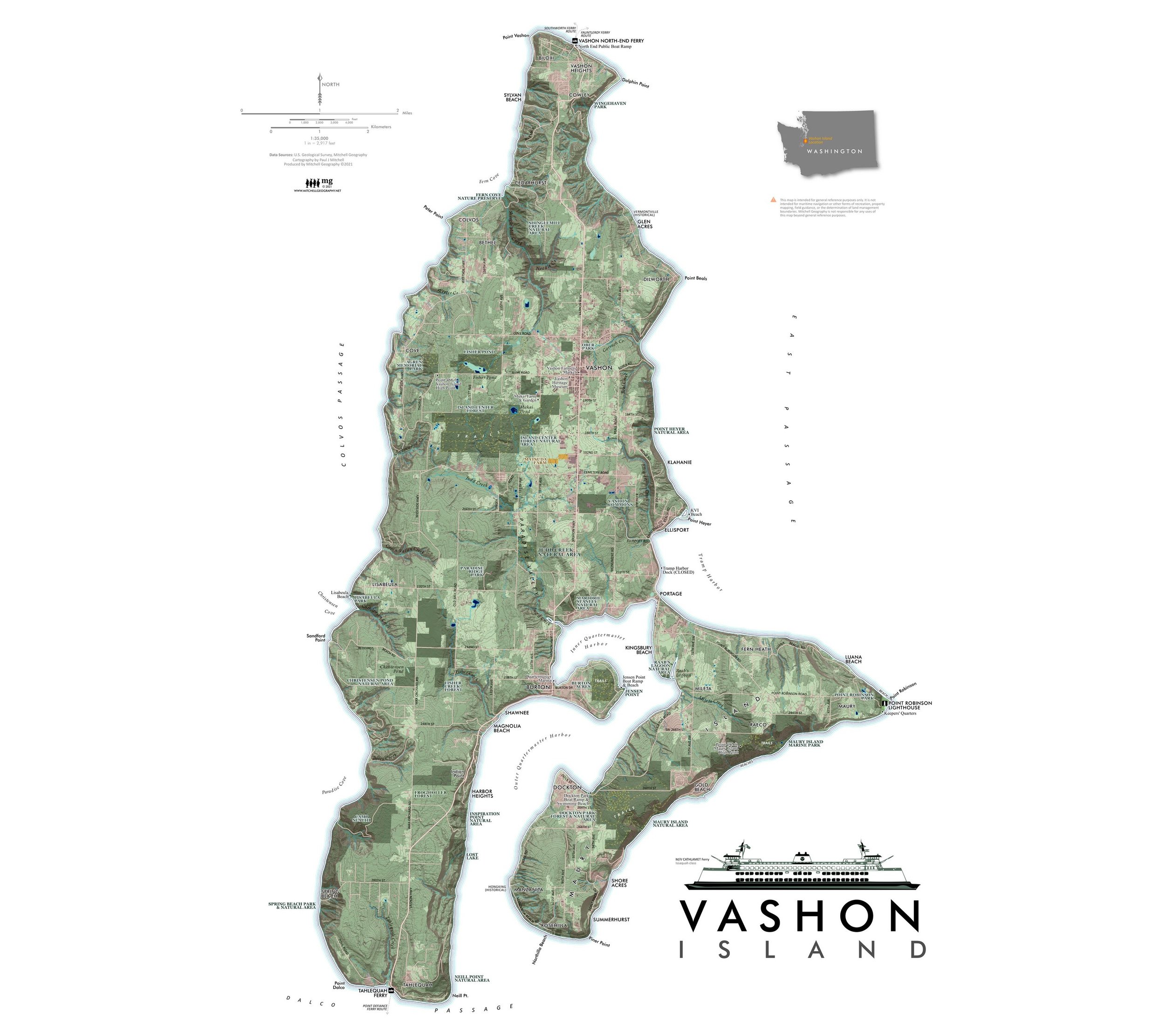
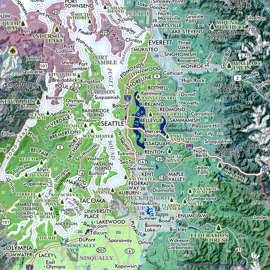
Vashon Island (24 in x 18 in)
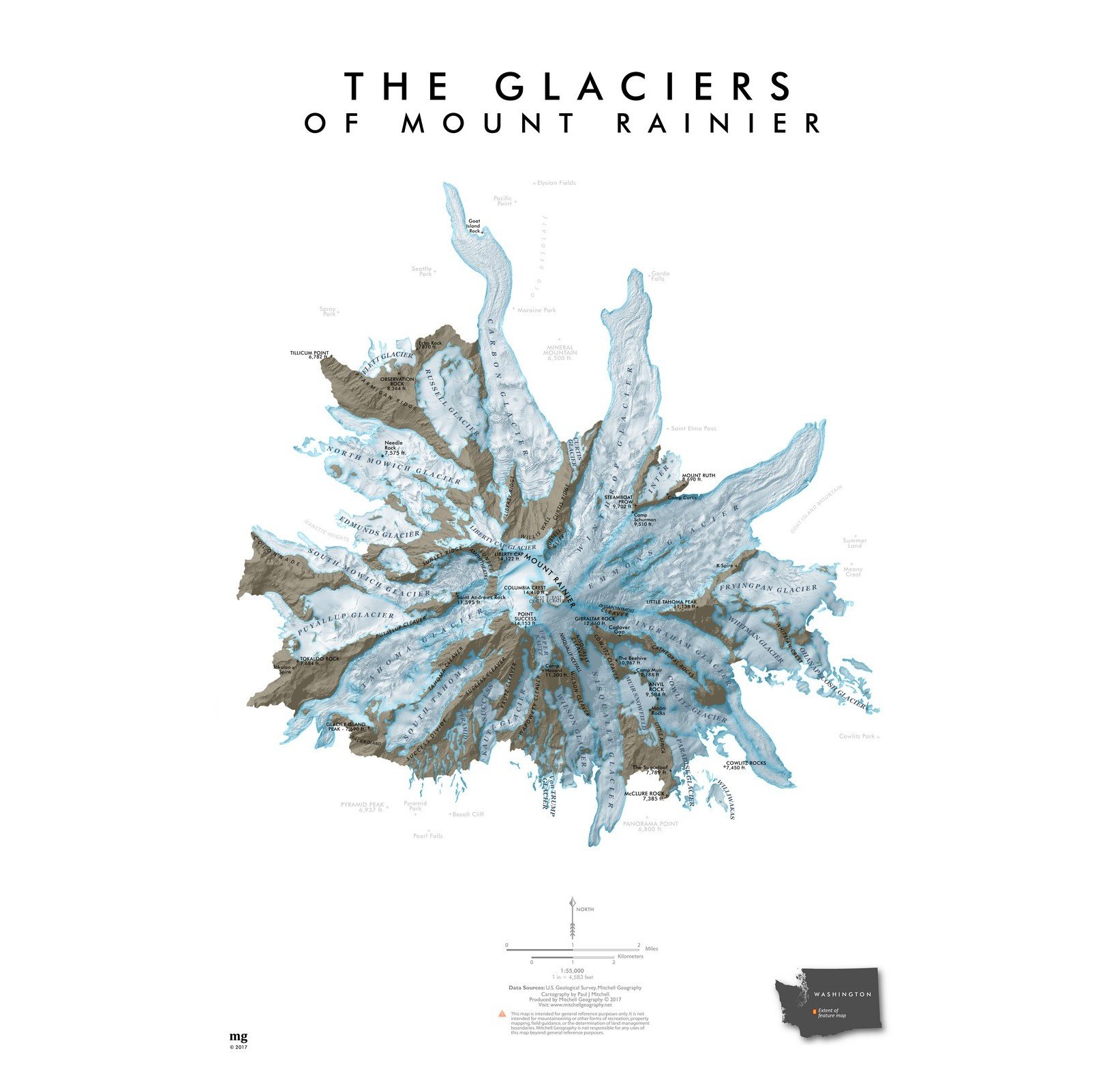
1:35,000
18 inch x 24 inch — flat wall map, printed on a heavy fine paper — shipped rolled.
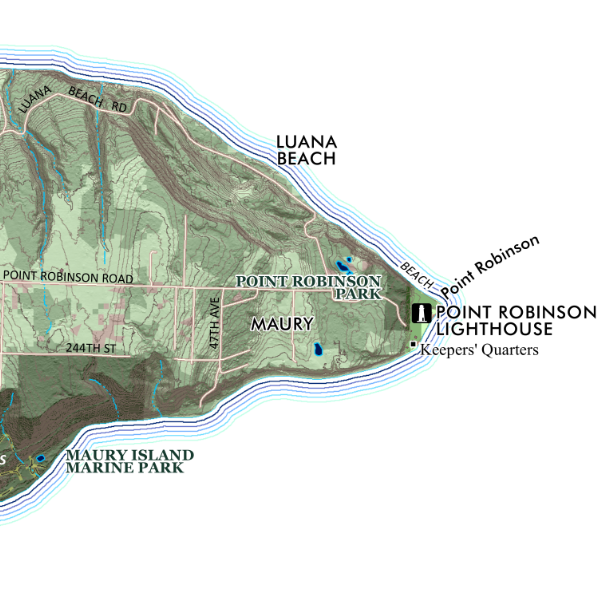
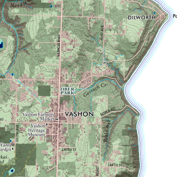
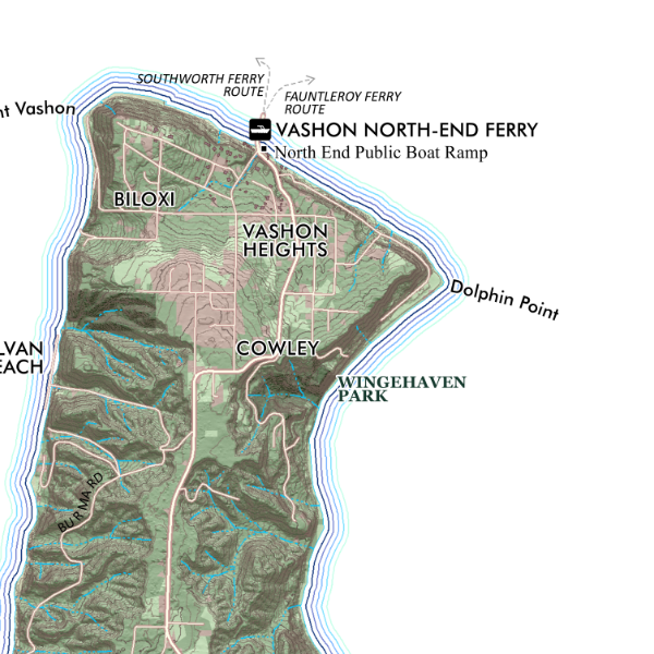
Overview map of Vashon Island, Washington. Map includes public parks and other preserves, building footprints and lidar derived topographic data. Places and natural features are labeled.
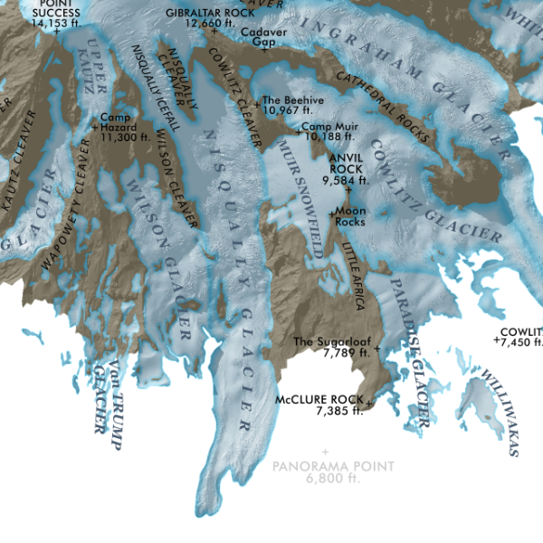
1:35,000
18 inch x 24 inch — flat wall map, printed on a heavy fine paper — shipped rolled.
Overview map of Vashon Island, Washington. Map includes public parks and other preserves, building footprints and lidar derived topographic data. Places and natural features are labeled.


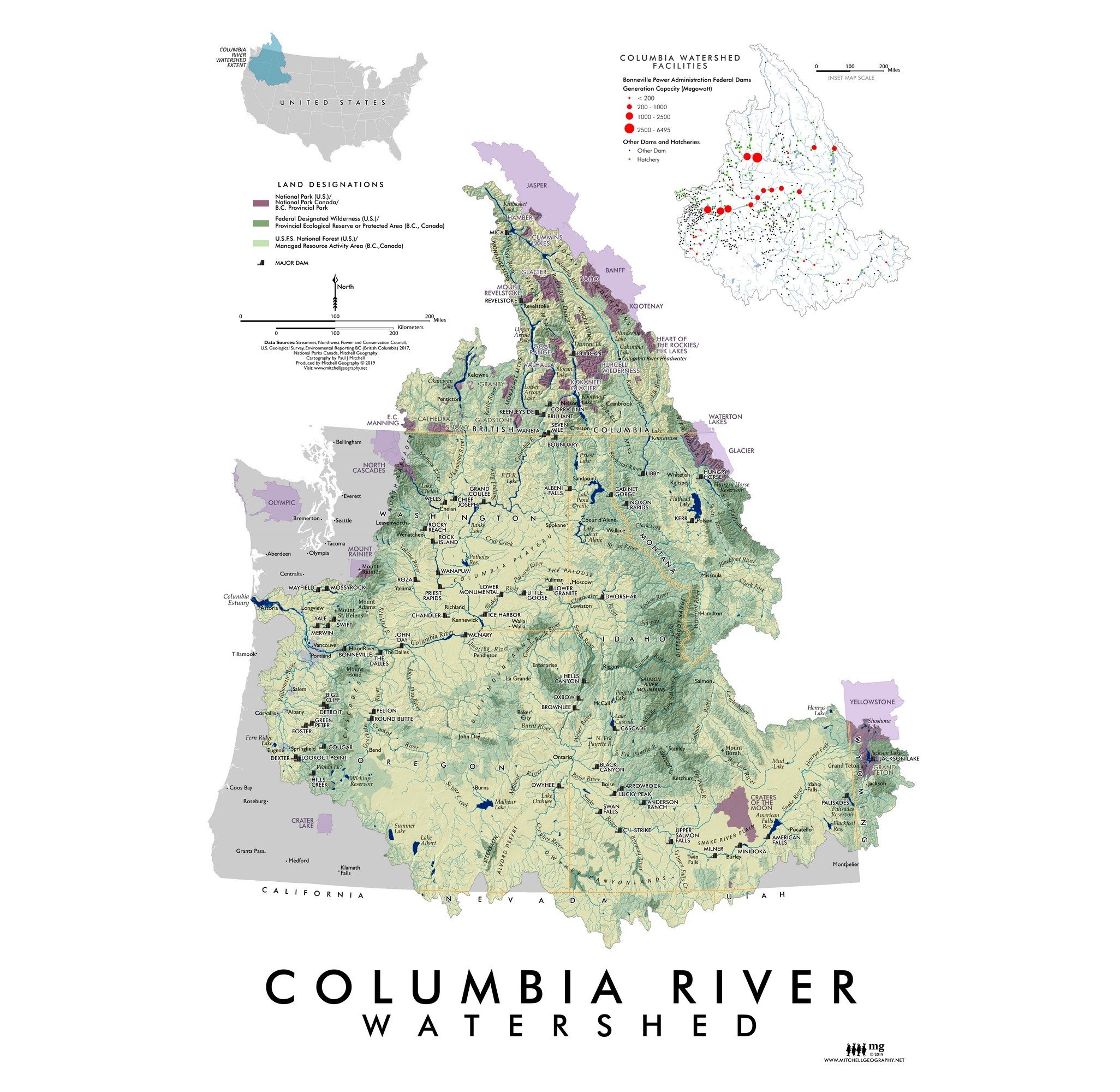
1:35,000
18 inch x 24 inch — flat wall map, printed on a heavy fine paper — shipped rolled.
Overview map of Vashon Island, Washington. Map includes public parks and other preserves, building footprints and lidar derived topographic data. Places and natural features are labeled.


![Washington [Japanese language] (24 in x 20 in)](https://images.squarespace-cdn.com/content/v1/64dfe5c447627a1ab4b29d07/1694699282568-VV2KAVQ0SIU2BF6VIE2J/WA_JA_framed.JPG)


