
Mt. Hood Glaciers (19 in x 13 in)
1:20,000
13 inch by 19 inch flat wall map, printed on heavy fine paper. Packed and shipped flat.
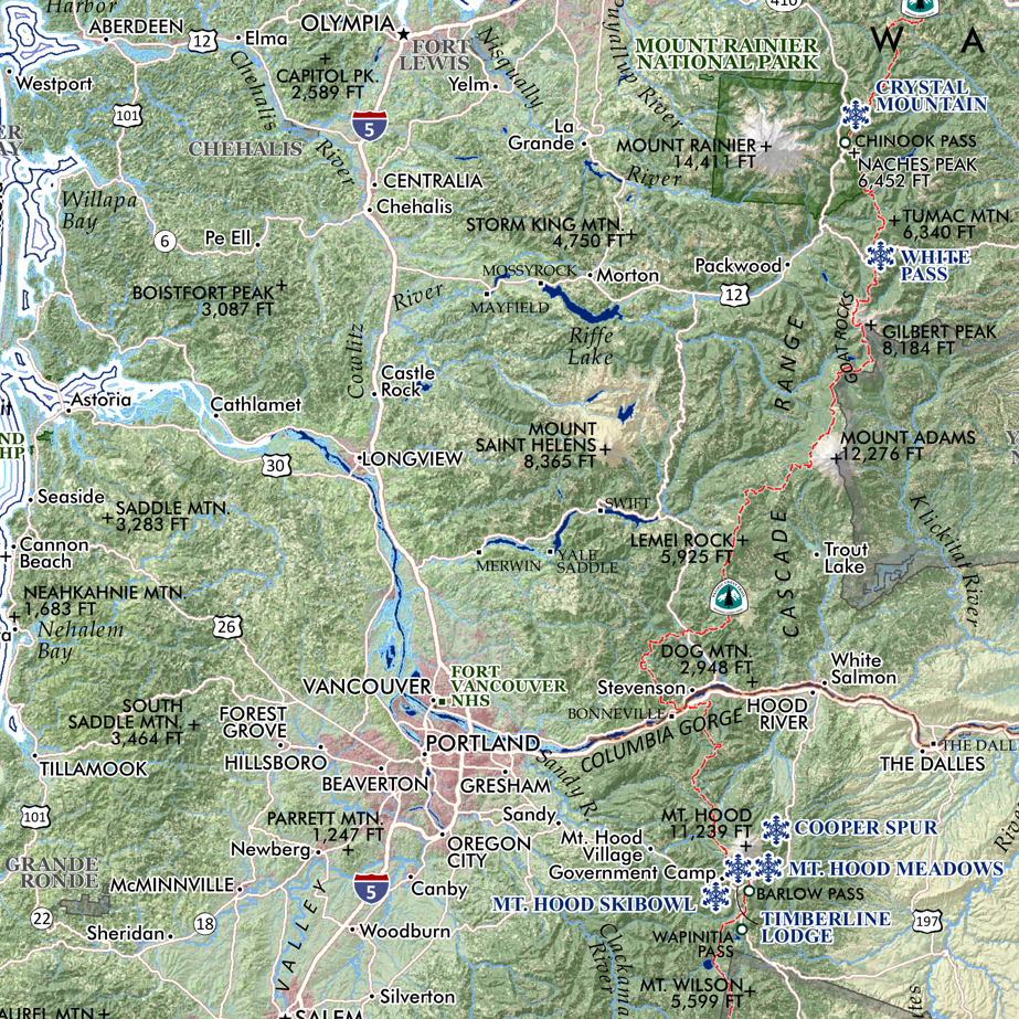
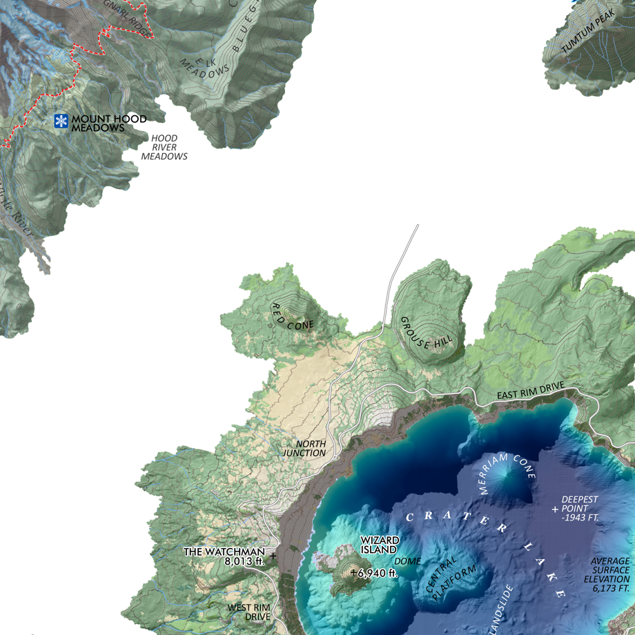
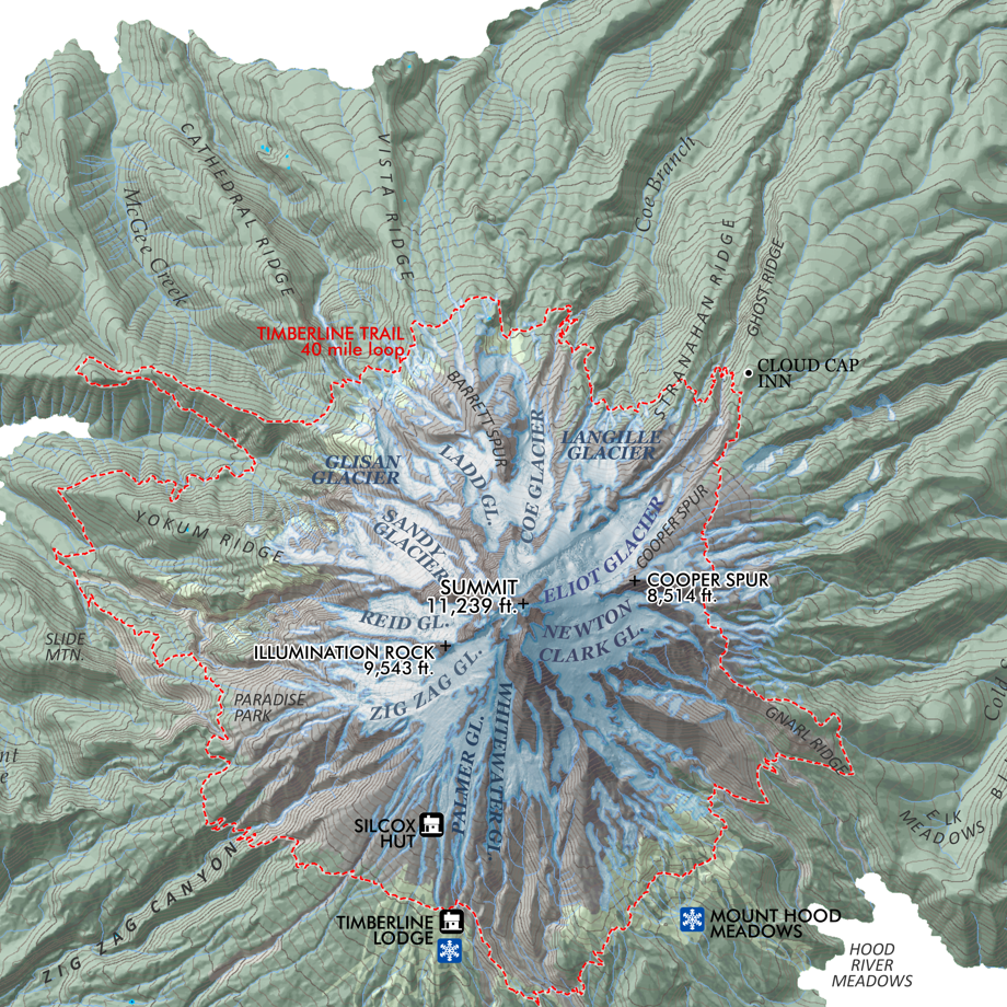
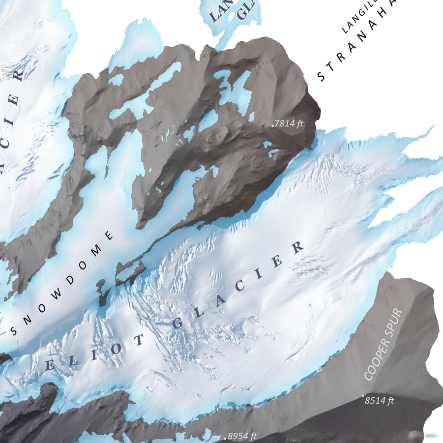
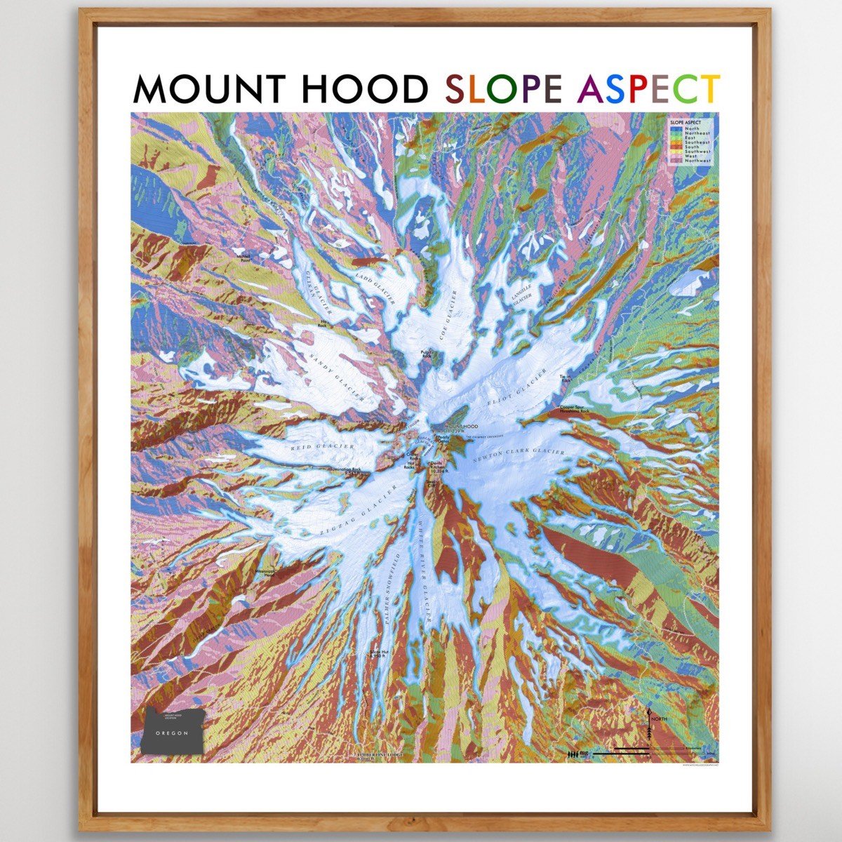
Mount Hood, Oregon. Updated in May 2024, based upon Oregon DOGAMI’s detailed LiDAR elevation model, my visually prominent mid-summer seasonal glacier and snowfield extent is derived at 1:2,000 from the same LiDAR model and corrected to current aerial imagery. Landforms and provincial feature names of chutes, faces, snowfields, along with spot elevation points for natural features, Silcox Hut, Timberline Lodge, and Cooper Spur shelter are included. Timberline’s upper chairlifts are mapped helping to identify the Palmer route.
1:20,000
13 inch by 19 inch flat wall map, printed on heavy fine paper. Packed and shipped flat.
Mount Hood, Oregon. Updated in May 2024, based upon Oregon DOGAMI’s detailed LiDAR elevation model, my visually prominent mid-summer seasonal glacier and snowfield extent is derived at 1:2,000 from the same LiDAR model and corrected to current aerial imagery. Landforms and provincial feature names of chutes, faces, snowfields, along with spot elevation points for natural features, Silcox Hut, Timberline Lodge, and Cooper Spur shelter are included. Timberline’s upper chairlifts are mapped helping to identify the Palmer route.