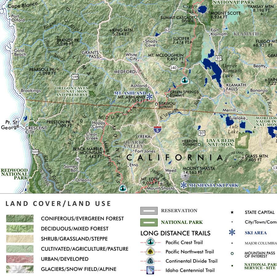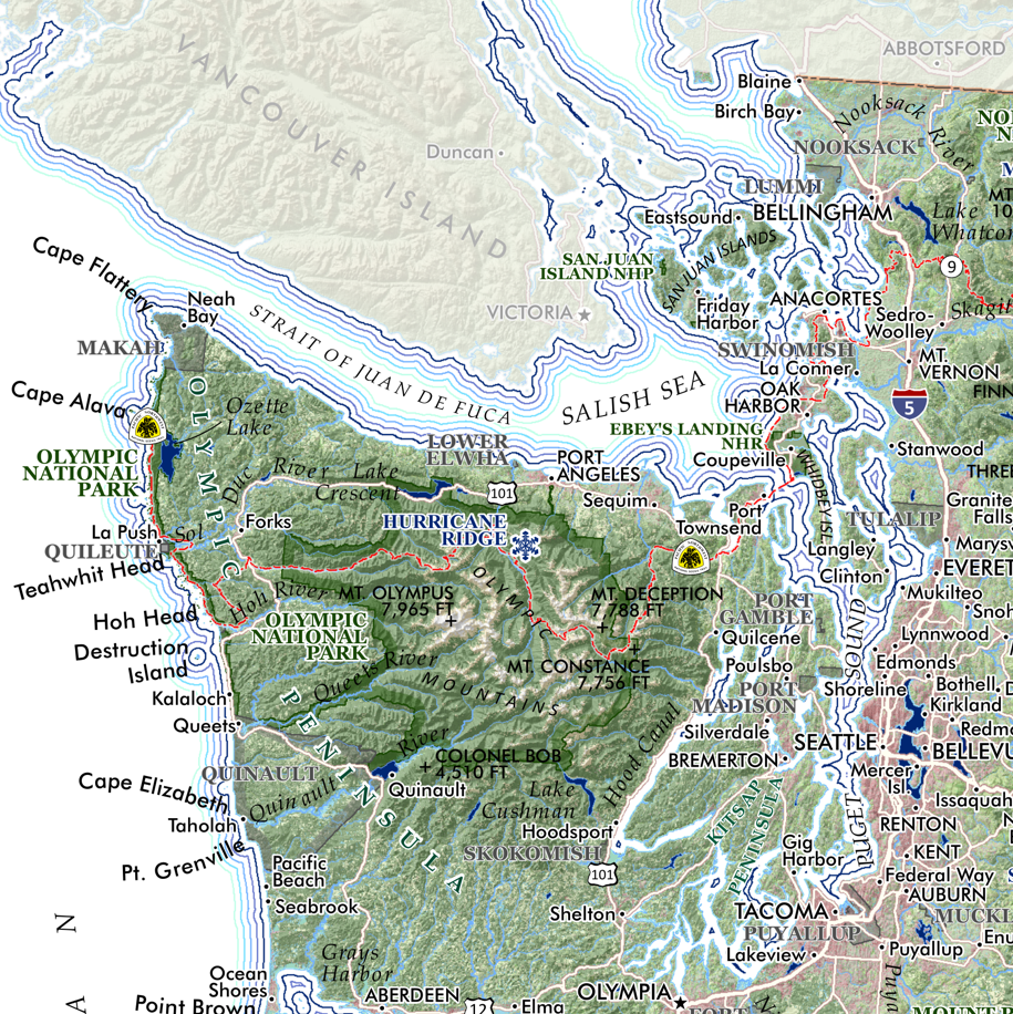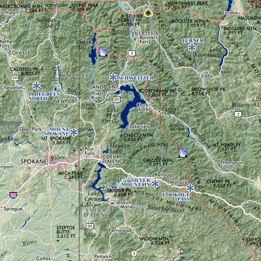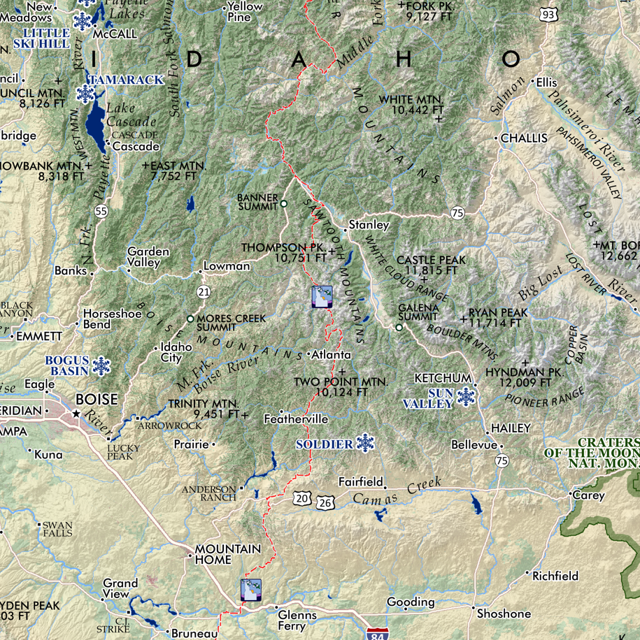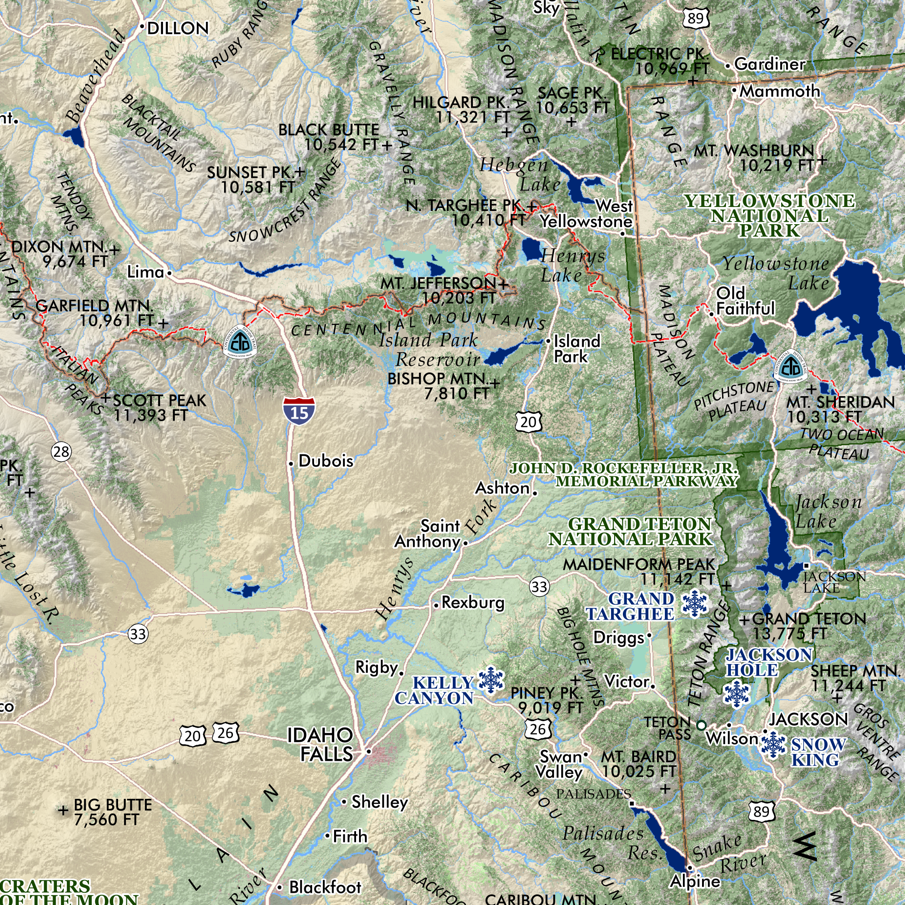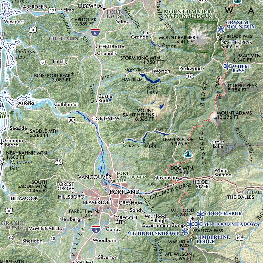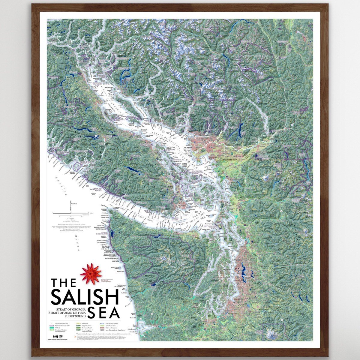
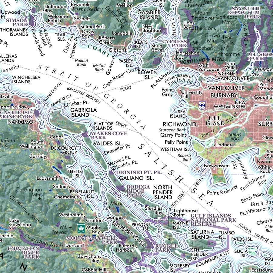
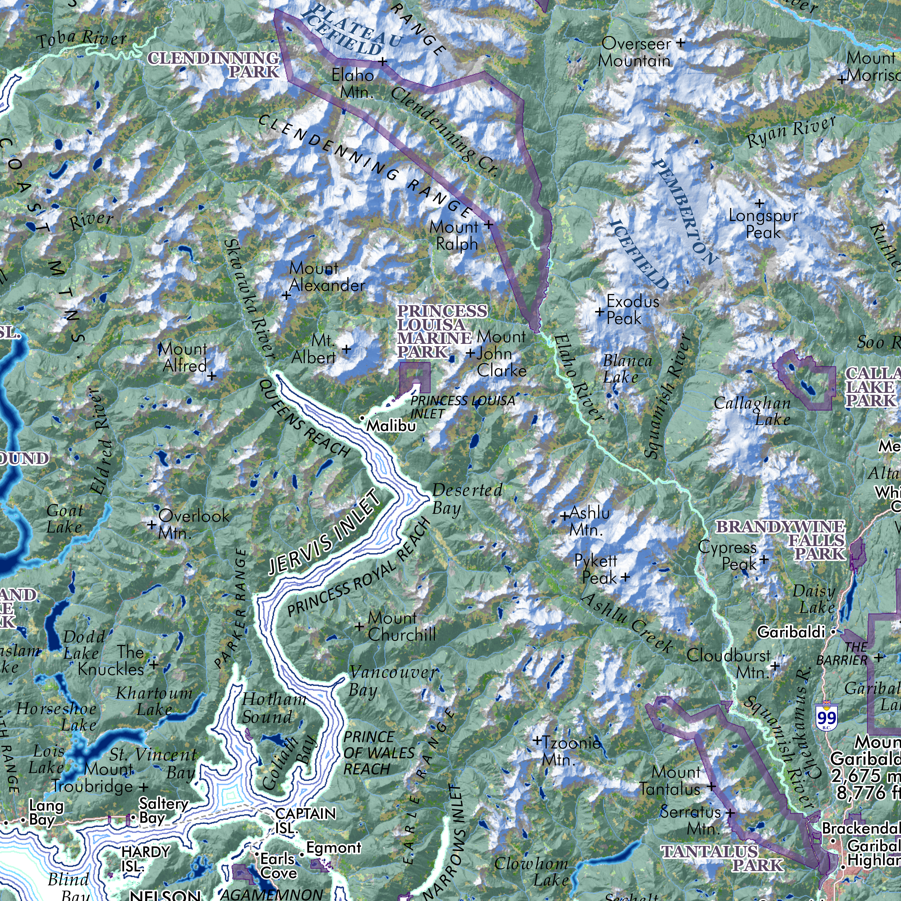
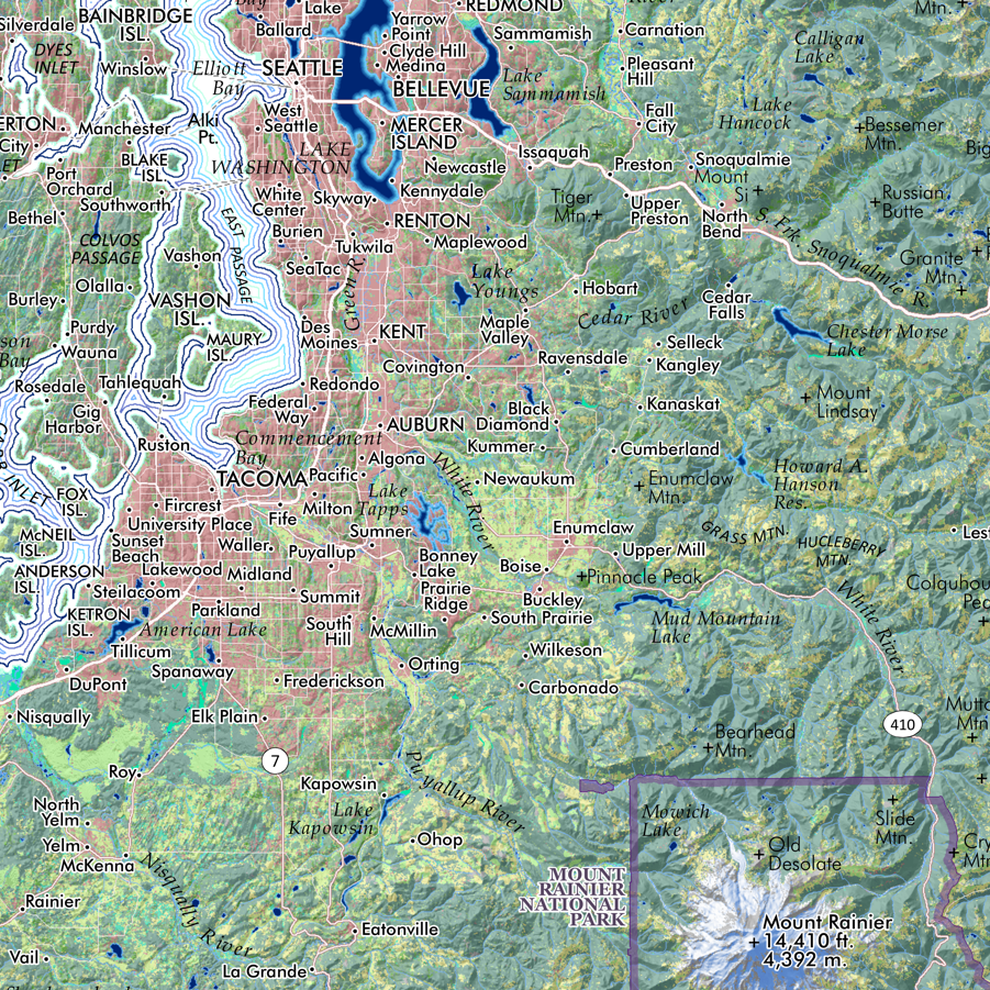
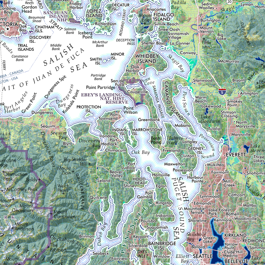
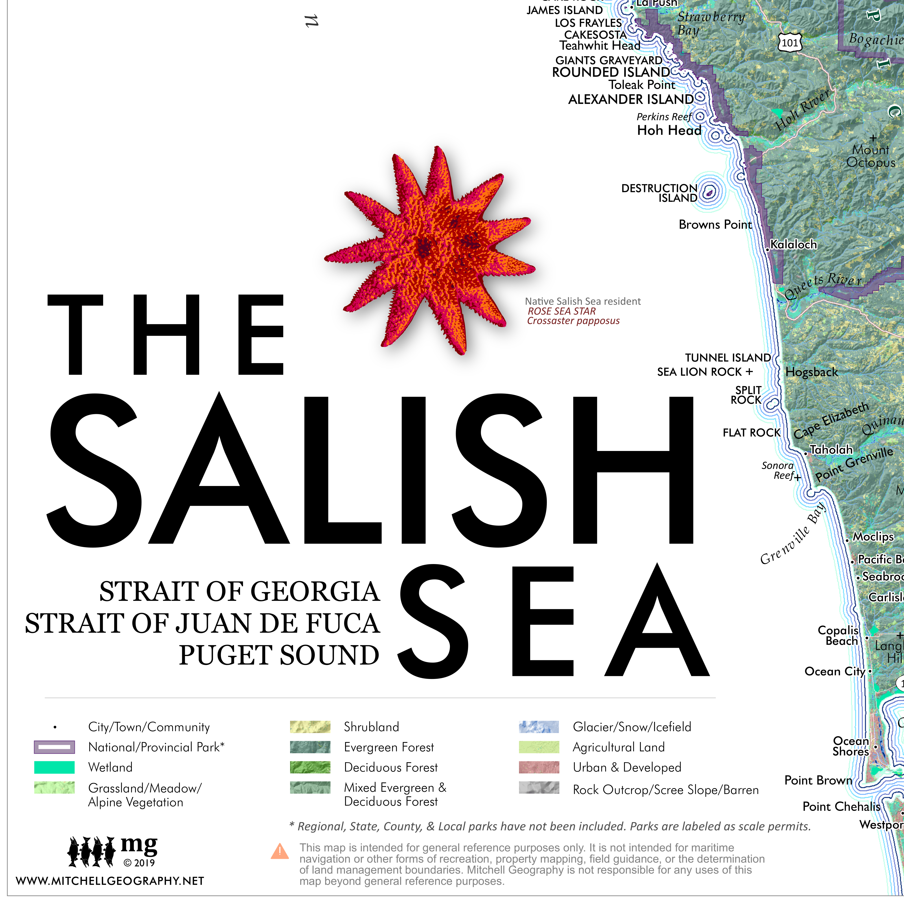
Salish Sea (24 in x 20 in)
1:750,000
20 inch x 24 inch — flat wall map, printed on a heavy fine paper — shipped rolled.
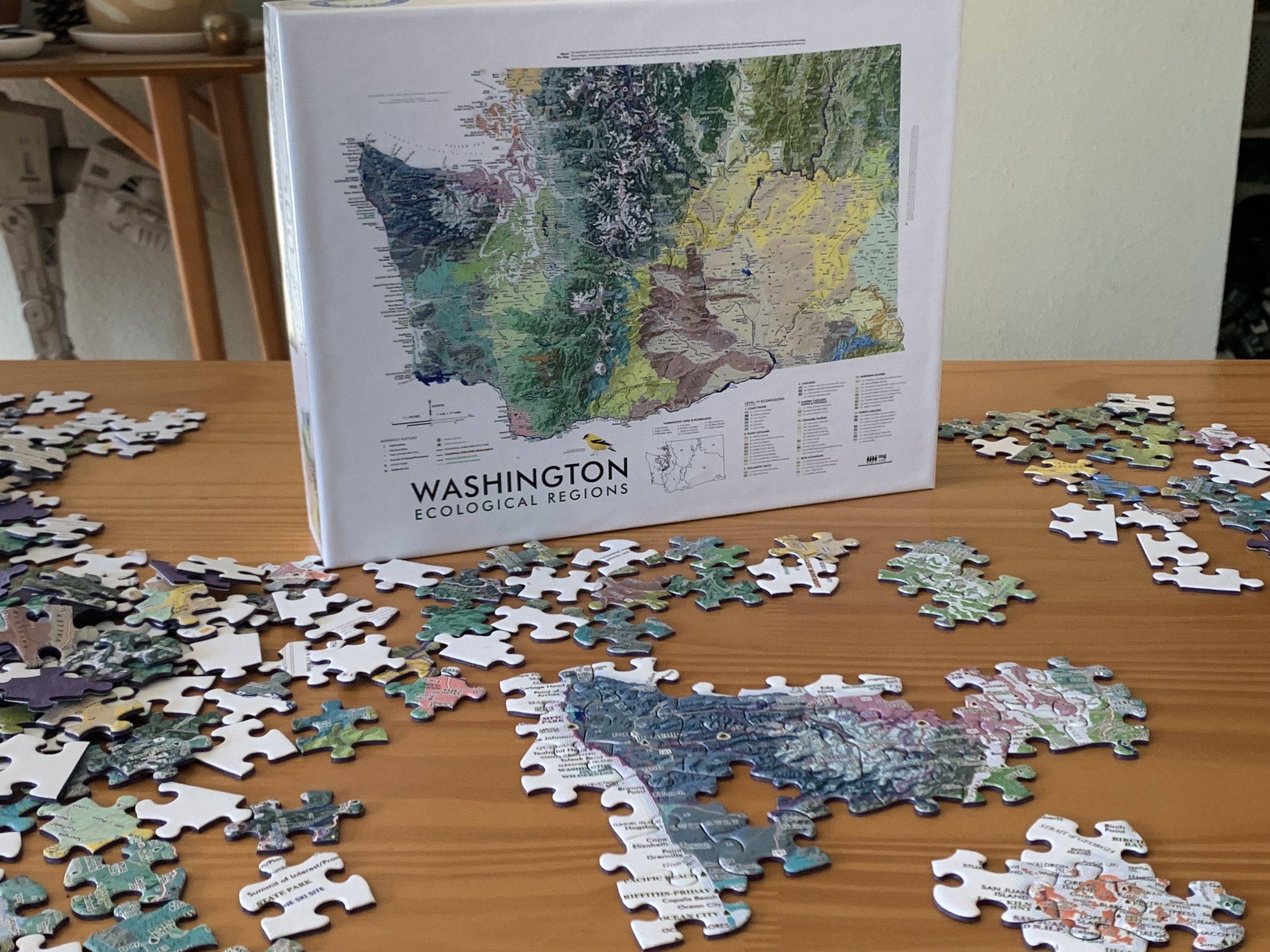
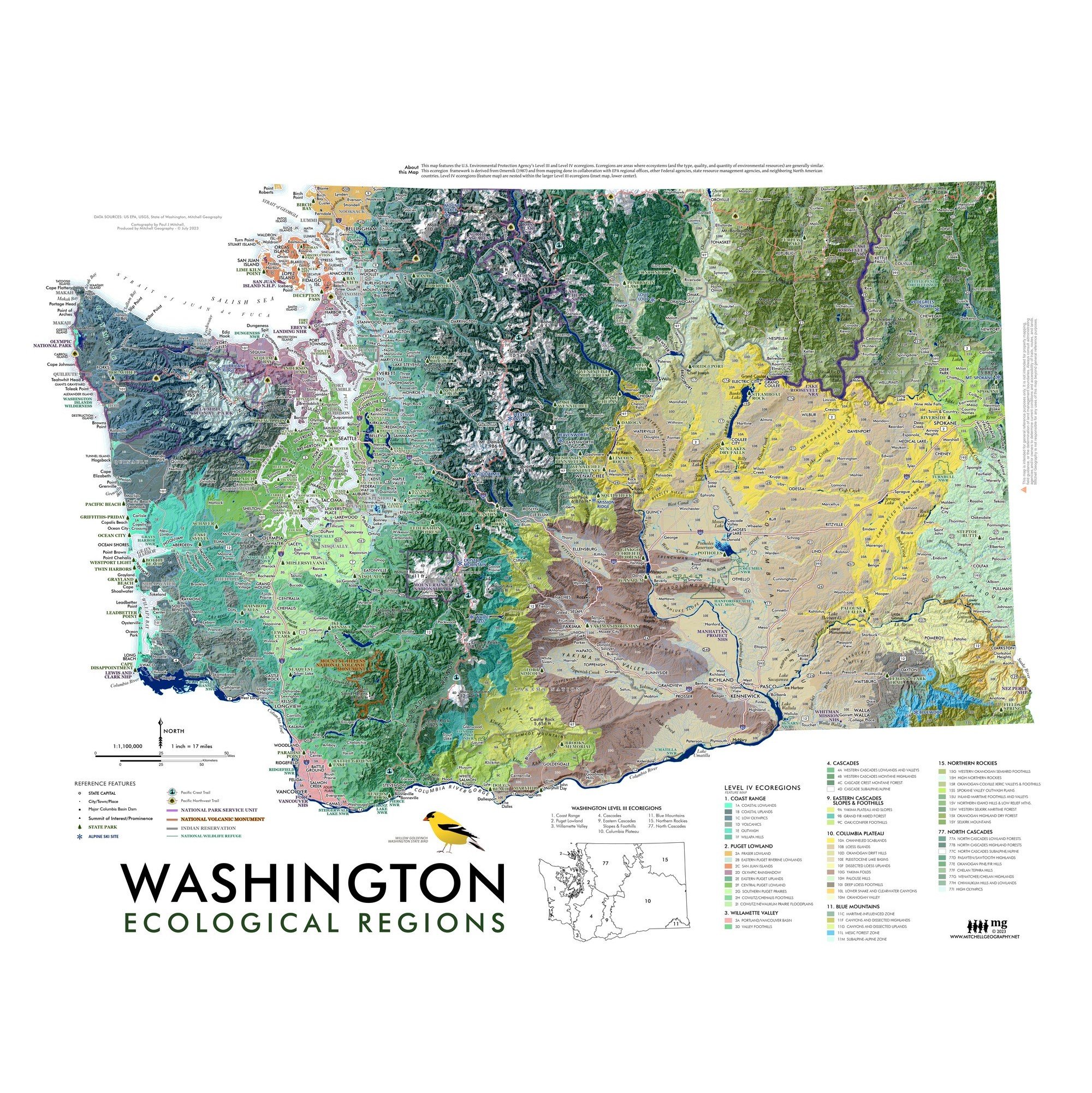
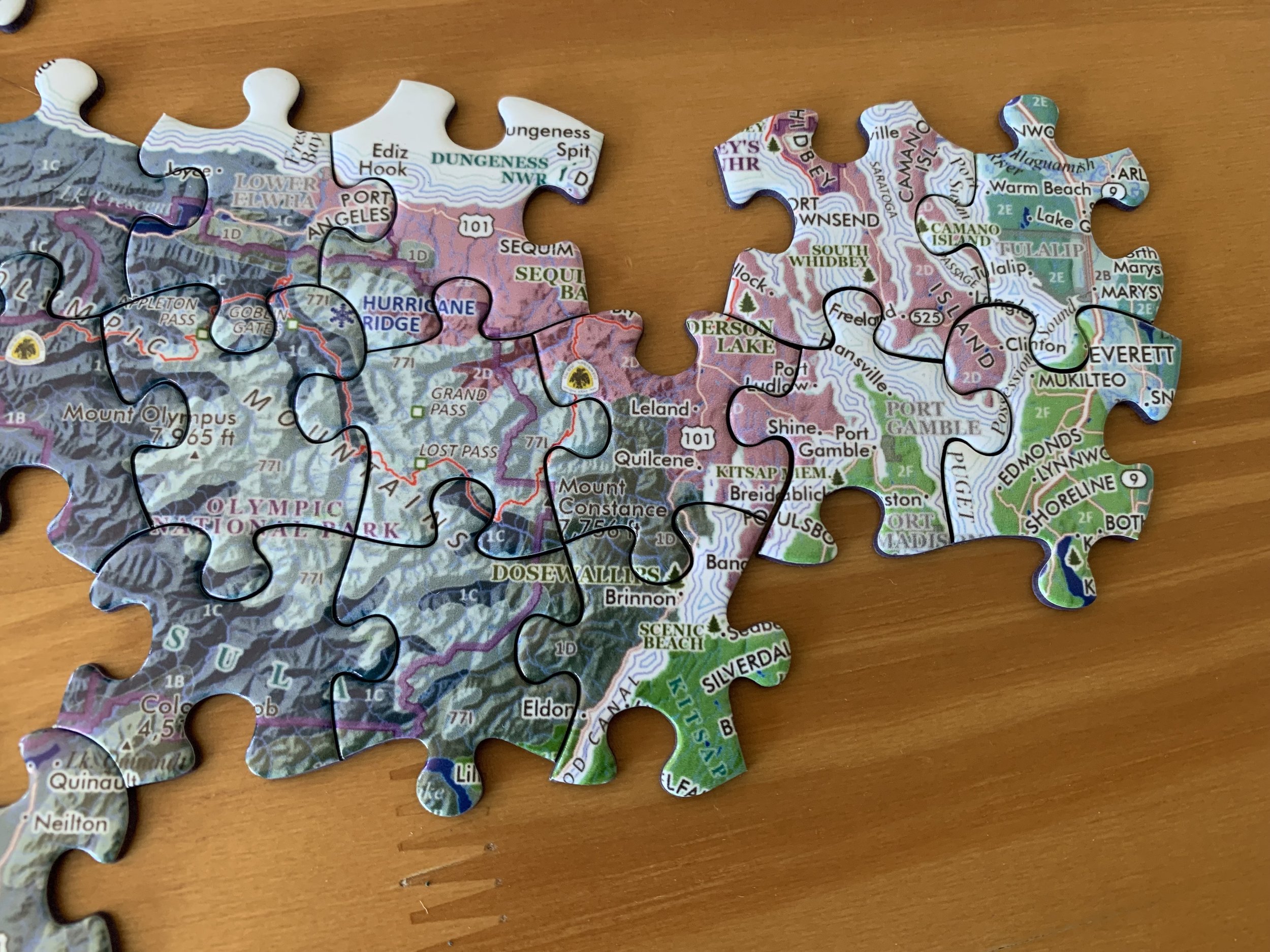
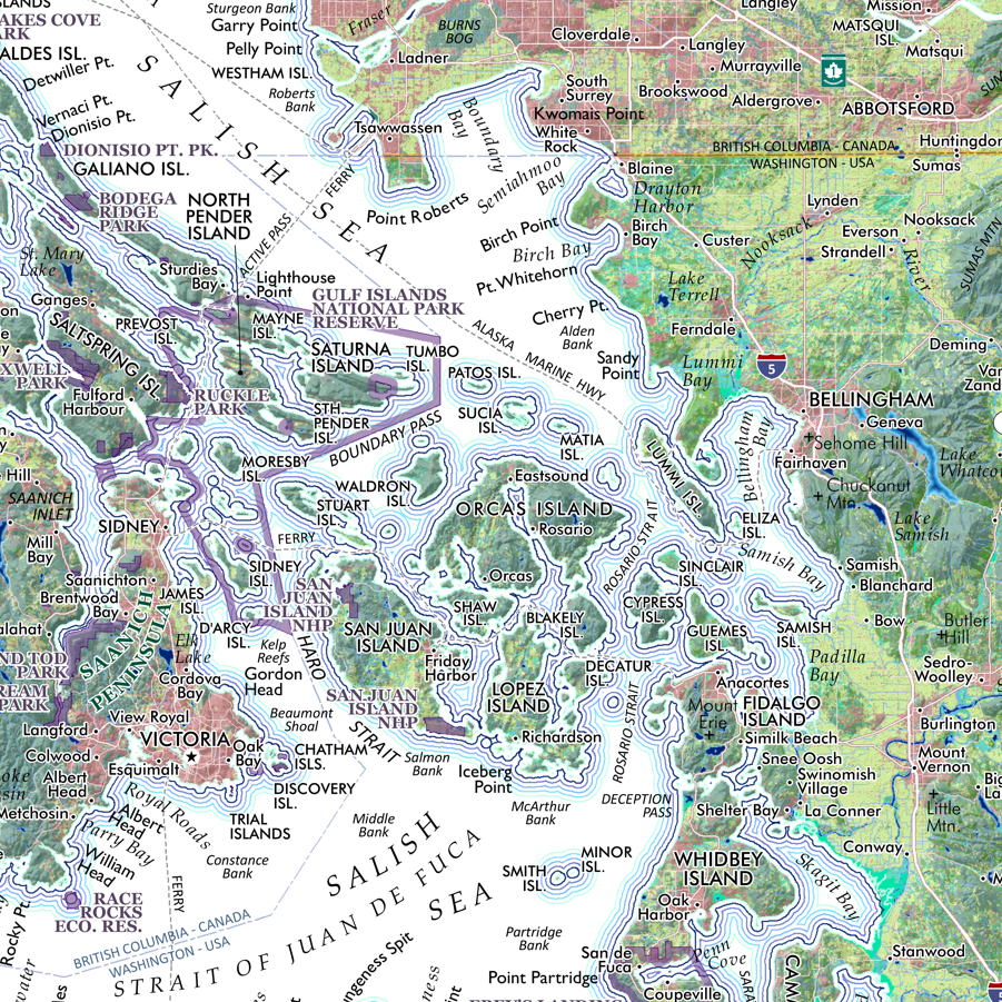
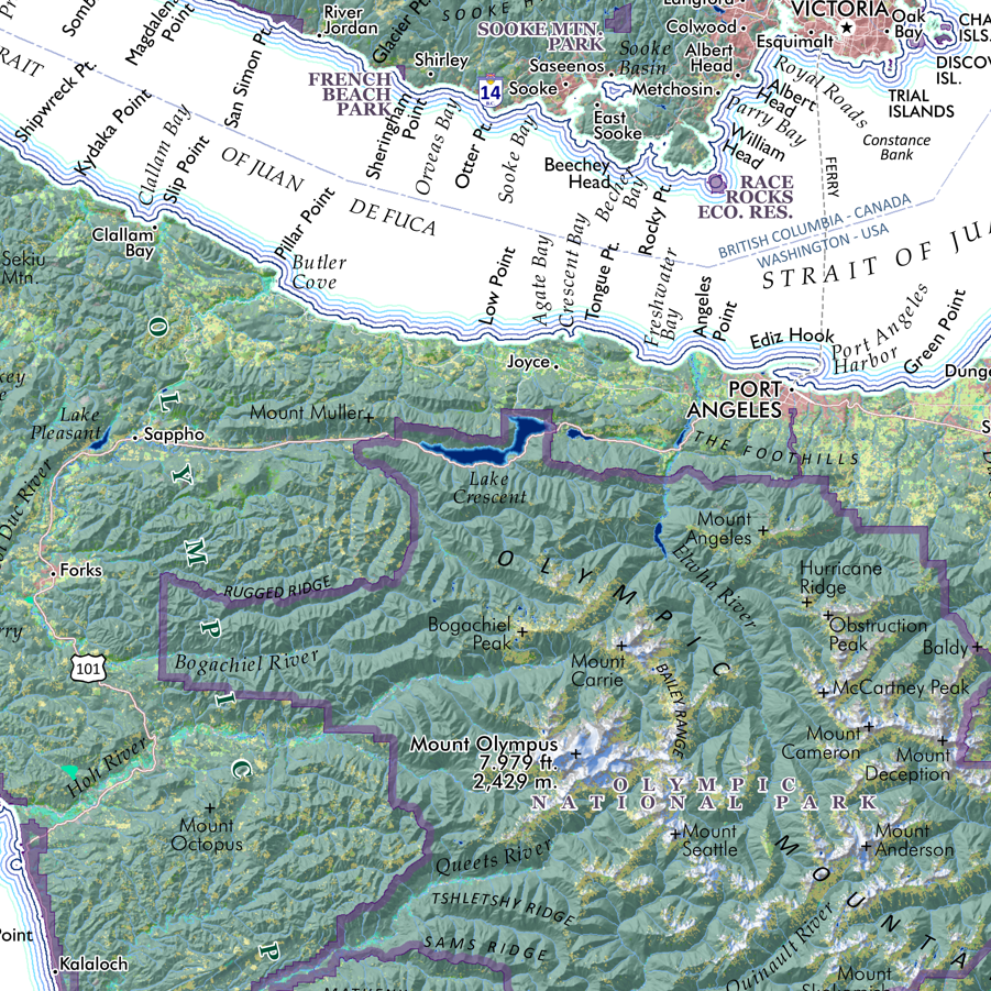
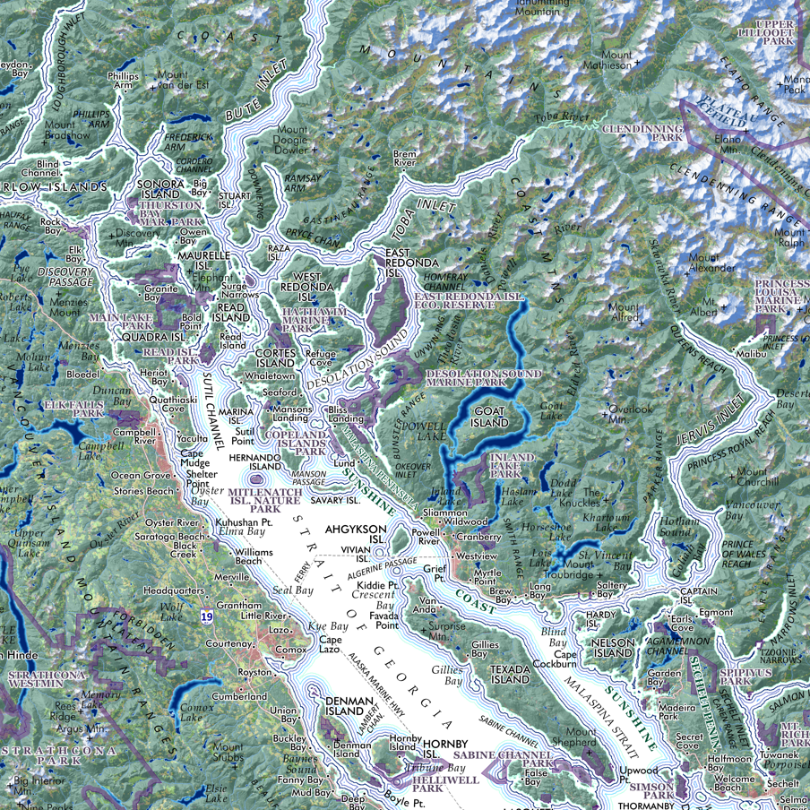
Detailed regional map of the Salish Sea, comprised of the Strait of Georgia, Strait of Juan de Fuca, and the Puget Sound. Place names, cities, prominent landforms, and national/provincial parts are labeled and delineated as scale permits.
****Errata Corrections Update March 18, 2020
CORRECTED — The I-90 interstate label at Snoqualmie Pass was incorrectly labeled as I-5. A few label placements were nudged to fix minor overlaps.
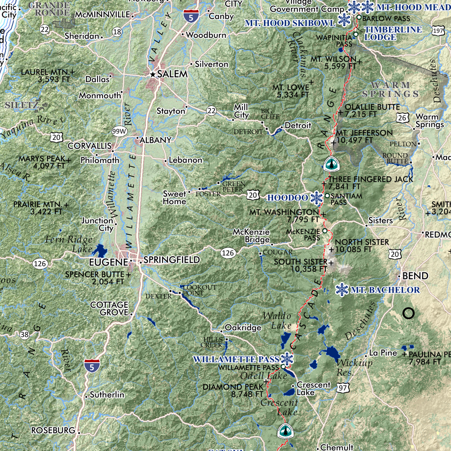
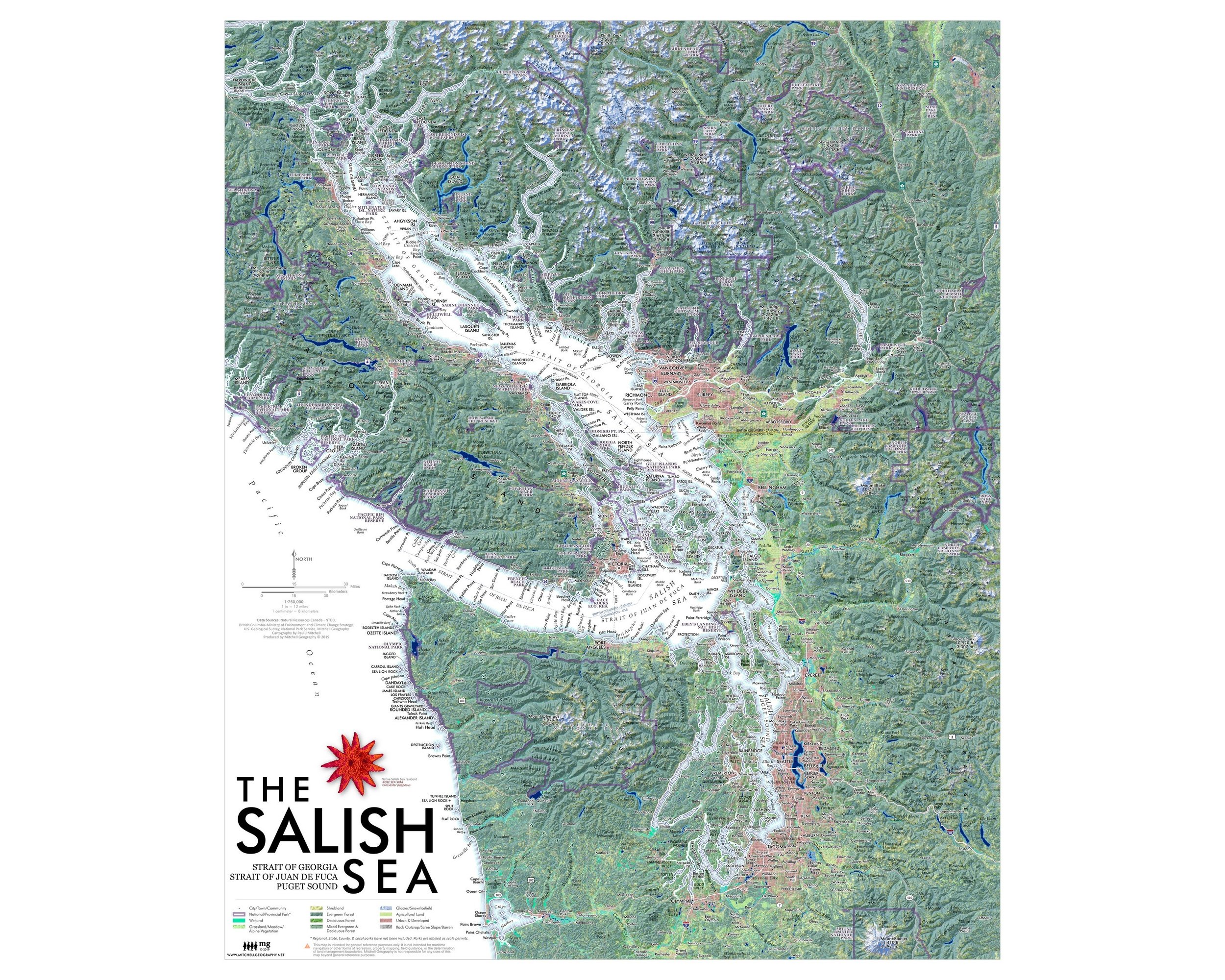
1:750,000
20 inch x 24 inch — flat wall map, printed on a heavy fine paper — shipped rolled.
Detailed regional map of the Salish Sea, comprised of the Strait of Georgia, Strait of Juan de Fuca, and the Puget Sound. Place names, cities, prominent landforms, and national/provincial parts are labeled and delineated as scale permits.
****Errata Corrections Update March 18, 2020
CORRECTED — The I-90 interstate label at Snoqualmie Pass was incorrectly labeled as I-5. A few label placements were nudged to fix minor overlaps.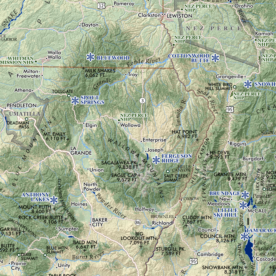