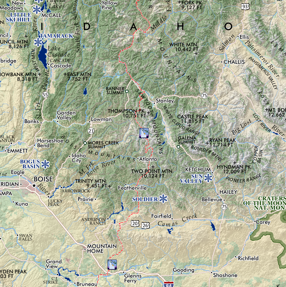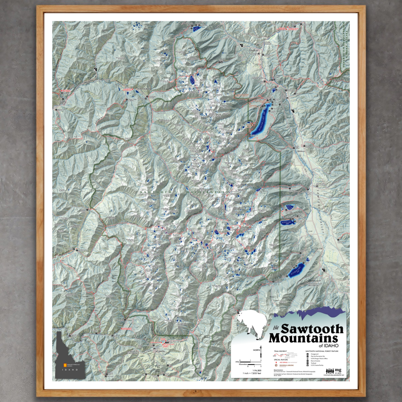
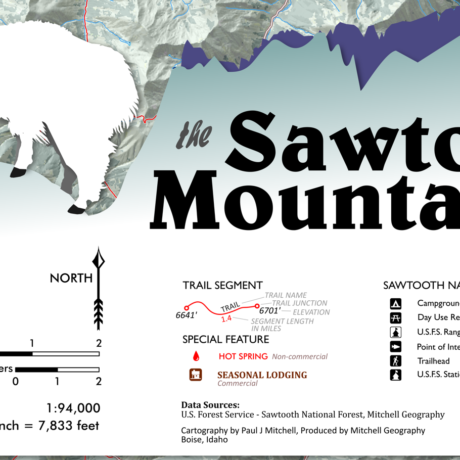
Sawtooth Mountains Idaho (24 in x 20 in)
1:94,000 :: (1 inch = 7833 ft)
24 inch x 20 inch — flat wall map, printed on a heavy fine paper — shipped rolled.
Made in January 2025.
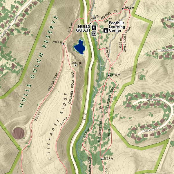
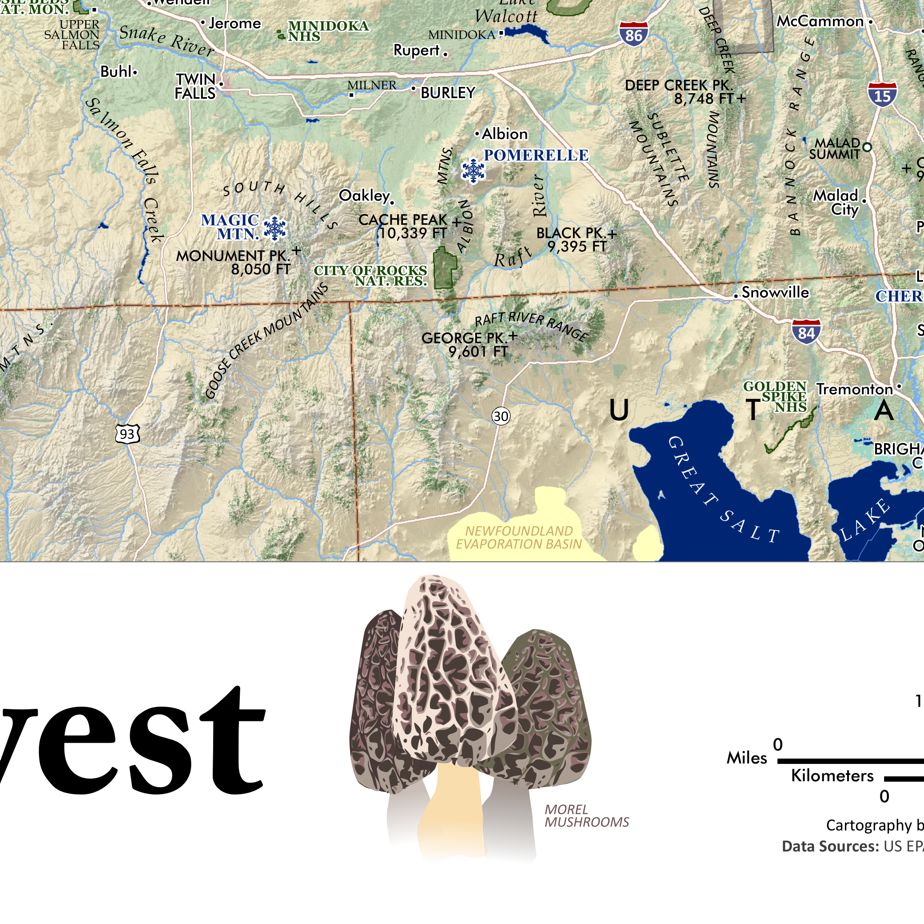
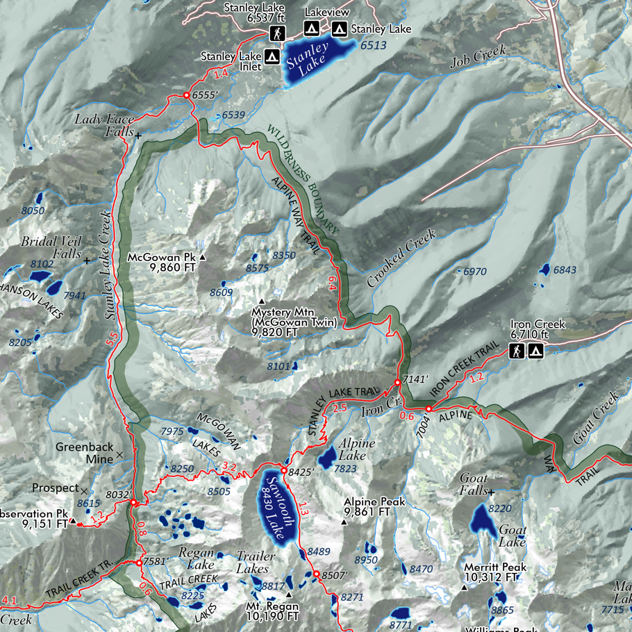
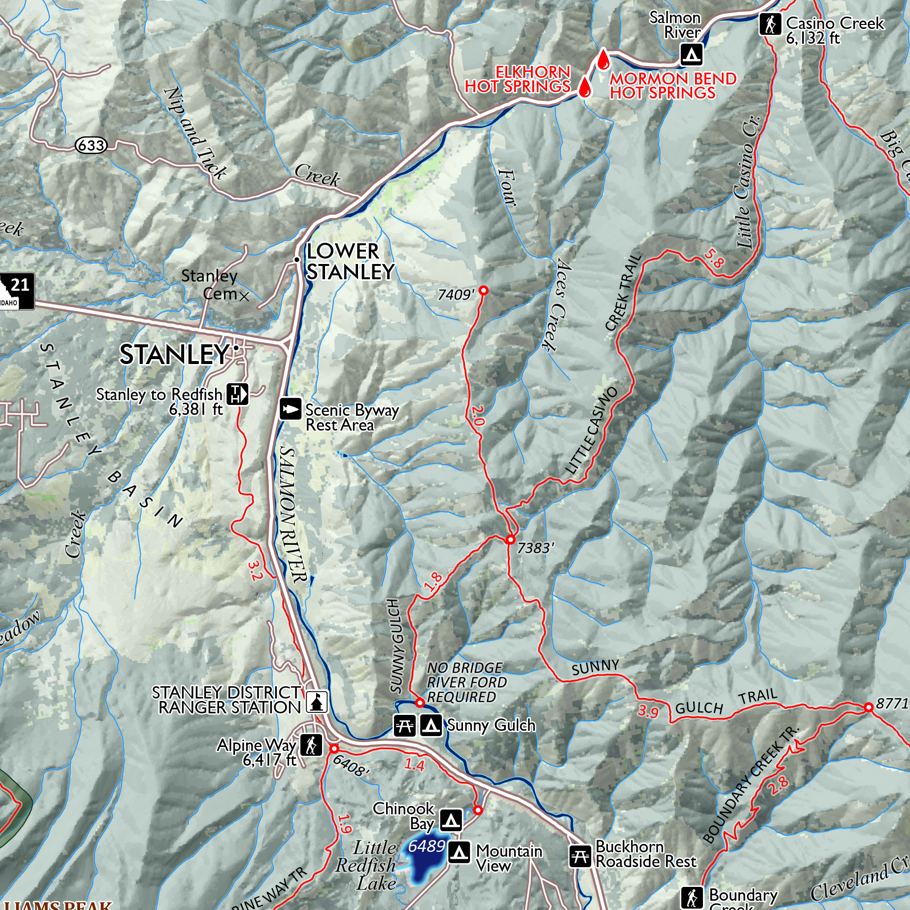
Mid-sized wall map of Idaho’s renowned Sawtooth Mountains in Central Idaho. Featuring official trails, USFS trailheads, campgrounds, adjacent lodges, familiar non-commercial hot springs, seasonal lodging, i.e. backcountry hut/yurts (i.e. SVT and SMG), lake spot elevations in every upper basin, summit, spire, landform place names, and some of the provincial alpine names.
This 2025 updated edition features a crisper shaded relief and improved legibility. Trip planning is greatly increased with the addition of trail segment mileages and elevations at trail junctions and primary passes encountered on the official trails. The Stanley to Redfish trail has also been added to this version.
My older large format Sawtooth Wilderness map is also available for DIGITAL DOWNLOAD only.
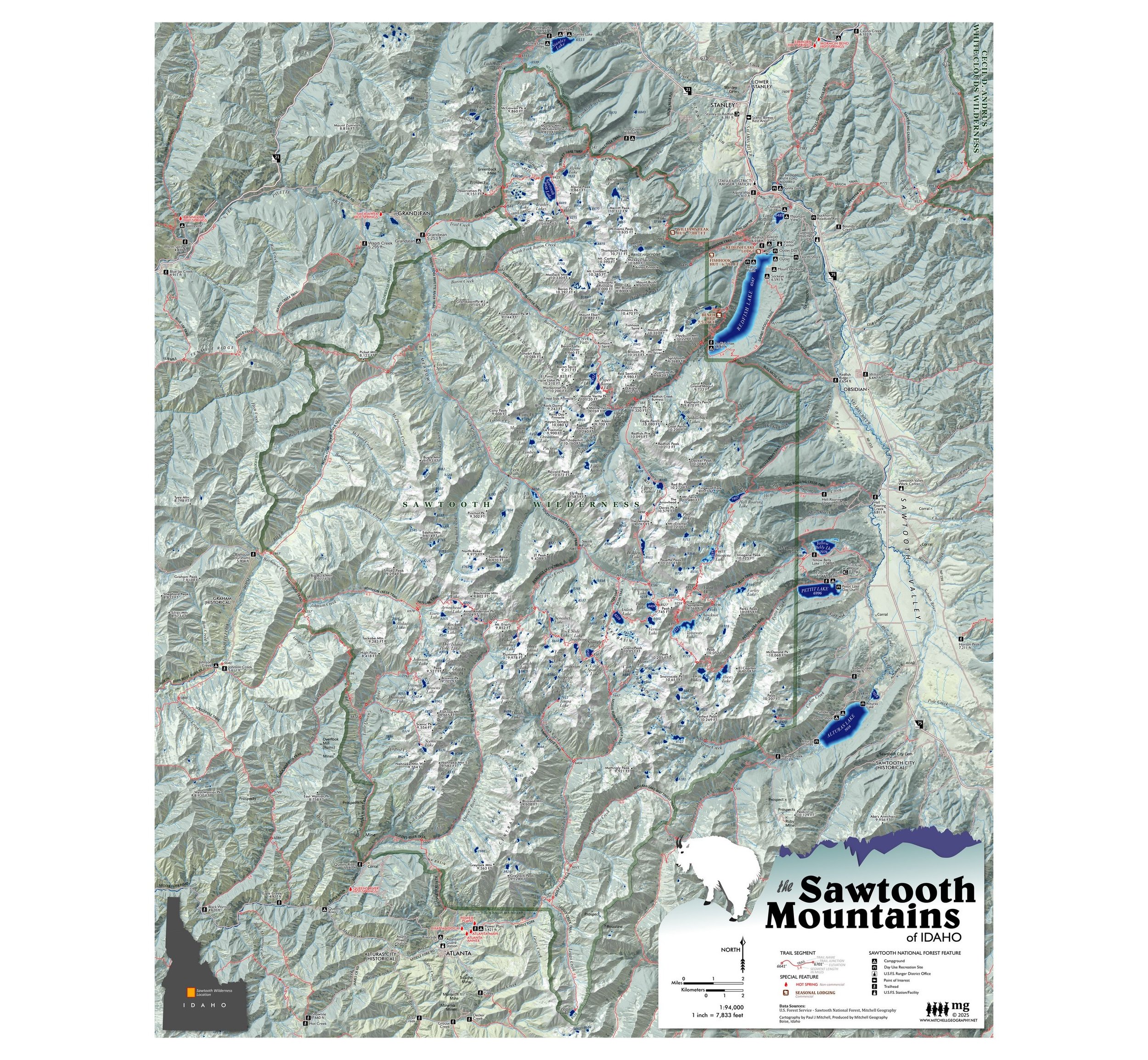
1:94,000 :: (1 inch = 7833 ft)
24 inch x 20 inch — flat wall map, printed on a heavy fine paper — shipped rolled.
Made in January 2025.
Mid-sized wall map of Idaho’s renowned Sawtooth Mountains in Central Idaho. Featuring official trails, USFS trailheads, campgrounds, adjacent lodges, familiar non-commercial hot springs, seasonal lodging, i.e. backcountry hut/yurts (i.e. SVT and SMG), lake spot elevations in every upper basin, summit, spire, landform place names, and some of the provincial alpine names.
This 2025 updated edition features a crisper shaded relief and improved legibility. Trip planning is greatly increased with the addition of trail segment mileages and elevations at trail junctions and primary passes encountered on the official trails. The Stanley to Redfish trail has also been added to this version.
My older large format Sawtooth Wilderness map is also available for DIGITAL DOWNLOAD only.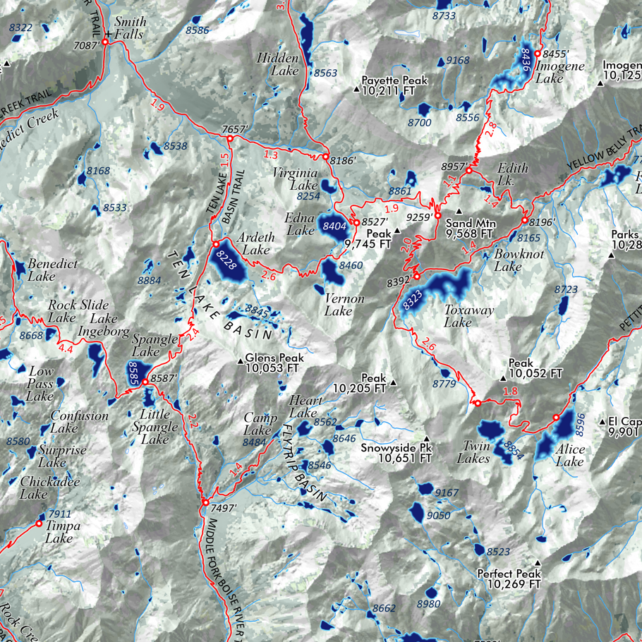
![Camel's Back [Boise Idaho] (19 in x 13 in)](https://images.squarespace-cdn.com/content/v1/64dfe5c447627a1ab4b29d07/1699989430957-PGLZ4WM4WRNNHFPDRKKY/CamelsBack_framed.JPG)